Maps & Plans
Building an online collection of maps related to Angkor, Khmer and Southeast Asia civilizations.
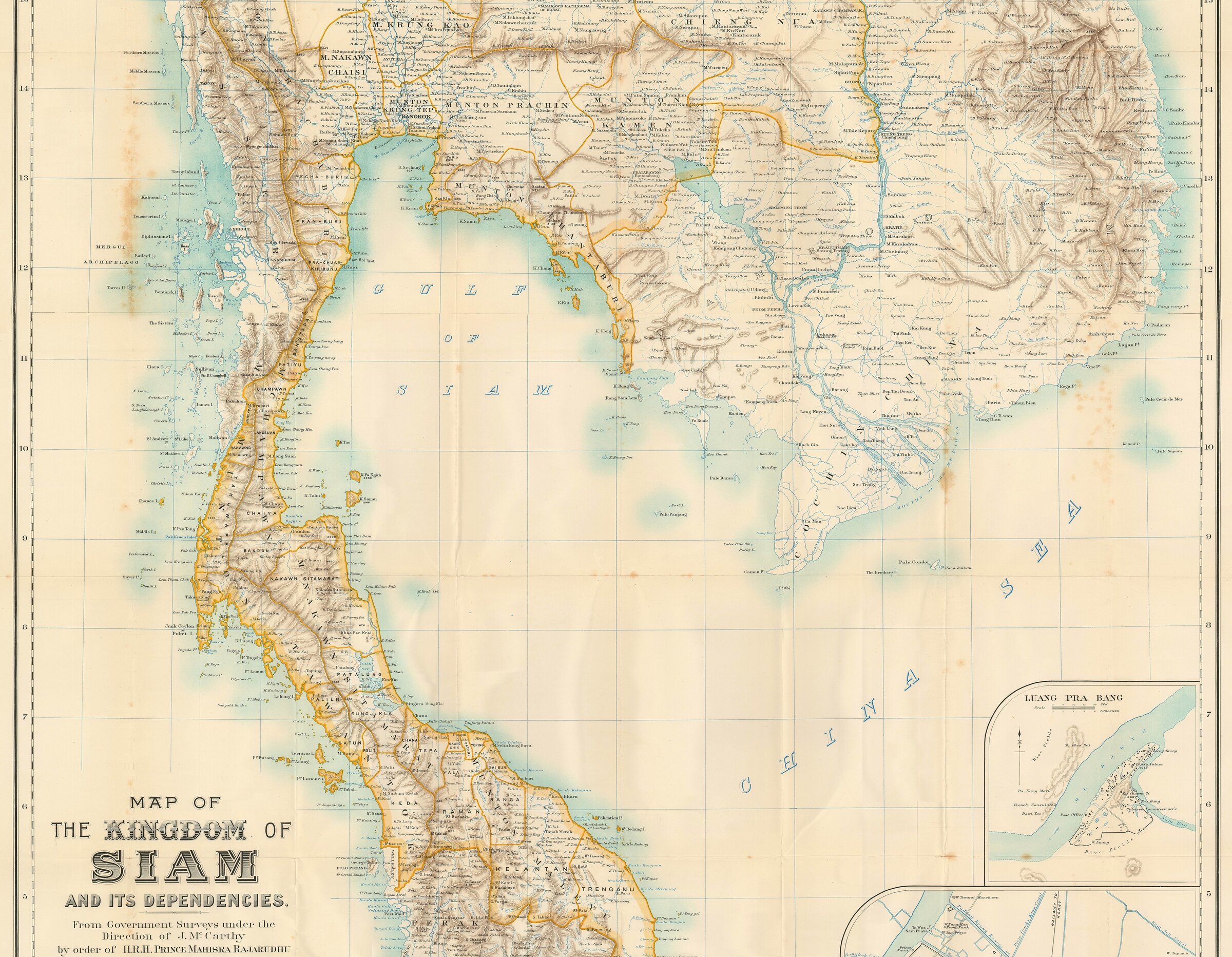
James F. McCarthy: The Kingdom of Siam and Its Dependencies [detail]
Surveyor General of Siam, 1900 | via Geographicus Rare Antique Maps (www.geographicus.com)
James F. McCarthy: The Kingdom of Siam and Its Dependencies [detail]
Surveyor General of Siam, 1900 | via Geographicus Rare Antique Maps (www.geographicus.com)
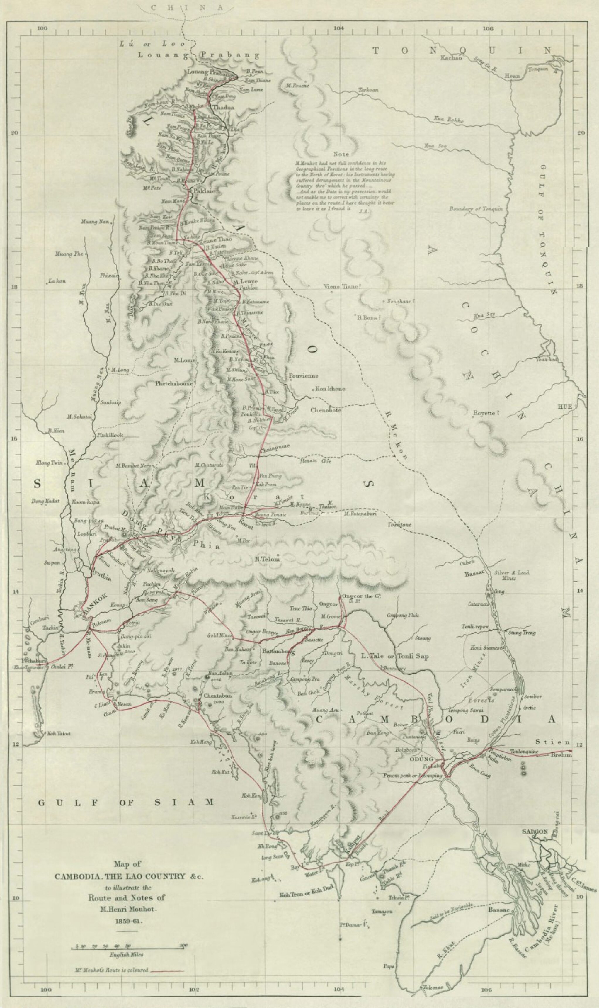
Map of Henri Mouhot's Route, 1859-61.
[reconstructed by Angkor Database from initial presentation in 4 parts]
Map of Henri Mouhot's Route, 1859-61.
[reconstructed by Angkor Database from initial presentation in 4 parts]
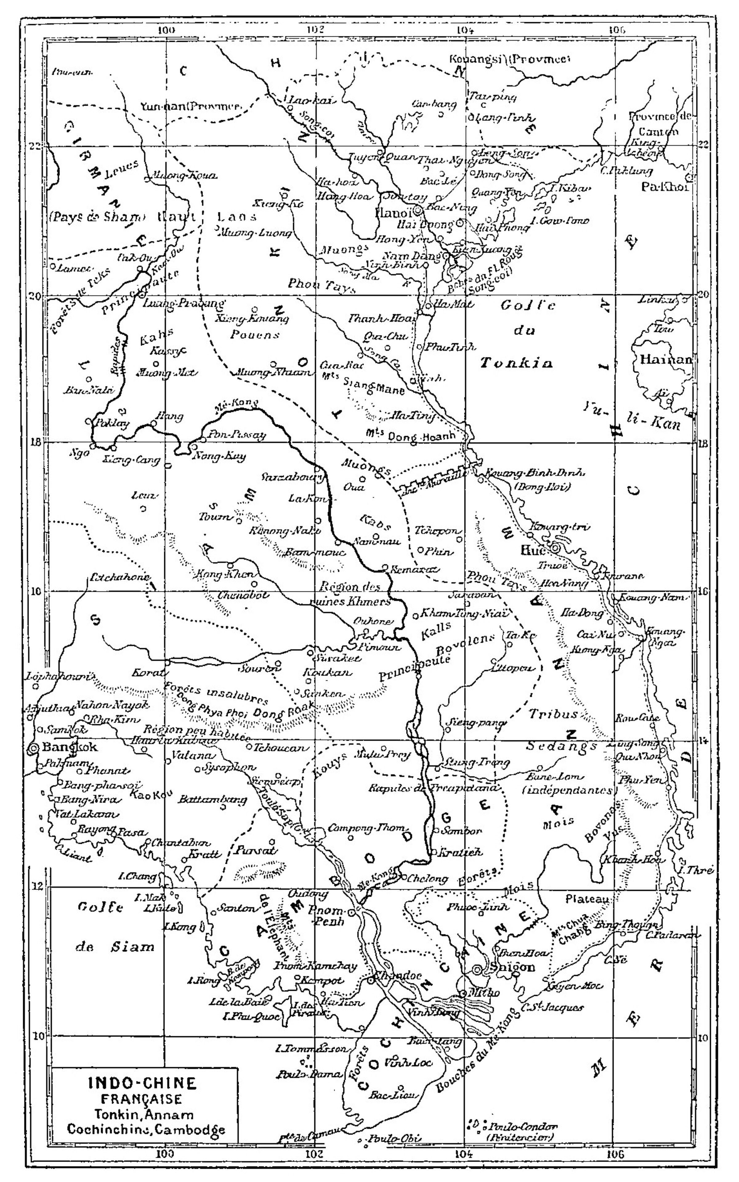
French Indochina (Tonkin, Annam, Cochinchina, Cambodia), 1896
in Henri Ponchalon, Souvenirs de voyage et de campagne 1858-1860, Tours, 1896 (via gallica.bnf.fr)
French Indochina (Tonkin, Annam, Cochinchina, Cambodia), 1896
in Henri Ponchalon, Souvenirs de voyage et de campagne 1858-1860, Tours, 1896 (via gallica.bnf.fr)
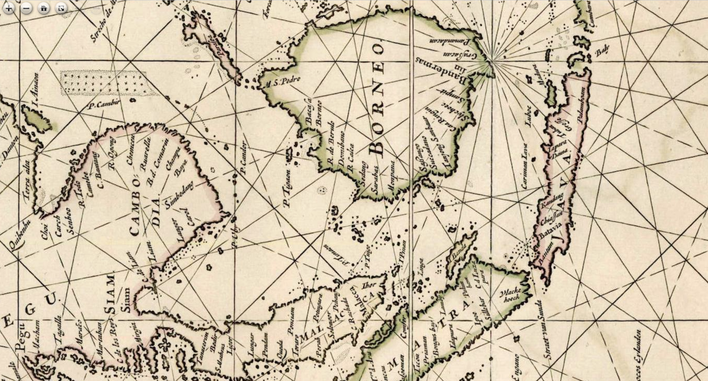
Ancient Portuguese, Dutch and Italian Maps, 16th-18th centuries, focused on Cambodia
Ancient Portuguese, Dutch and Italian Maps, 16th-18th centuries, focused on Cambodia
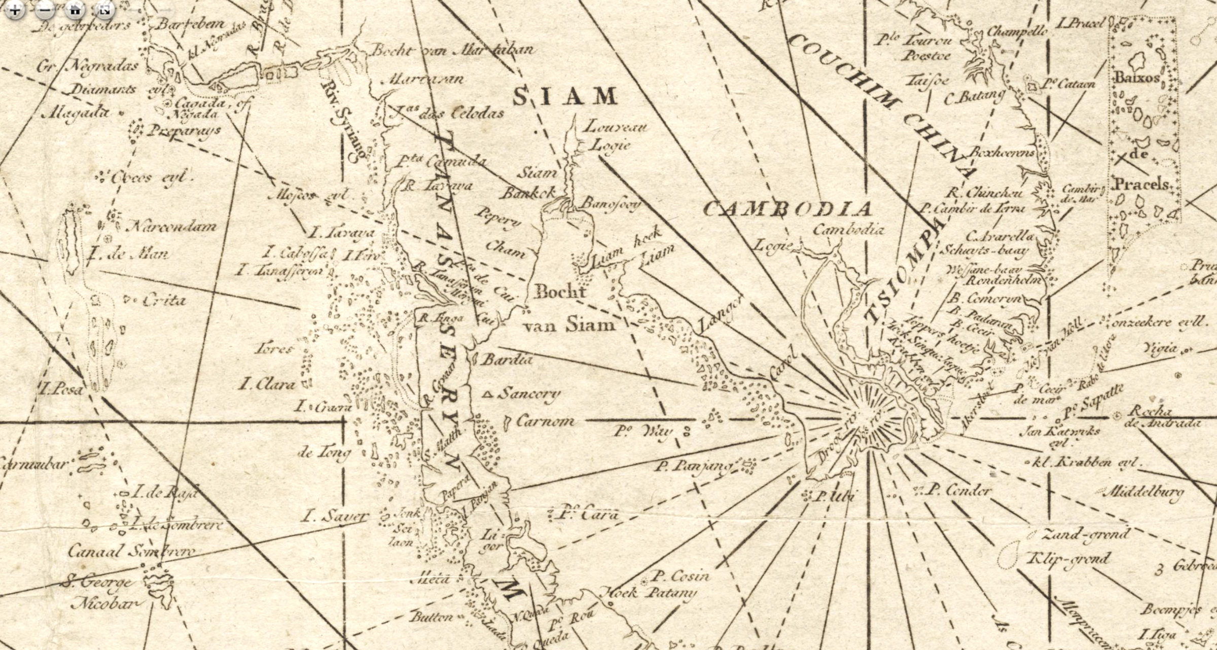
Ancient Portuguese, Dutch and Italian Maps, 16th-18th centuries, focused on Cambodia
Ancient Portuguese, Dutch and Italian Maps, 16th-18th centuries, focused on Cambodia
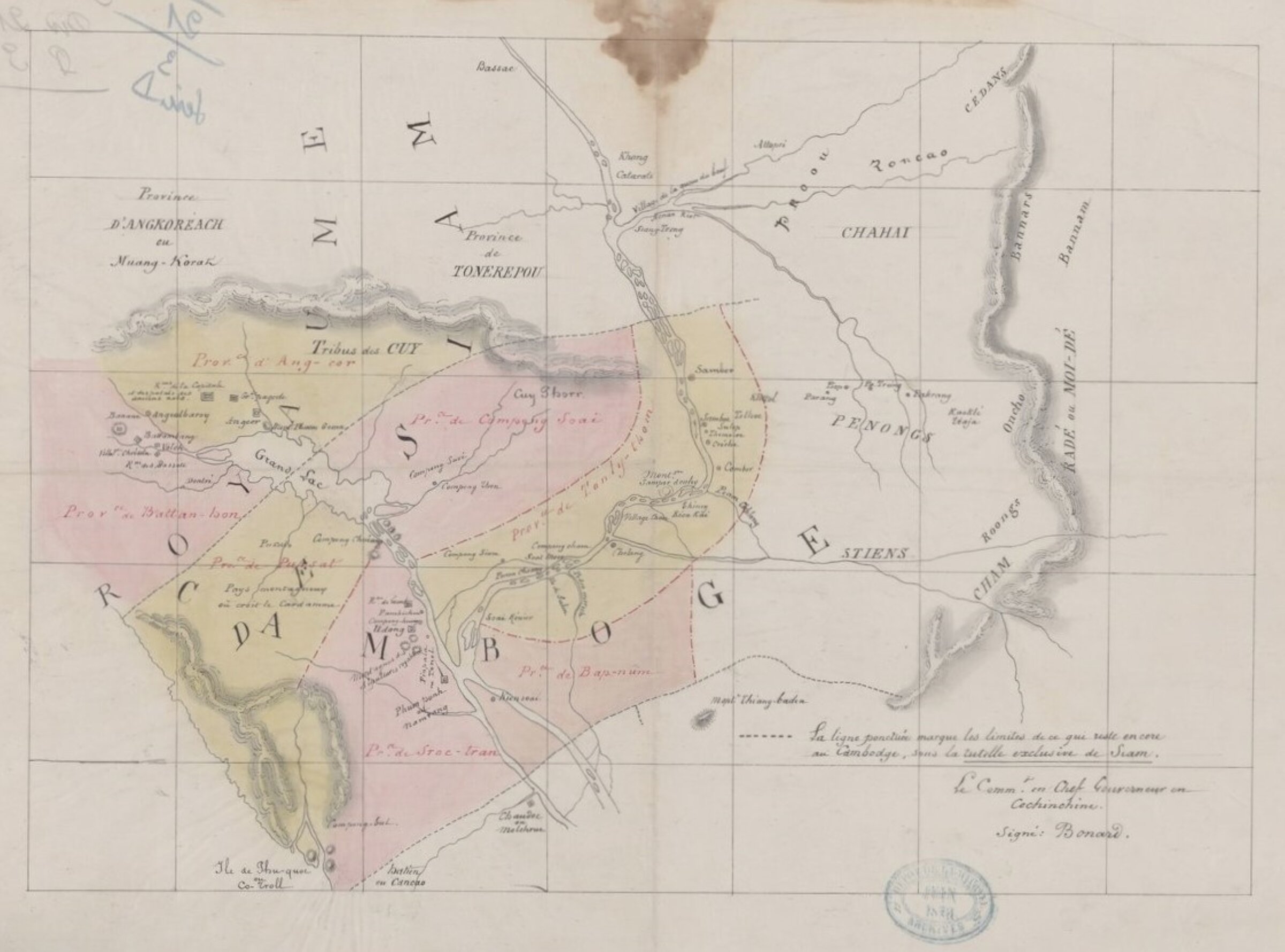
Frontieres francaises du Royaume du Cambodge, 1867 [French Borders of the Kingdom of Cambodia]
L.A. Bonard for French Minister of the Navy and Colonies, 1867 [gallica.bnf.fr]
Frontieres francaises du Royaume du Cambodge, 1867 [French Borders of the Kingdom of Cambodia]
L.A. Bonard for French Minister of the Navy and Colonies, 1867 [gallica.bnf.fr]
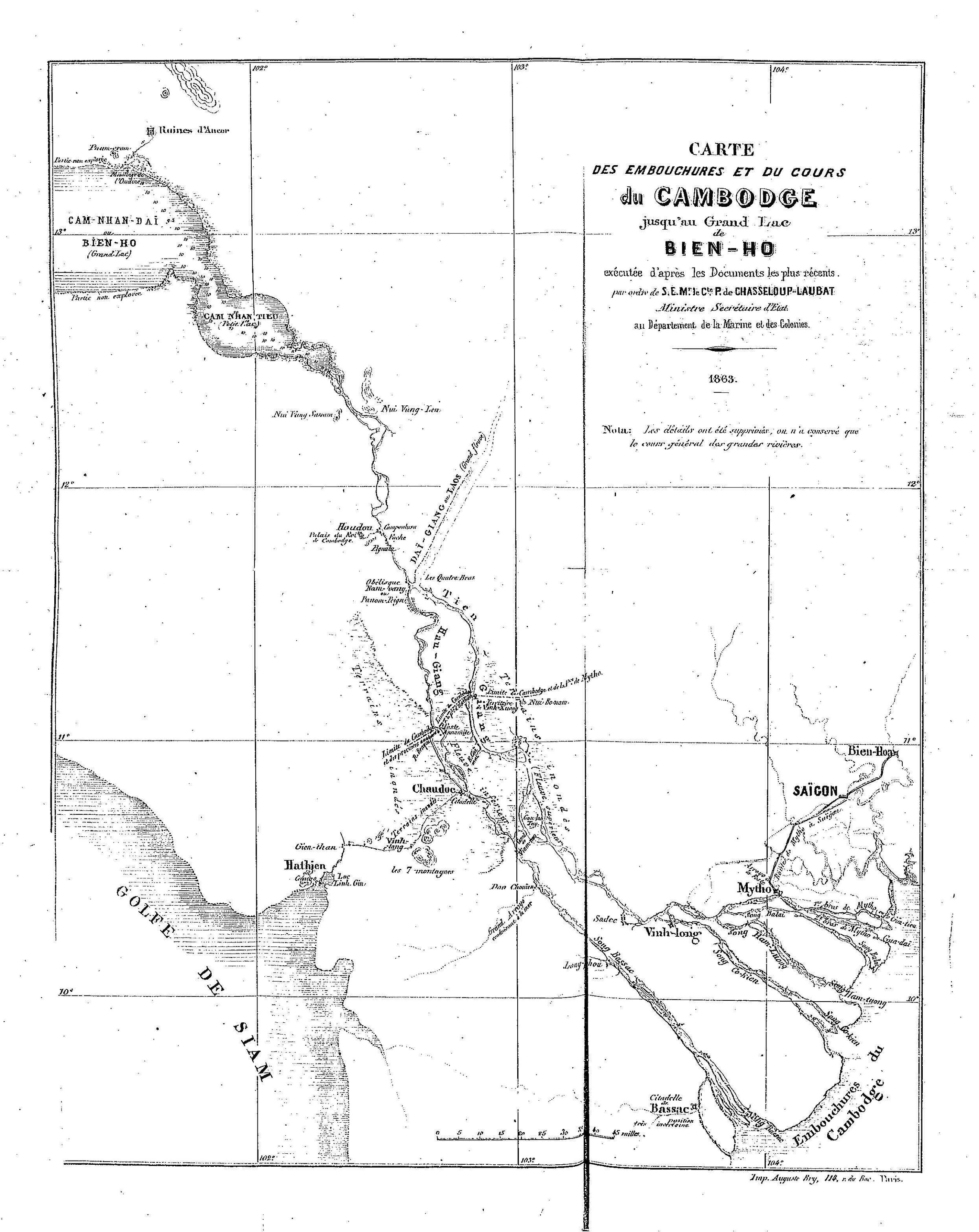
Carte des embouchures et du cours du Cambodge jusqu'au Grand lac de Bien Ho, 1863 [Cambodge River from its estuaries to Bien Ho Great Lake]
fron L.A. Bonard, "Exploration du Grand Fleuve du Cambodge, RMC, 1863
Carte des embouchures et du cours du Cambodge jusqu'au Grand lac de Bien Ho, 1863 [Cambodge River from its estuaries to Bien Ho Great Lake]
fron L.A. Bonard, "Exploration du Grand Fleuve du Cambodge, RMC, 1863
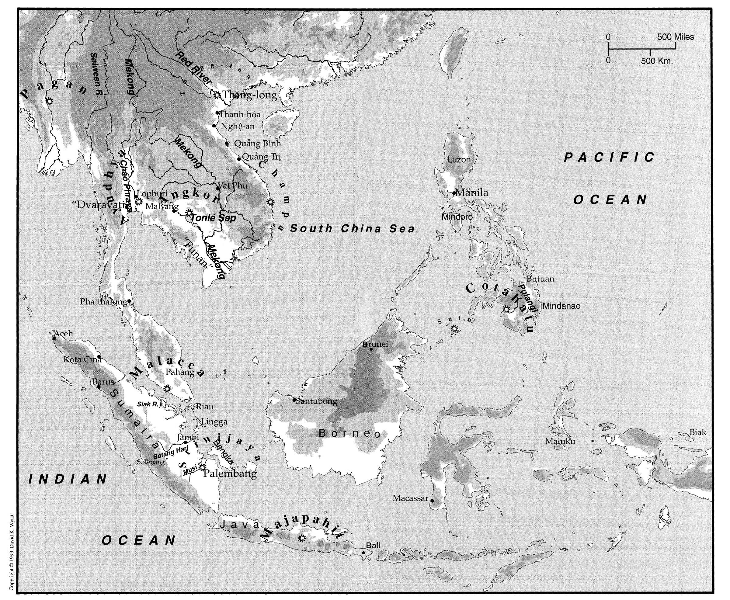
Early Southeast Asia [c. 7th century] Map
in O.W. Wolters 1999. ©David K. Wyatt.
Early Southeast Asia [c. 7th century] Map
in O.W. Wolters 1999. ©David K. Wyatt.
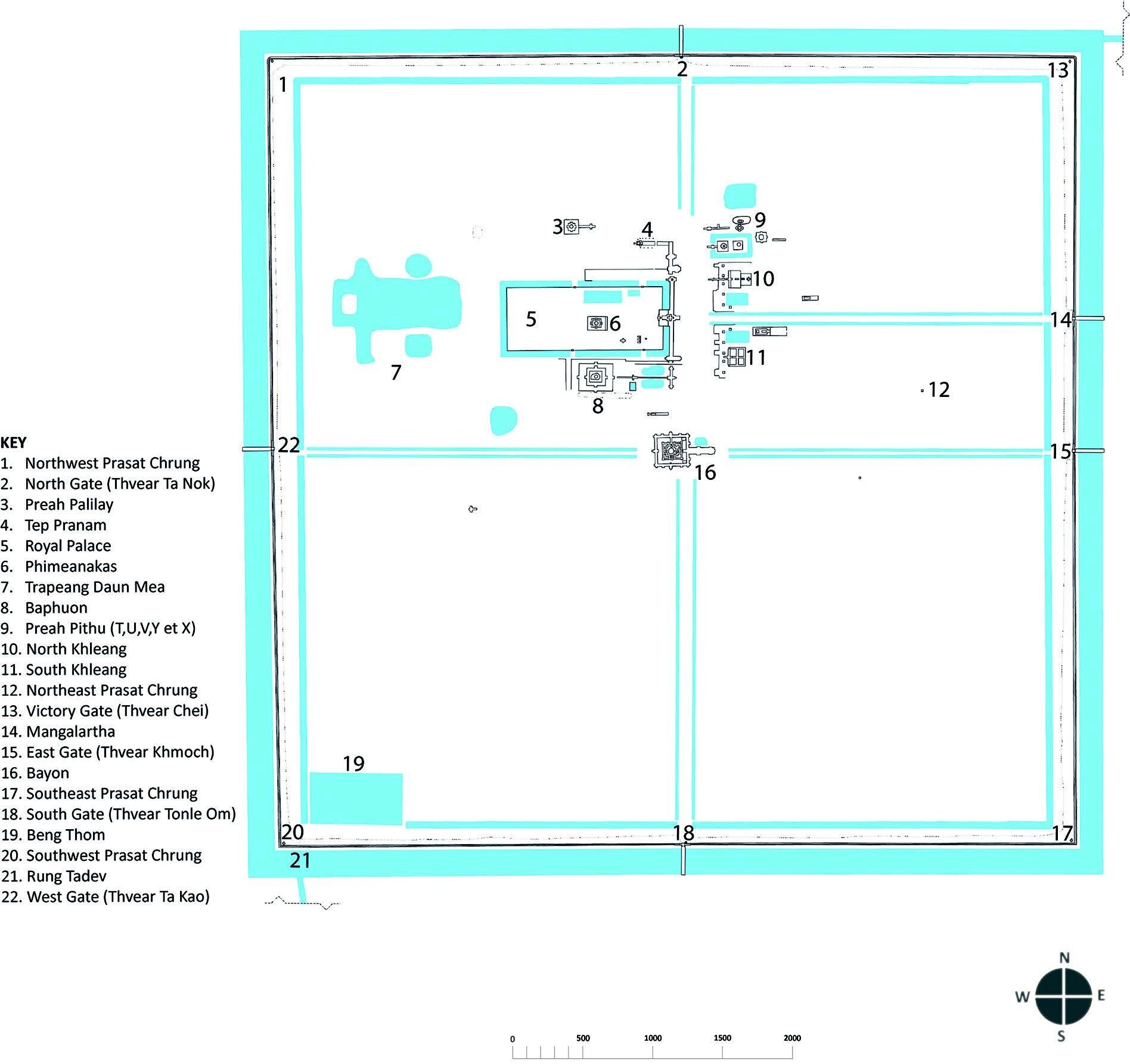
Angkor Thom City
layout by Olivier Cunin; in Swati Chemburkar, "Khmer Empire and Southeast Asia, 800-1450"
Angkor Thom City
layout by Olivier Cunin; in Swati Chemburkar, "Khmer Empire and Southeast Asia, 800-1450"
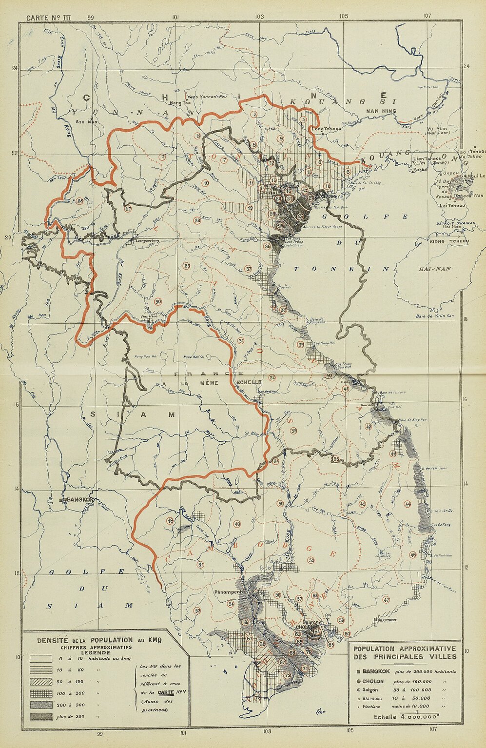
French Indochina Population Density Map
in Brenier, Economic Atlas, 1913
French Indochina Population Density Map
in Brenier, Economic Atlas, 1913
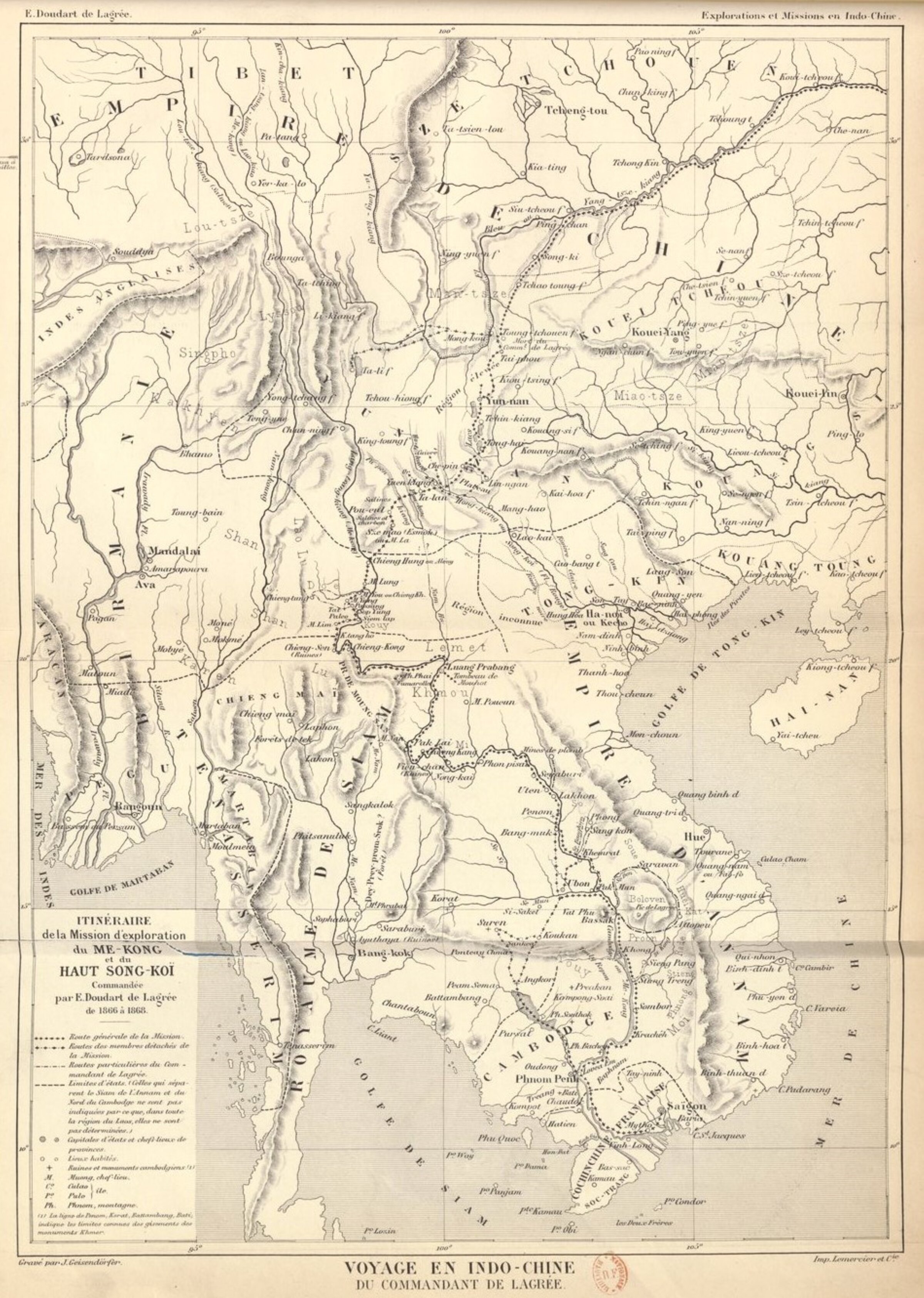
Itineraire de la mission d'exploration du Mekong et Haut Song-Koi, Cdt de Lagree
map by J. Geisendörfer, 1885
Itineraire de la mission d'exploration du Mekong et Haut Song-Koi, Cdt de Lagree
map by J. Geisendörfer, 1885
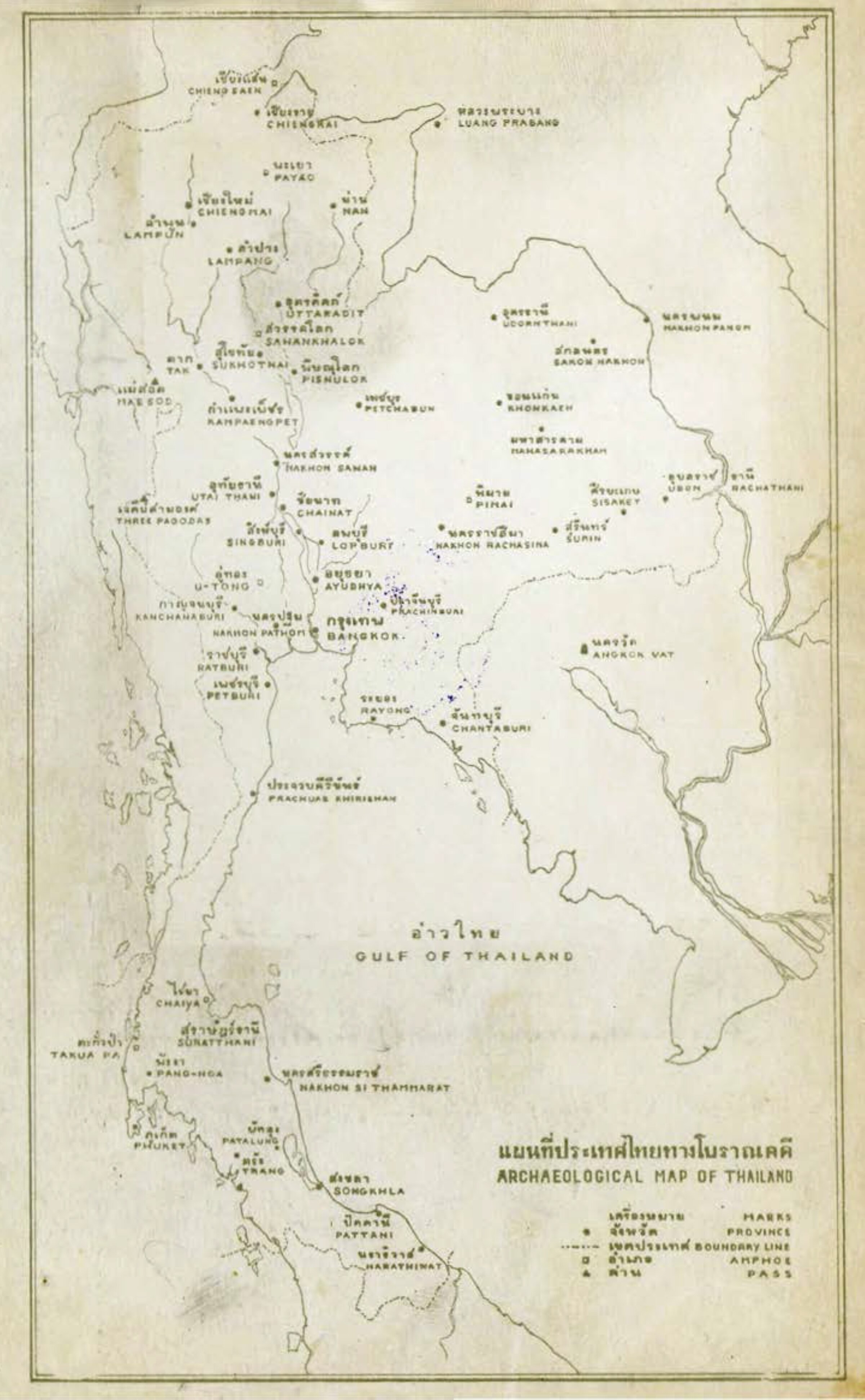
Archaeological Map of Thailand, 1970
in SMC Diskul, Art in Thailand: A Brief History
Archaeological Map of Thailand, 1970
in SMC Diskul, Art in Thailand: A Brief History
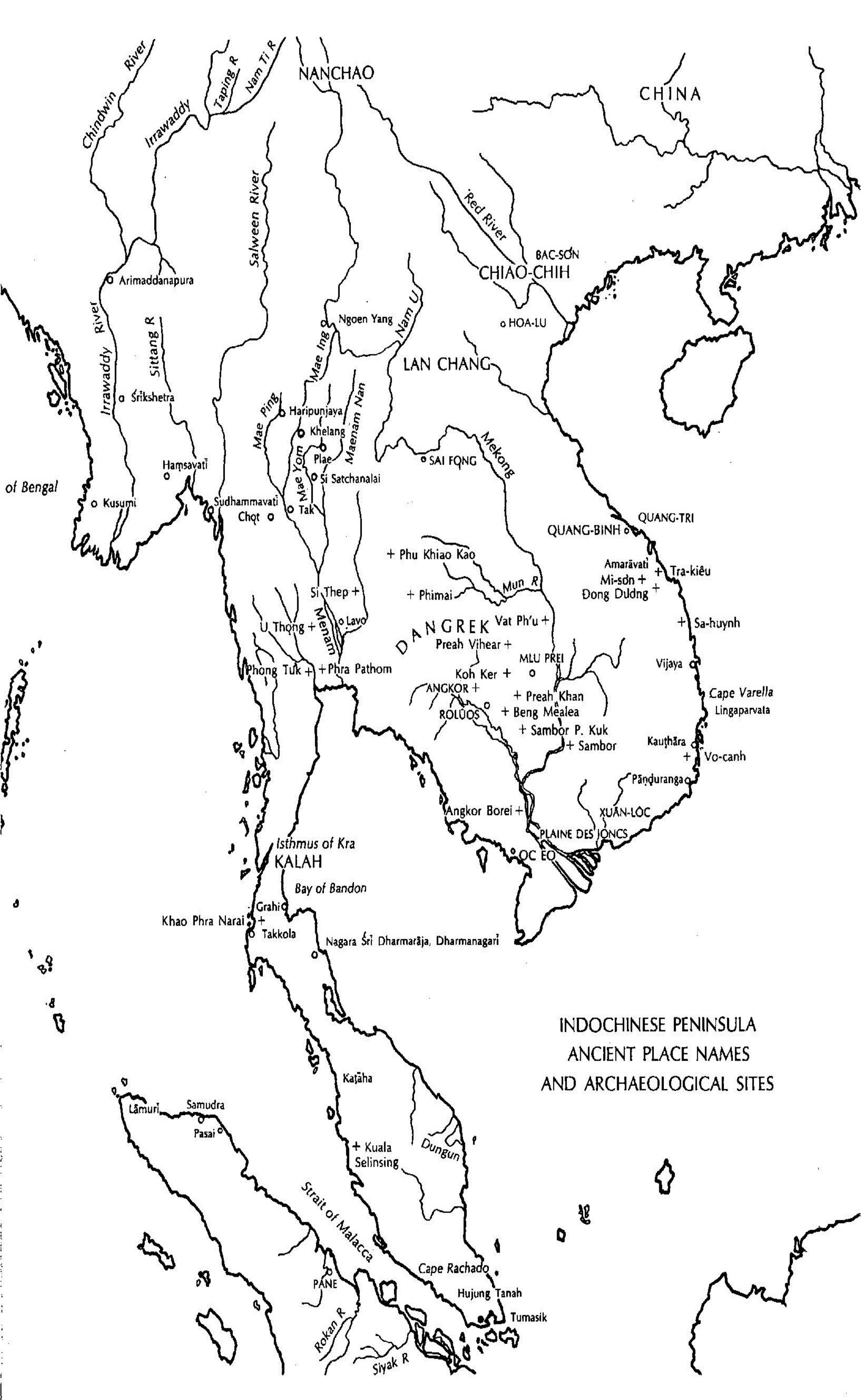
Ancient Place Names and Archaeological Sites
in George Coedes, The Indianized States of Southeast Asia
Ancient Place Names and Archaeological Sites
in George Coedes, The Indianized States of Southeast Asia
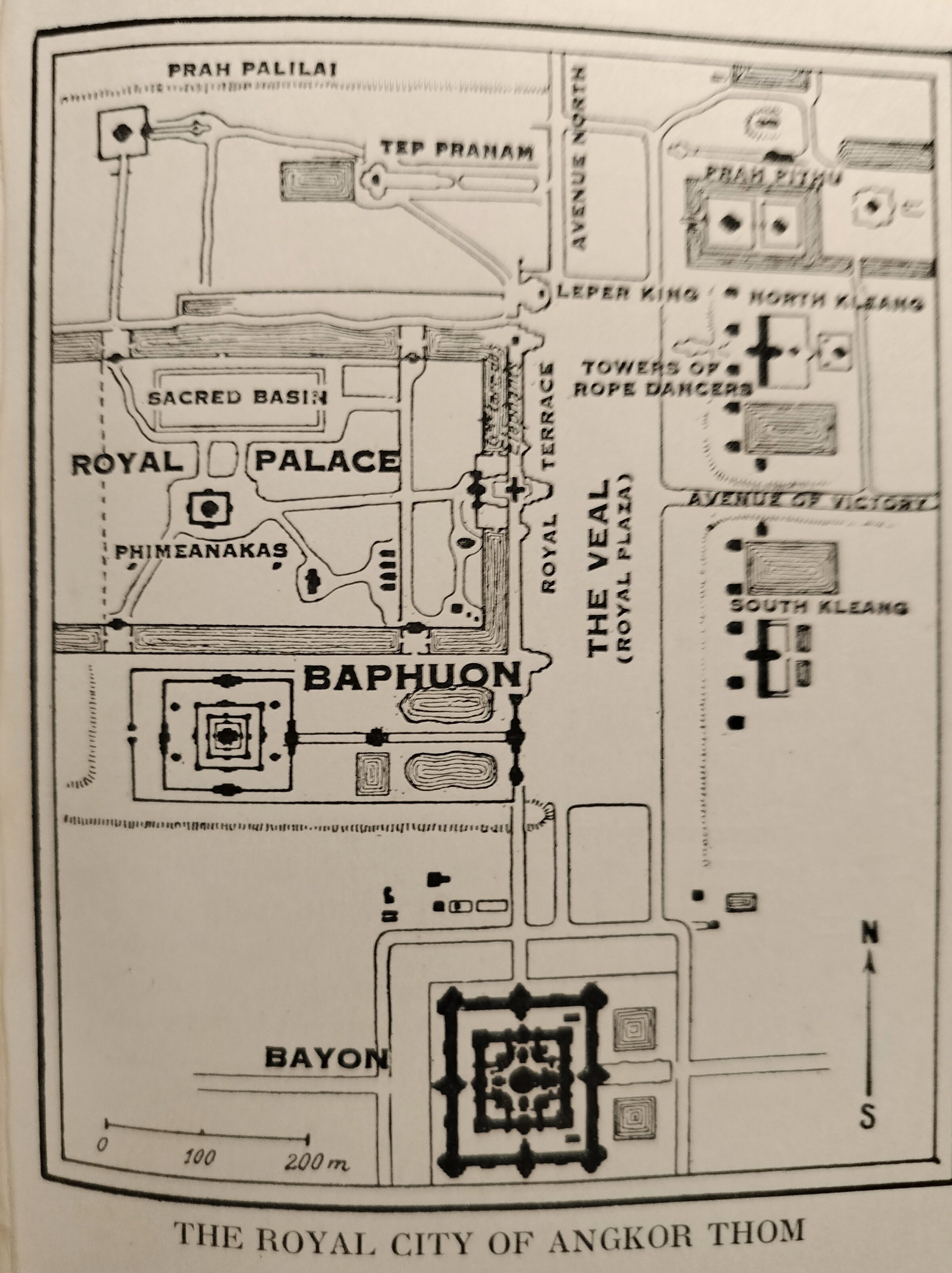
Angkor Thom Map, 1937
in Dickason D.H., Wondrous Angkor, 1937
Angkor Thom Map, 1937
in Dickason D.H., Wondrous Angkor, 1937
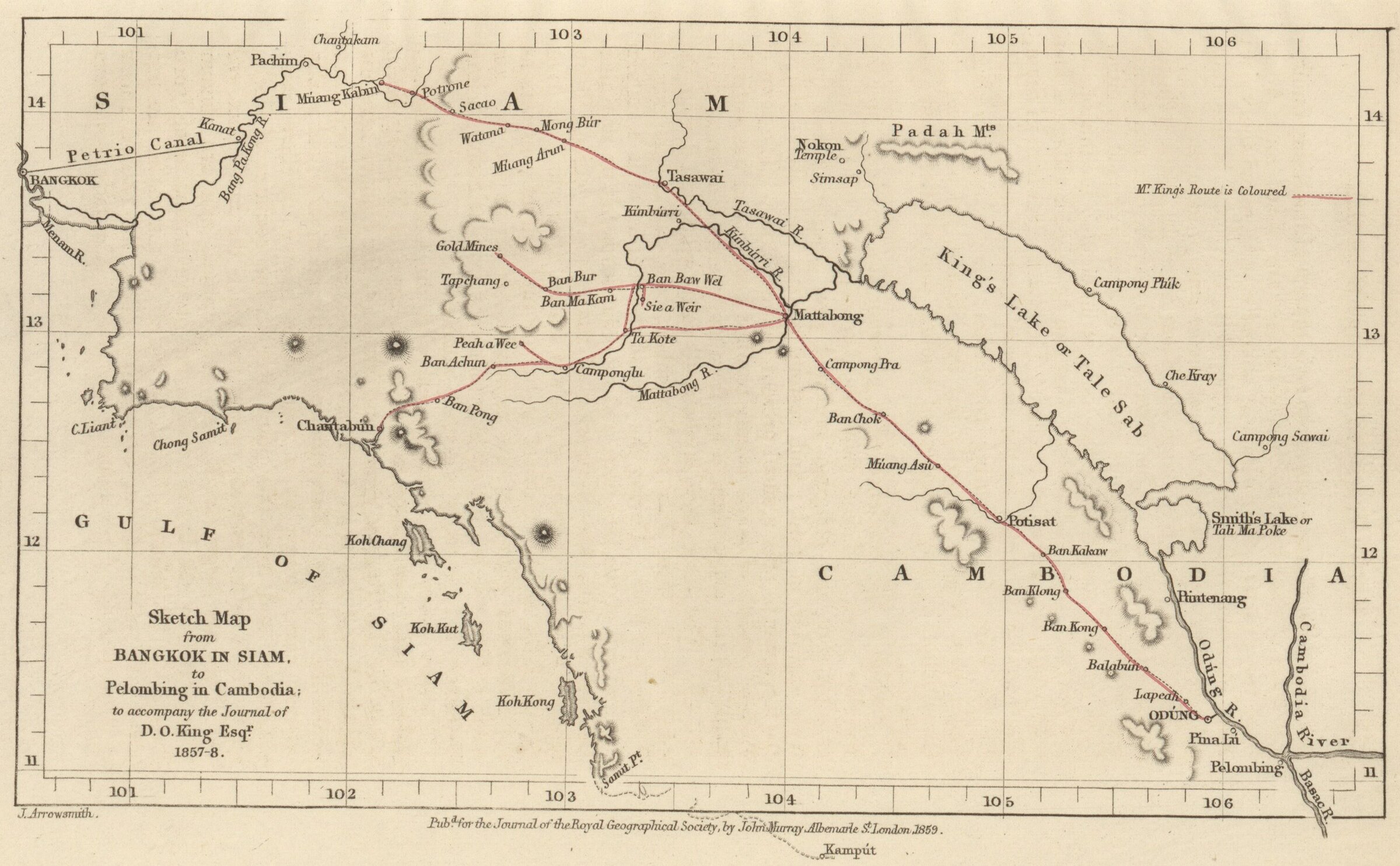
Itinerary of D.O. King through Siam and Cambodia, 1857
in David Olyphant King, Travels in Siam and Cambodia, 1859
Itinerary of D.O. King through Siam and Cambodia, 1857
in David Olyphant King, Travels in Siam and Cambodia, 1859
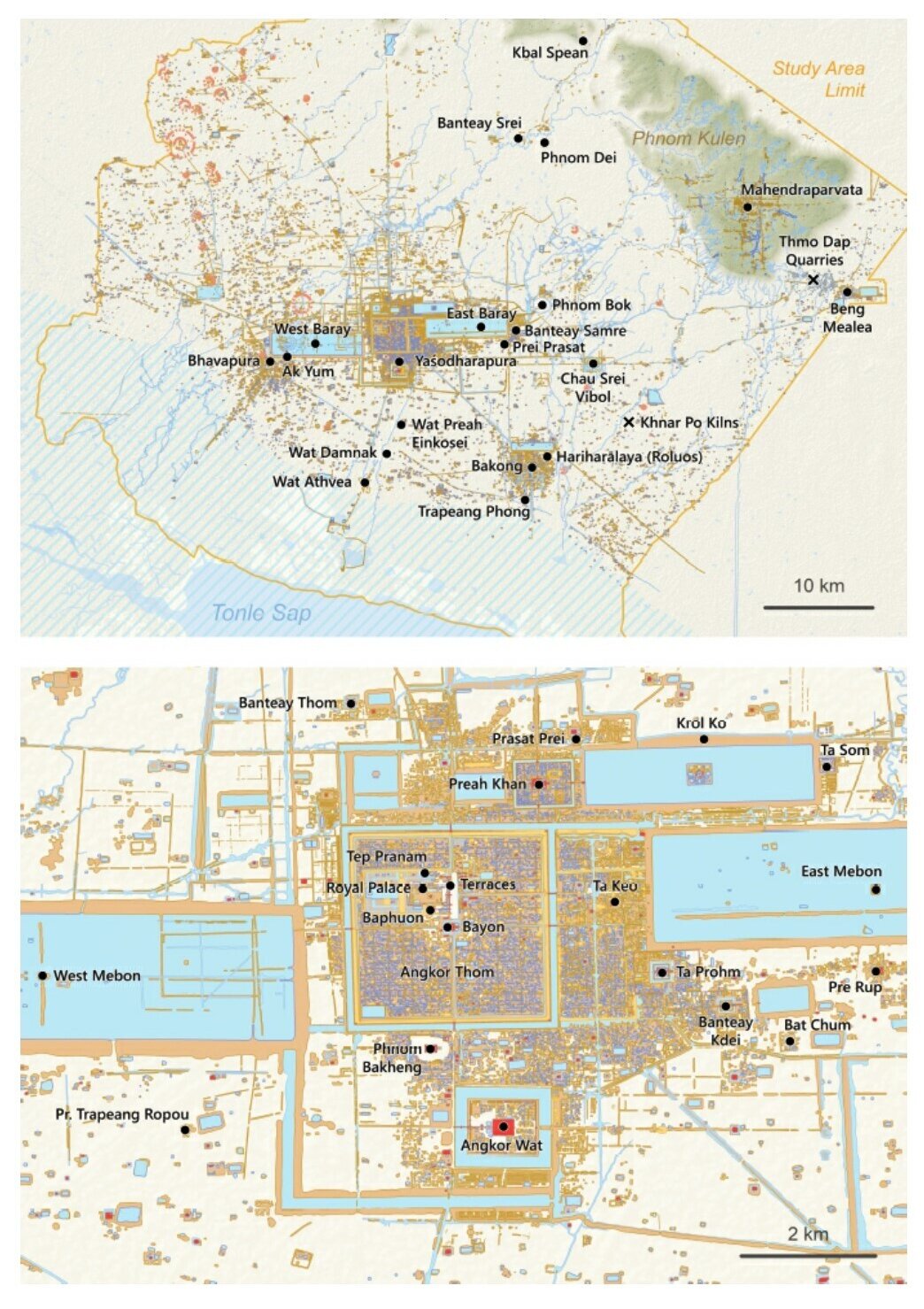
Angkor and Area in the 2000s
World Maps
Angkor and Area in the 2000s
World Maps
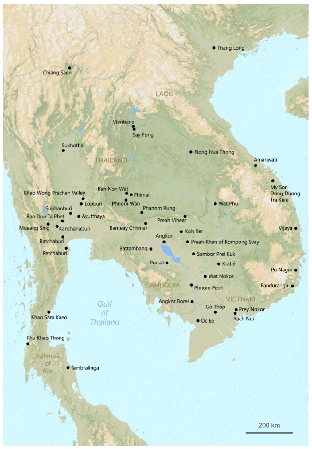
Archaelogical Sites of mainland Southeast Asia, 21st century
Miriam Stark and alt.
Archaelogical Sites of mainland Southeast Asia, 21st century
Miriam Stark and alt.
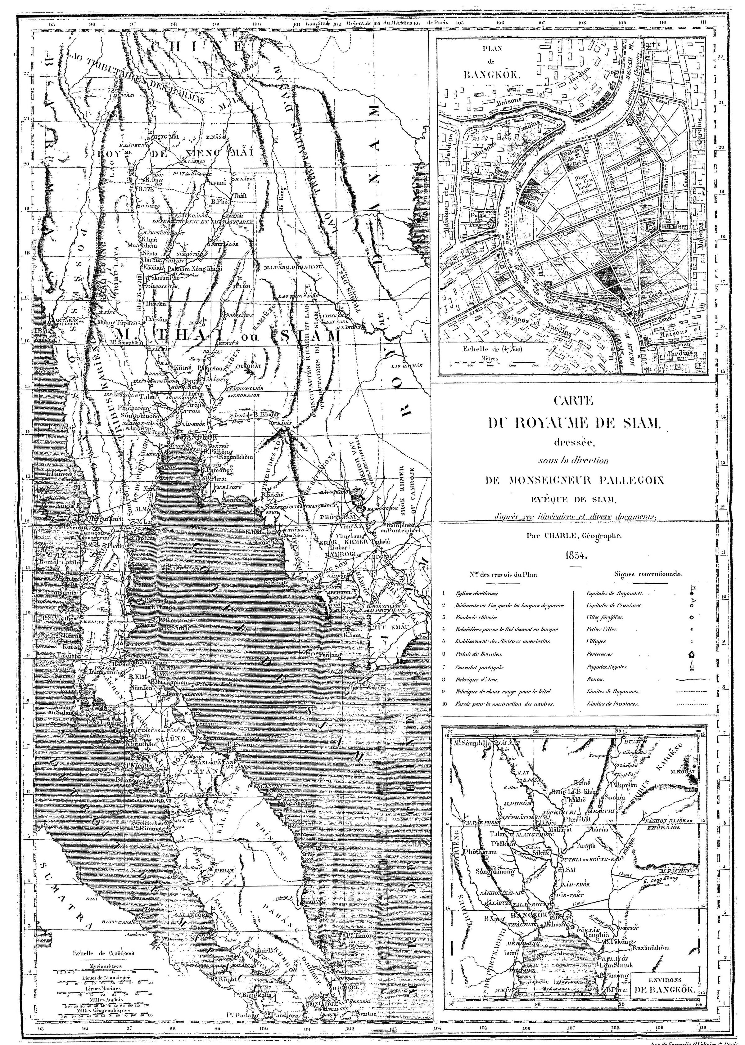
Carte du Royaume du Siam par Mgr Pallegoix [Kingdom of Siam Map], 1854
in Pallegoix, Description du Royaume Thai ou Siam
Carte du Royaume du Siam par Mgr Pallegoix [Kingdom of Siam Map], 1854
in Pallegoix, Description du Royaume Thai ou Siam
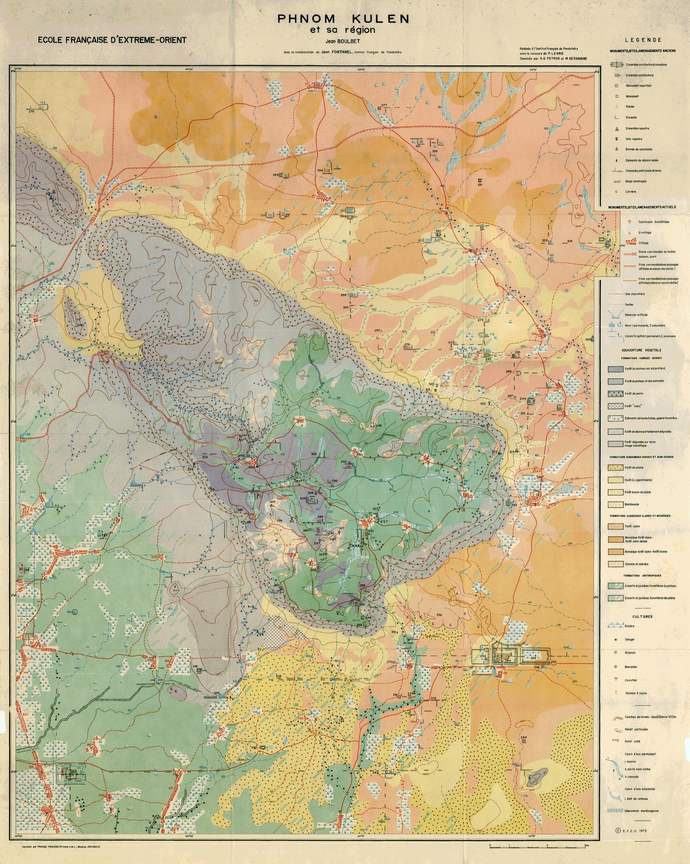
Phnom Kulen et sa région [Phnom Kulen and its area], 1973
by Jean Boulbet, EFEO.
Phnom Kulen et sa région [Phnom Kulen and its area], 1973
by Jean Boulbet, EFEO.
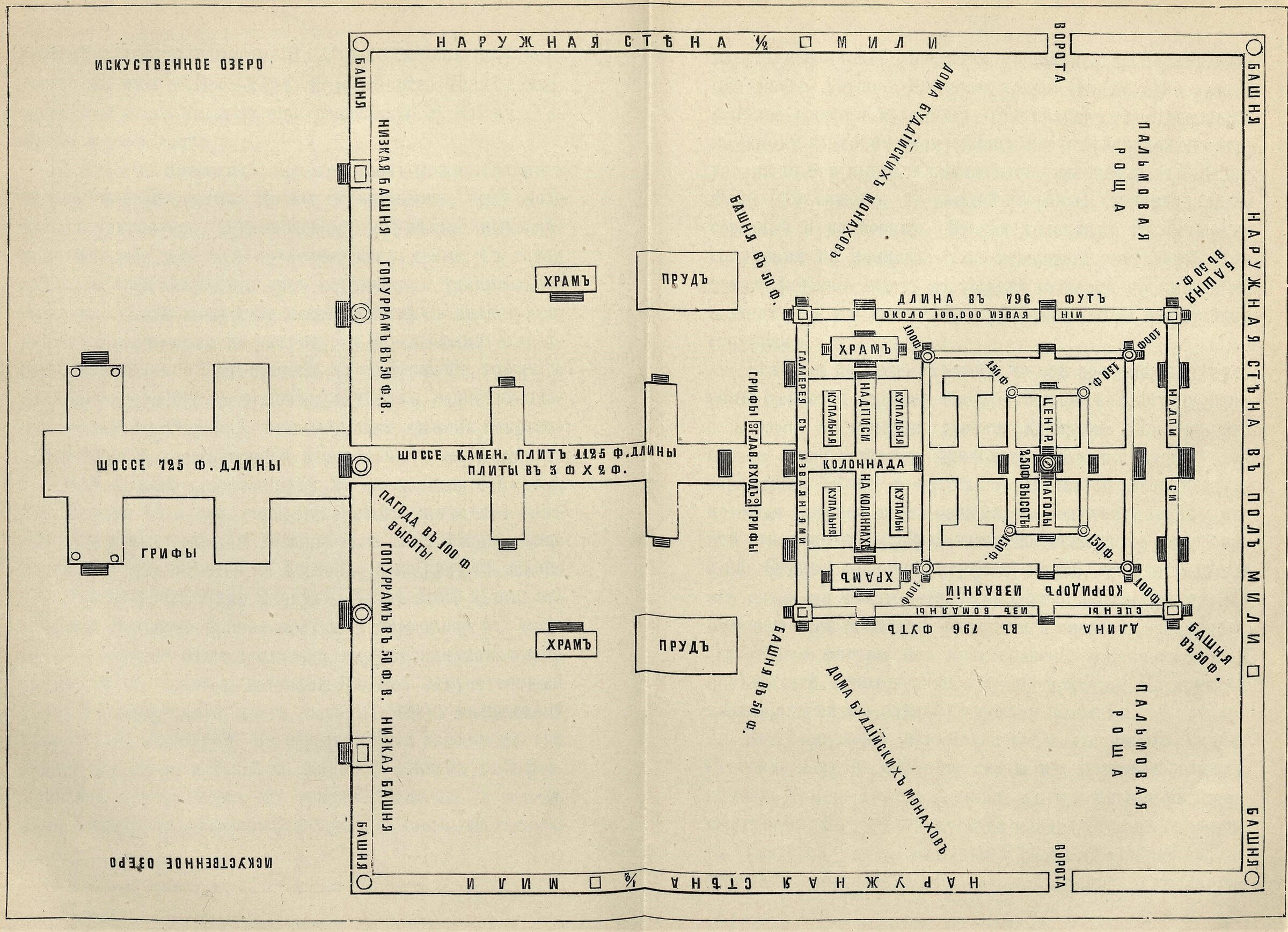
Angkor Wat Plan, 1895 [Russian]
by Grigory de Vollan in По белу свету (Across The World), 1895
Angkor Wat Plan, 1895 [Russian]
by Grigory de Vollan in По белу свету (Across The World), 1895