Maps & Plans
Building an online collection of maps related to Angkor, Khmer and Southeast Asia civilizations.
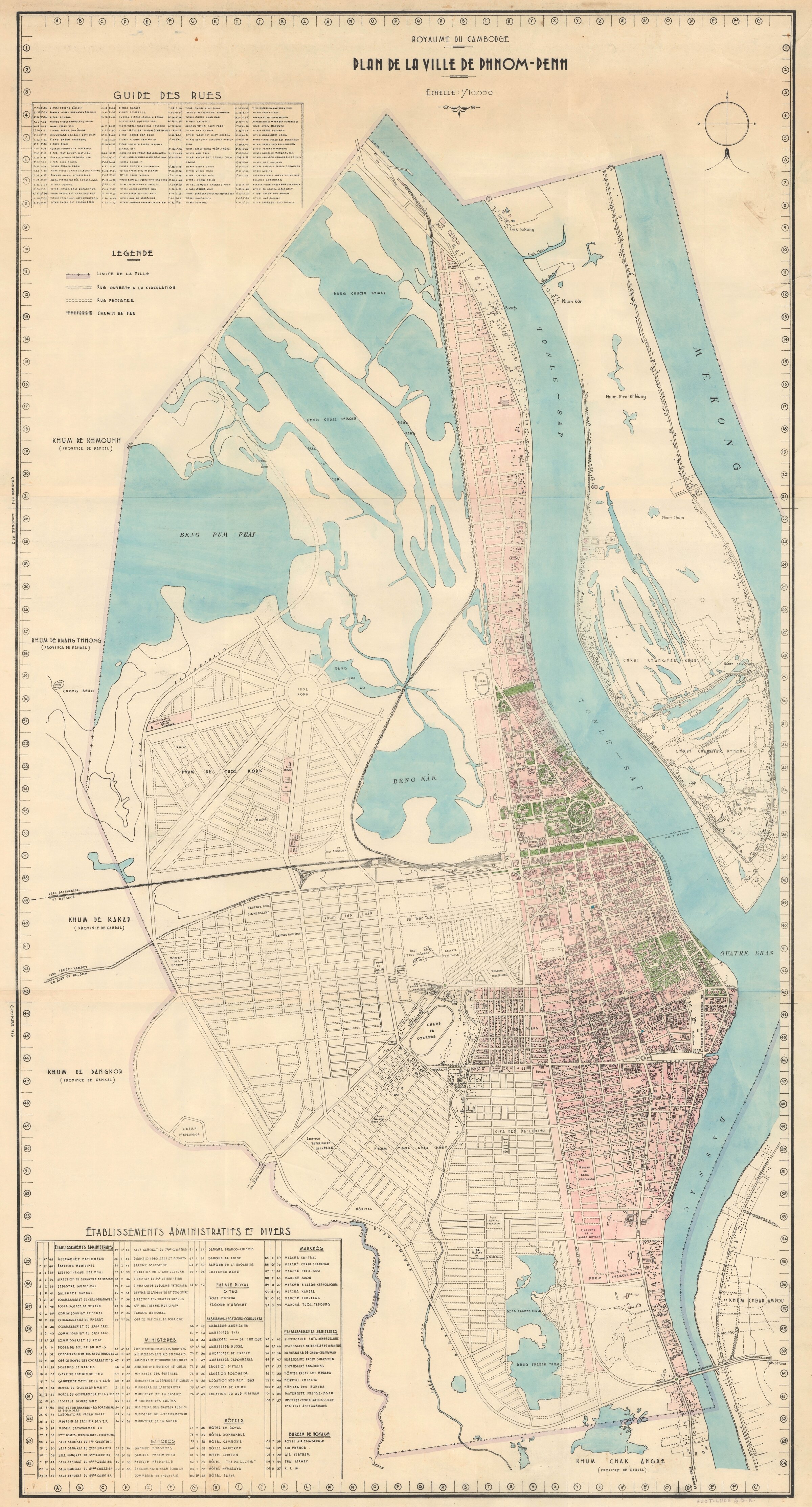
Plan de la Ville de Phnom Penh - Project c. 1956-1960
1956-1960 Draft by Service Géographique Khmer (SGK) from a 1935 map by colonial Service Géographique de l'Indochine (SGI). [compressed file from hi-res image purchased from Geographicus.com, July 2026. Contact us for available highest resolution file.]
1956-1960 Draft by Service Géographique Khmer (SGK) from a 1935 map by colonial Service Géographique de l'Indochine (SGI). [compressed file from hi-res image purchased from Geographicus.com, July 2026. Contact us for available highest resolution file.]
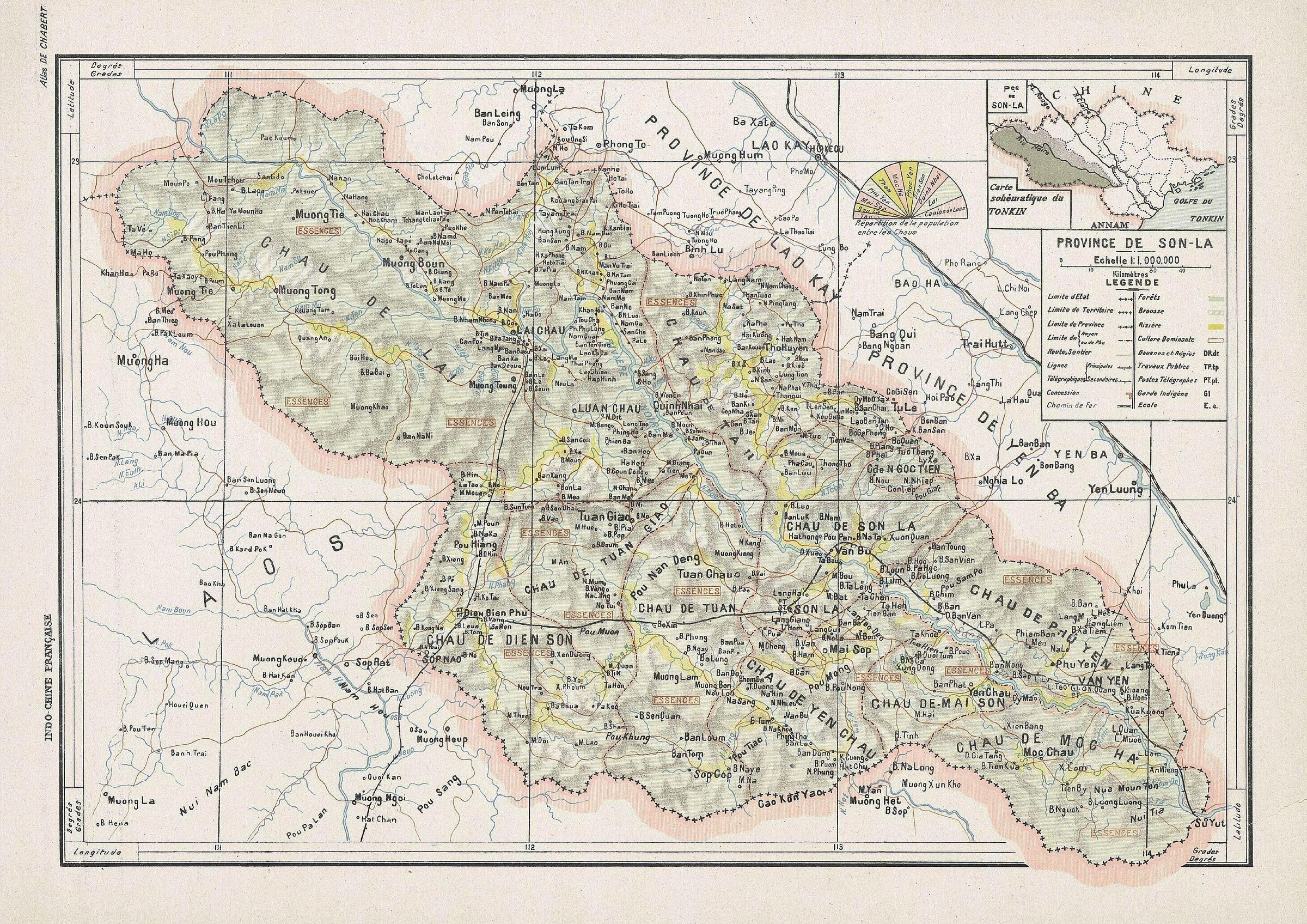
Province de Son La 1909
Map of Son-la region from Chabert & L.Gallois, Atlas, Hanoi-Haiphong, 1909.
Map of Son-la region from Chabert & L.Gallois, Atlas, Hanoi-Haiphong, 1909.
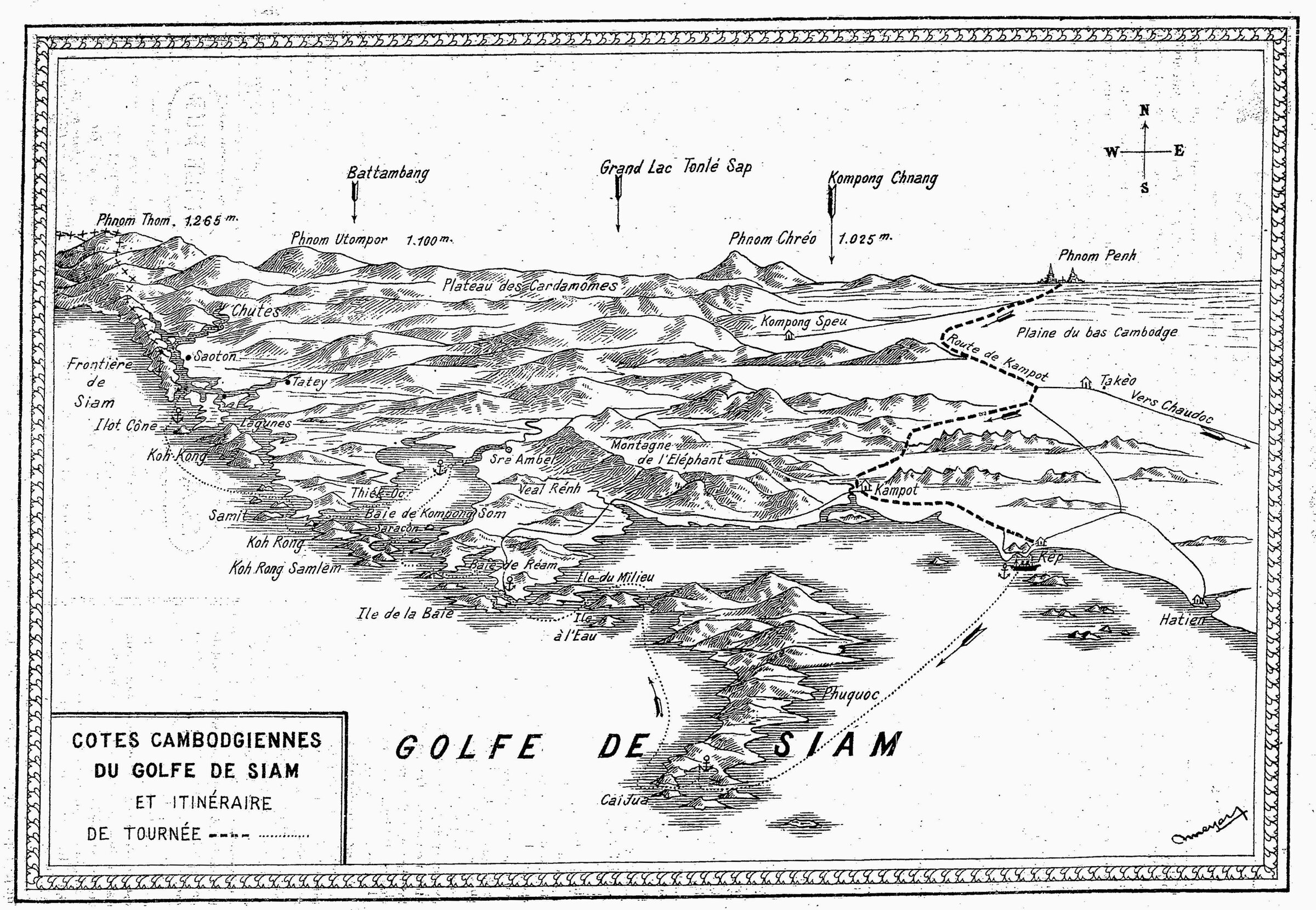
Côtes Cambodgiennes du Golf de Siam [Gulf of Siam, Cambodian Coastline], 1925
Map of the Gulf of Siam drawn by Roland Meyer before 1925 [published in "Croisière au Golfe de Siam", L'éveil économique de l'Indochine, 15 Jan.1925]
Map of the Gulf of Siam drawn by Roland Meyer before 1925 [published in "Croisière au Golfe de Siam", L'éveil économique de l'Indochine, 15 Jan.1925]
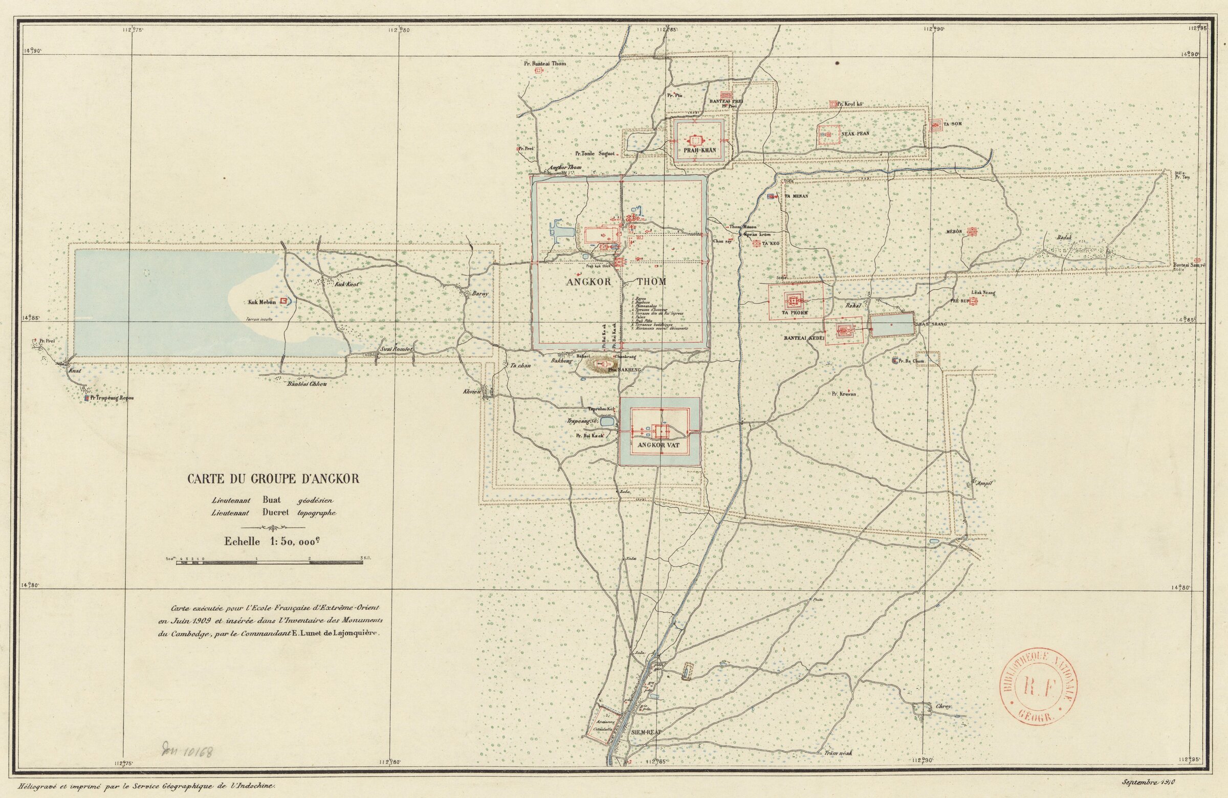
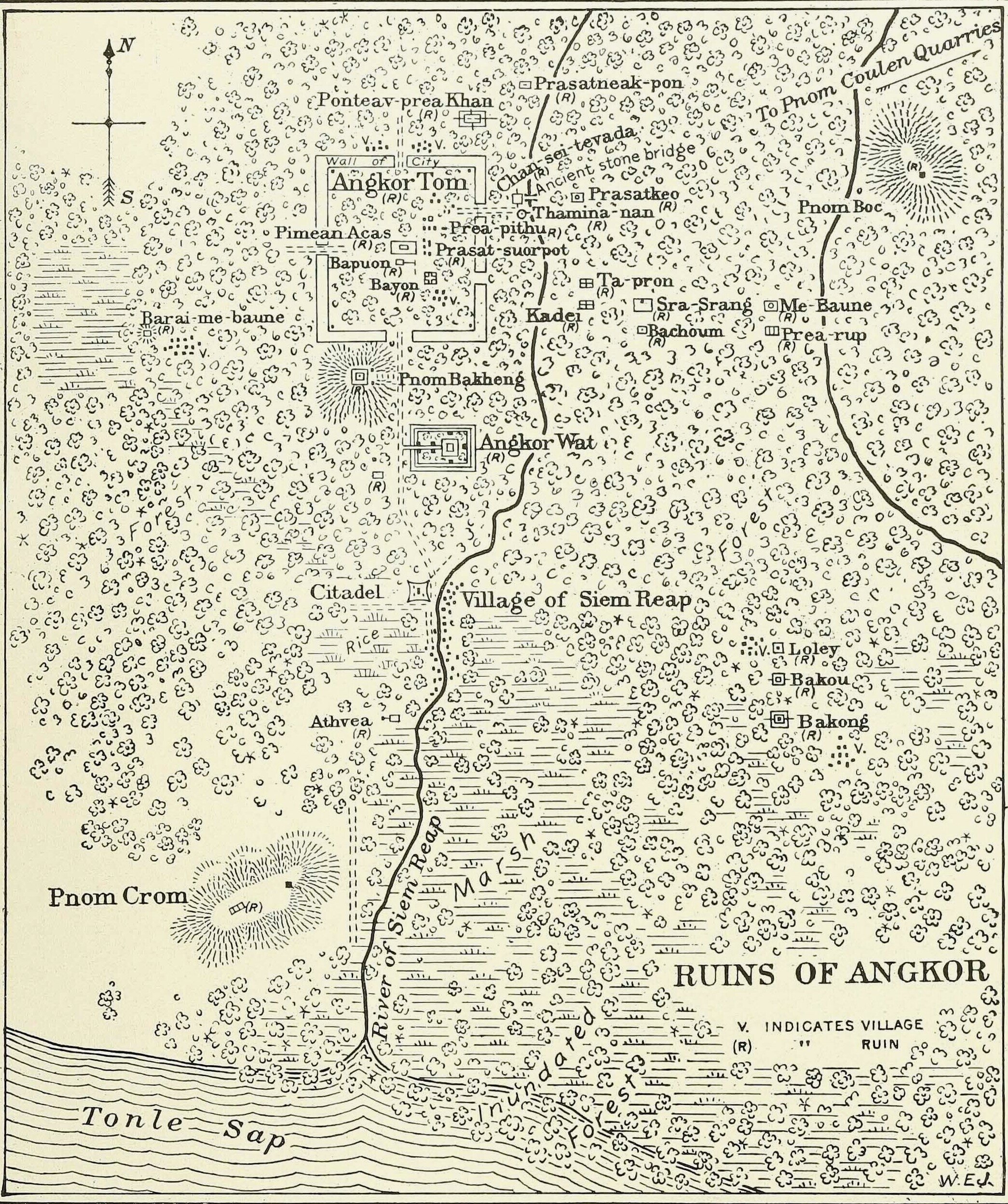
Map of Angkor Group, 1909-1911
Map drafted in 1909 by Lt Buat, geodetic engineer, and Lt Ducret, topographer, and printed in September 1910 to be published in Lunet de Lajonquière, Inventaire descriptif des monuments du Cambodge, Vol. III, 1911.[via gallica.bnf.fr]
Map drafted in 1909 by Lt Buat, geodetic engineer, and Lt Ducret, topographer, and printed in September 1910 to be published in Lunet de Lajonquière, Inventaire descriptif des monuments du Cambodge, Vol. III, 1911.[via gallica.bnf.fr]
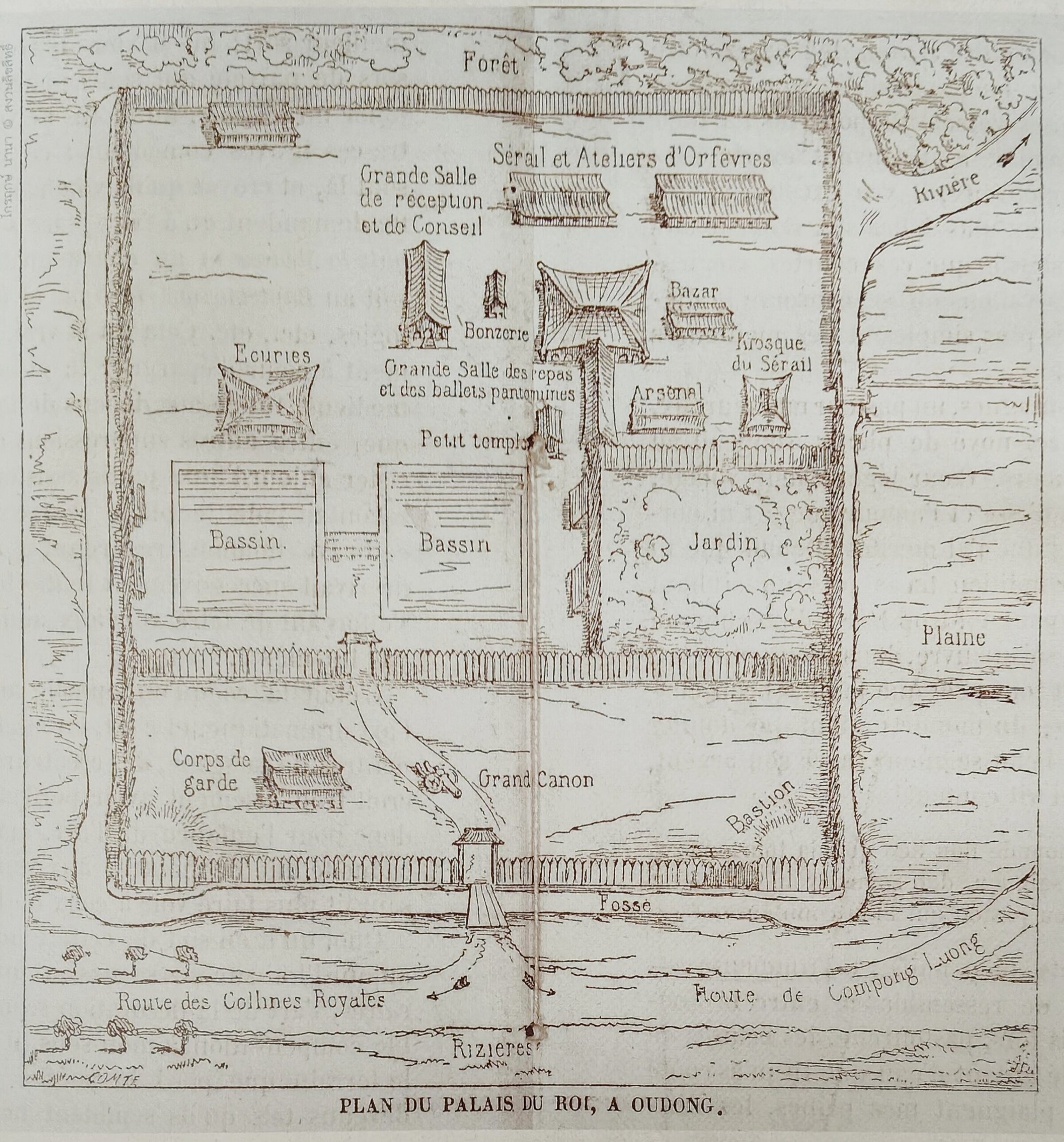
Oudong Royal Palace by Spooner
The only known plan of Oudong Royal Palace, site of Cambodian royal power until King Norodom undertook the erection of the new Palace in Phnom Penh starting from 1865 [source: L'Illustration, 30 Jan. 1864 [n 1092]: 72.]
The only known plan of Oudong Royal Palace, site of Cambodian royal power until King Norodom undertook the erection of the new Palace in Phnom Penh starting from 1865 [source: L'Illustration, 30 Jan. 1864 [n 1092]: 72.]
Spooner map 1866
'Ponthei Srey' [Banteay Srei] and 'Villes and Ruins' [Cities and Ruins] located on Phnom Kulen shown on this A. Spooner's map [L'Illustration, 1866].
'Ponthei Srey' [Banteay Srei] and 'Villes and Ruins' [Cities and Ruins] located on Phnom Kulen shown on this A. Spooner's map [L'Illustration, 1866].
Map01 HCMC
Analytical Map of Saigon [Gia Dinh] by Ngo Minh Hung [in Vietnam Desk: Transformation of built cultural heritage in old Saigon (Ho Chi Minh City), 5 Sept. 2022].
Analytical Map of Saigon [Gia Dinh] by Ngo Minh Hung [in Vietnam Desk: Transformation of built cultural heritage in old Saigon (Ho Chi Minh City), 5 Sept. 2022].
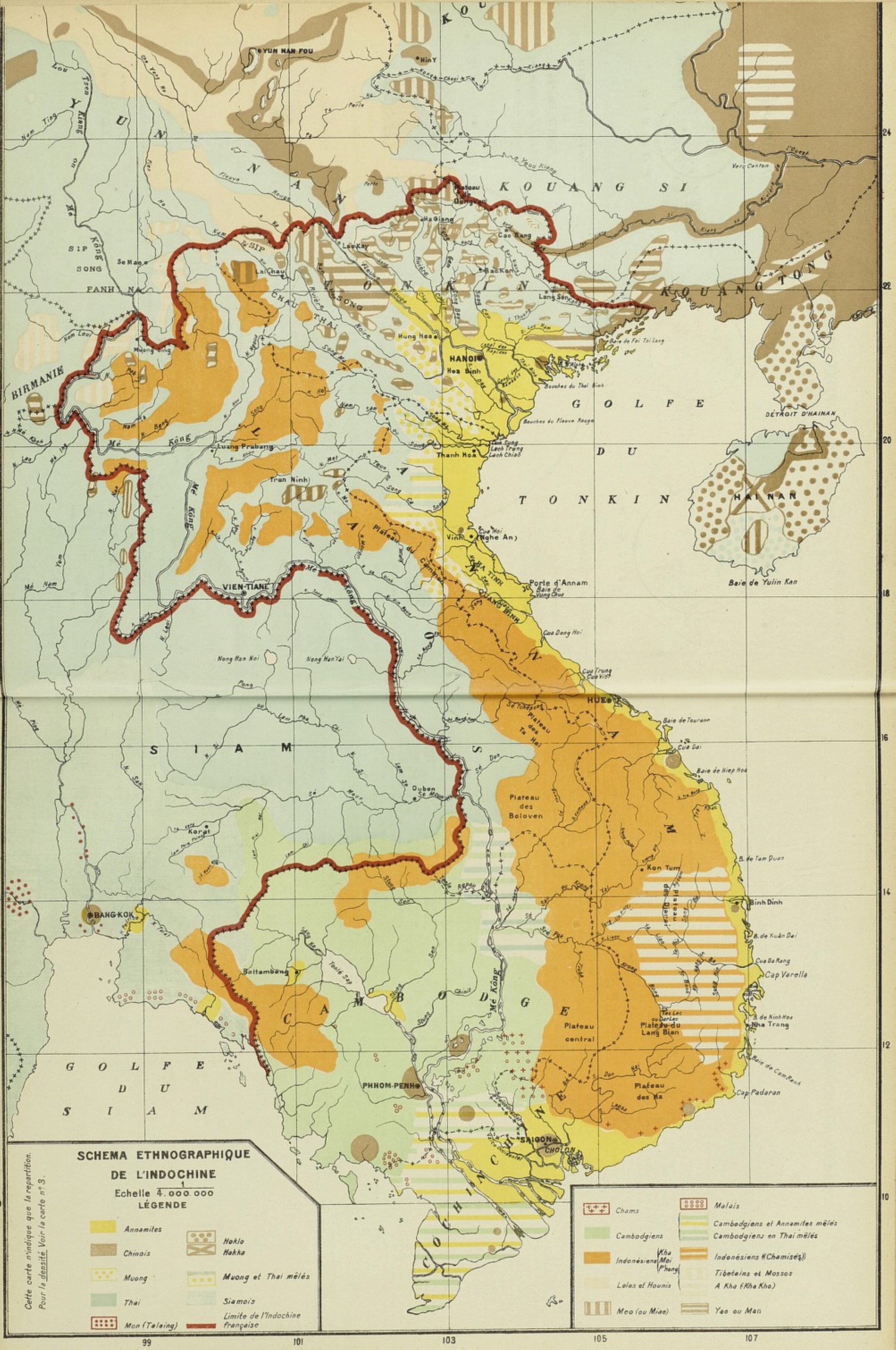
"Ethnographic Diagram of Indochina", 1914
in Henri Brenier, Essai d'atlas statistique de l'Indochine, GGI, Hanoi-Haiphong, 1914.
in Henri Brenier, Essai d'atlas statistique de l'Indochine, GGI, Hanoi-Haiphong, 1914.
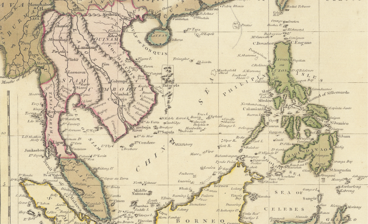
South China Sea Channels between China, Southeast Asia and New Holland, 1794
Detail of An Accurate Map of the Islands and Channels between China and New Holland by
Robert Wilkinson (1752 - 1825), London 1794. [from the reproduction at Ruderman-Rare Maps].
Detail of An Accurate Map of the Islands and Channels between China and New Holland by
Robert Wilkinson (1752 - 1825), London 1794. [from the reproduction at Ruderman-Rare Maps].
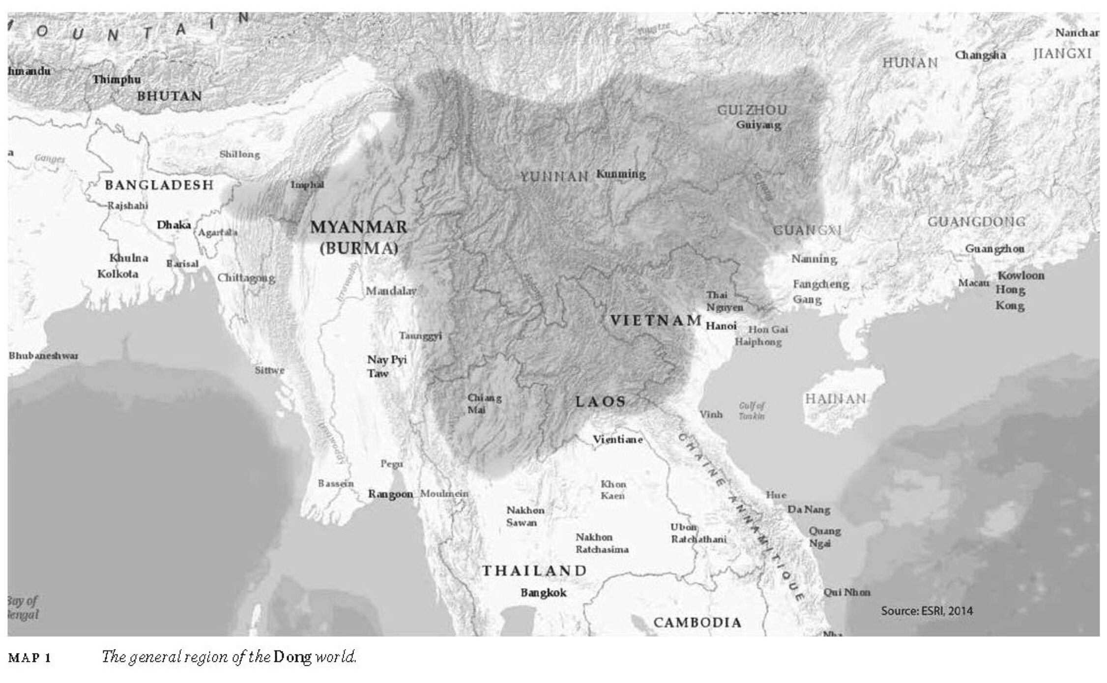
The Dong World, general region
The general region of the Dong world according to the editors [Map 1 in J. Whitmore & J. Anderson eds., China’s Encounters on the South and Southwest: Reforging the Fiery Frontier Over Two Millennia, 2015. Source: ESRI, 2014].
The general region of the Dong world according to the editors [Map 1 in J. Whitmore & J. Anderson eds., China’s Encounters on the South and Southwest: Reforging the Fiery Frontier Over Two Millennia, 2015. Source: ESRI, 2014].
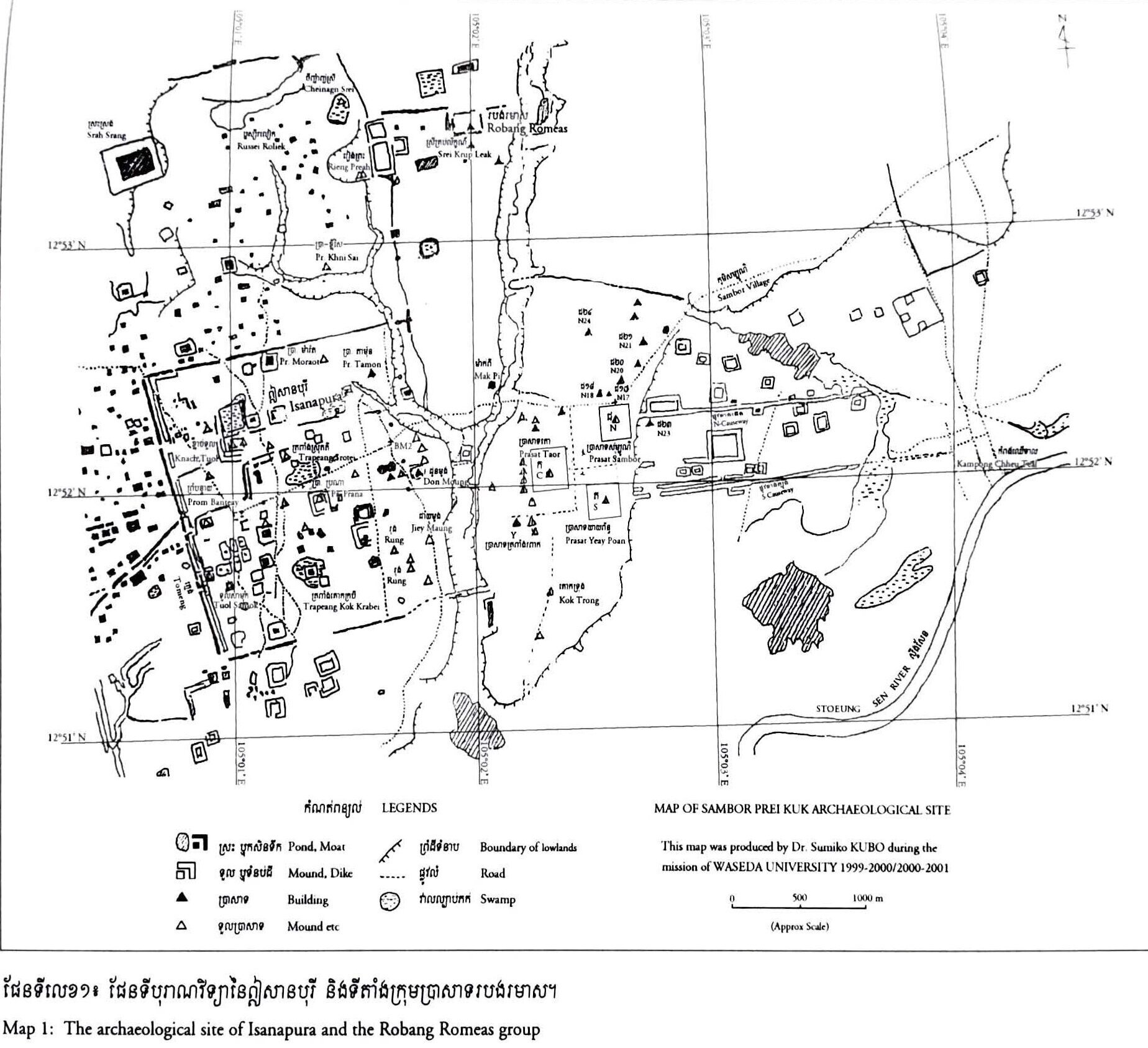
Keo Kinal Ishanapura Map
The site of Sambor Prei Kuk, map by Dr. Sumiko Kubo draught during the Waseda University mission 1999-2001 [repr. in Keo Kinal 2004.]
The site of Sambor Prei Kuk, map by Dr. Sumiko Kubo draught during the Waseda University mission 1999-2001 [repr. in Keo Kinal 2004.]
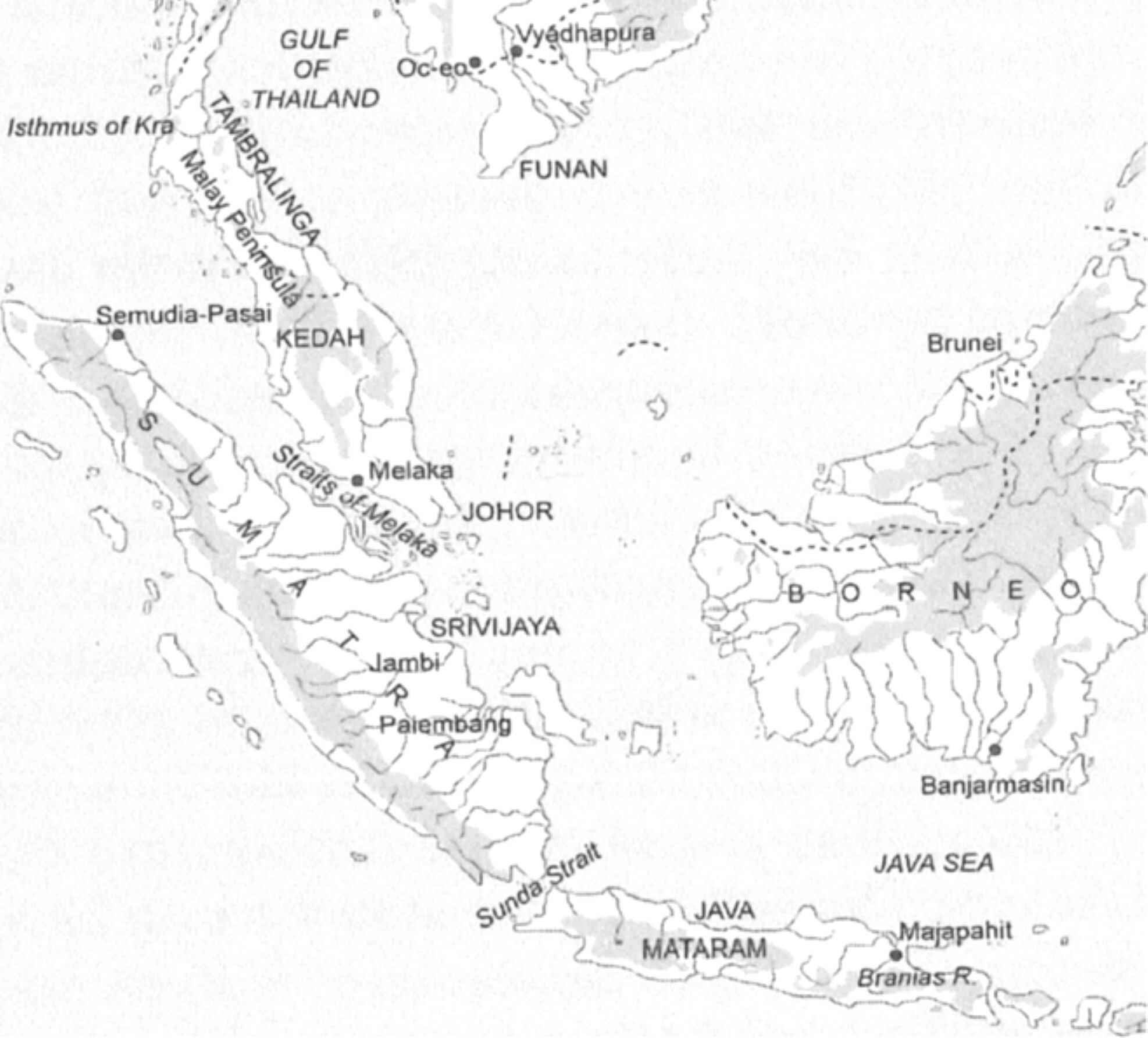
Melaka Straits, 15h century
15th-century Straits of Melaka: South China Sea - Eastern Indian Ocean Passageway. [Map by the the Ball State University Cartographer and K.R. Hall, in Whitmore 2022, p 417.]
15th-century Straits of Melaka: South China Sea - Eastern Indian Ocean Passageway. [Map by the the Ball State University Cartographer and K.R. Hall, in Whitmore 2022, p 417.]
Thang Long Citadel site c. 1880
'Annamite map of Hanoi' collected betw. 1876 and 1883 [Paris, Bibliothèque Nationale de France, DCP-GE A-395 (RES), public domain, repr. in Discovering Vietnam's Ancient Capital, 2024].
'Annamite map of Hanoi' collected betw. 1876 and 1883 [Paris, Bibliothèque Nationale de France, DCP-GE A-395 (RES), public domain, repr. in Discovering Vietnam's Ancient Capital, 2024].
Catalogue Guimet 25
Outline Map showing the ruins of Angkor
Illustrating Jacob E. Conner's article in National Geographic 23-3, March 1912.
Illustrating Jacob E. Conner's article in National Geographic 23-3, March 1912.
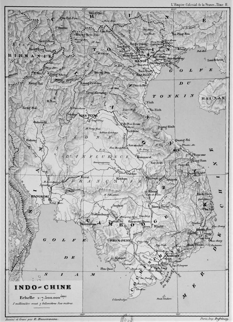
Map of Indochina, c. 1901
Map of Indochina by R. Hausermann, [from J. Gervais-Courtellemont, Empire colonial de la France: Indochine, 1901.]
Map of Indochina by R. Hausermann, [from J. Gervais-Courtellemont, Empire colonial de la France: Indochine, 1901.]
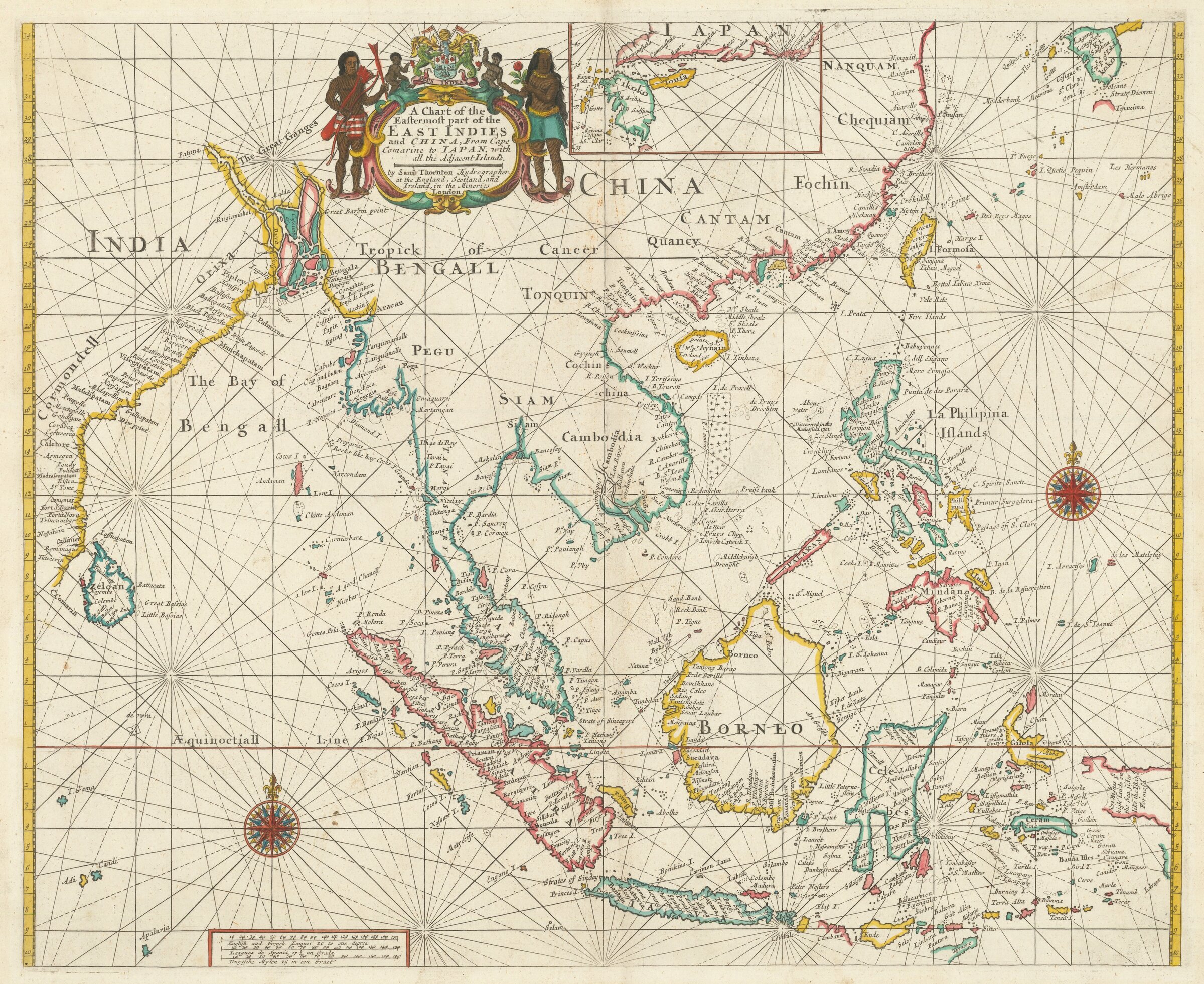
Navigation Map for the English East India Company, c.1706
Samuel Thornton's Chart of the Easternmost part of the East Indies and China, From Cape Comarine to Iapan, with all the Adjacent Islands, London, c. 1706. [see more here].
Samuel Thornton's Chart of the Easternmost part of the East Indies and China, From Cape Comarine to Iapan, with all the Adjacent Islands, London, c. 1706. [see more here].
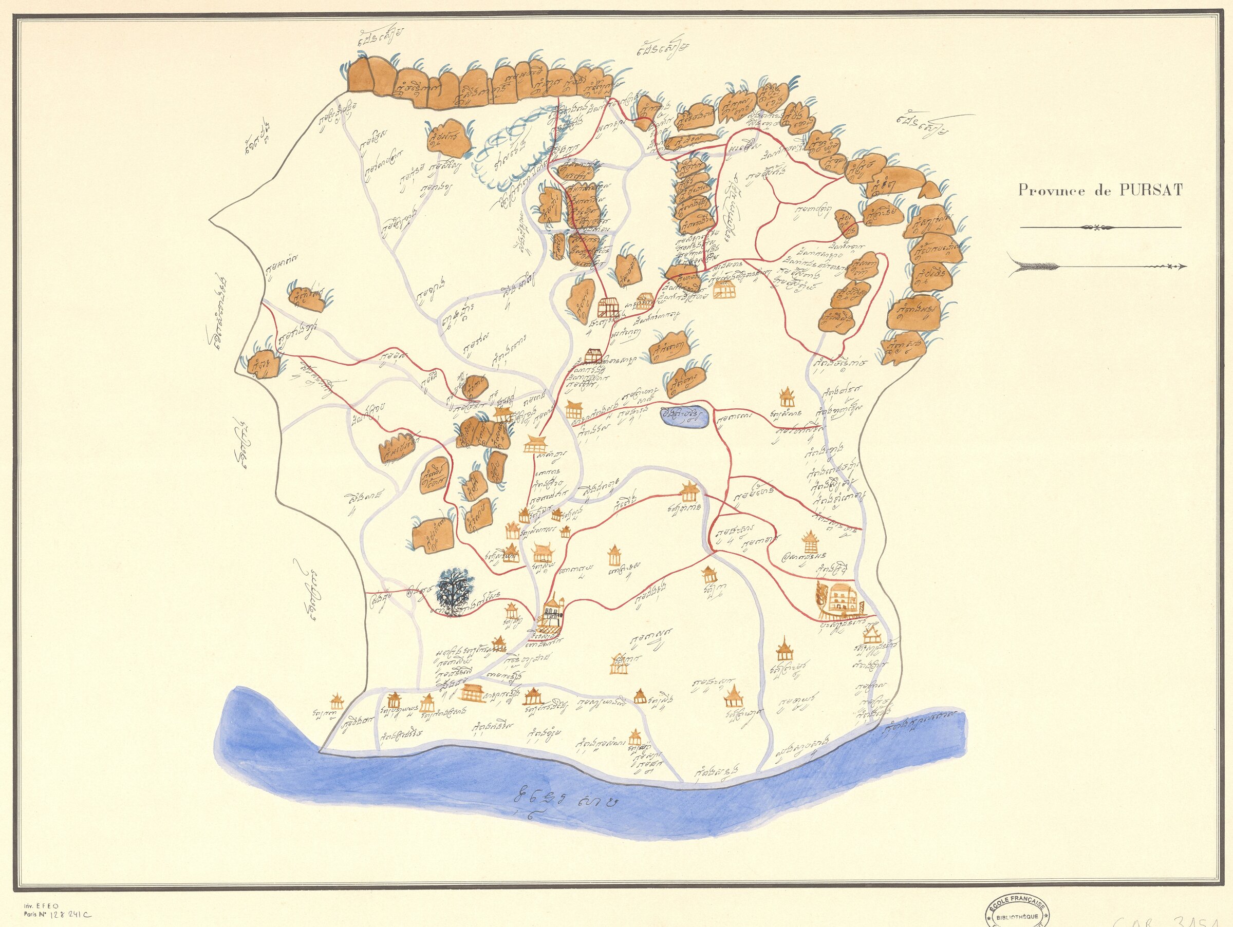
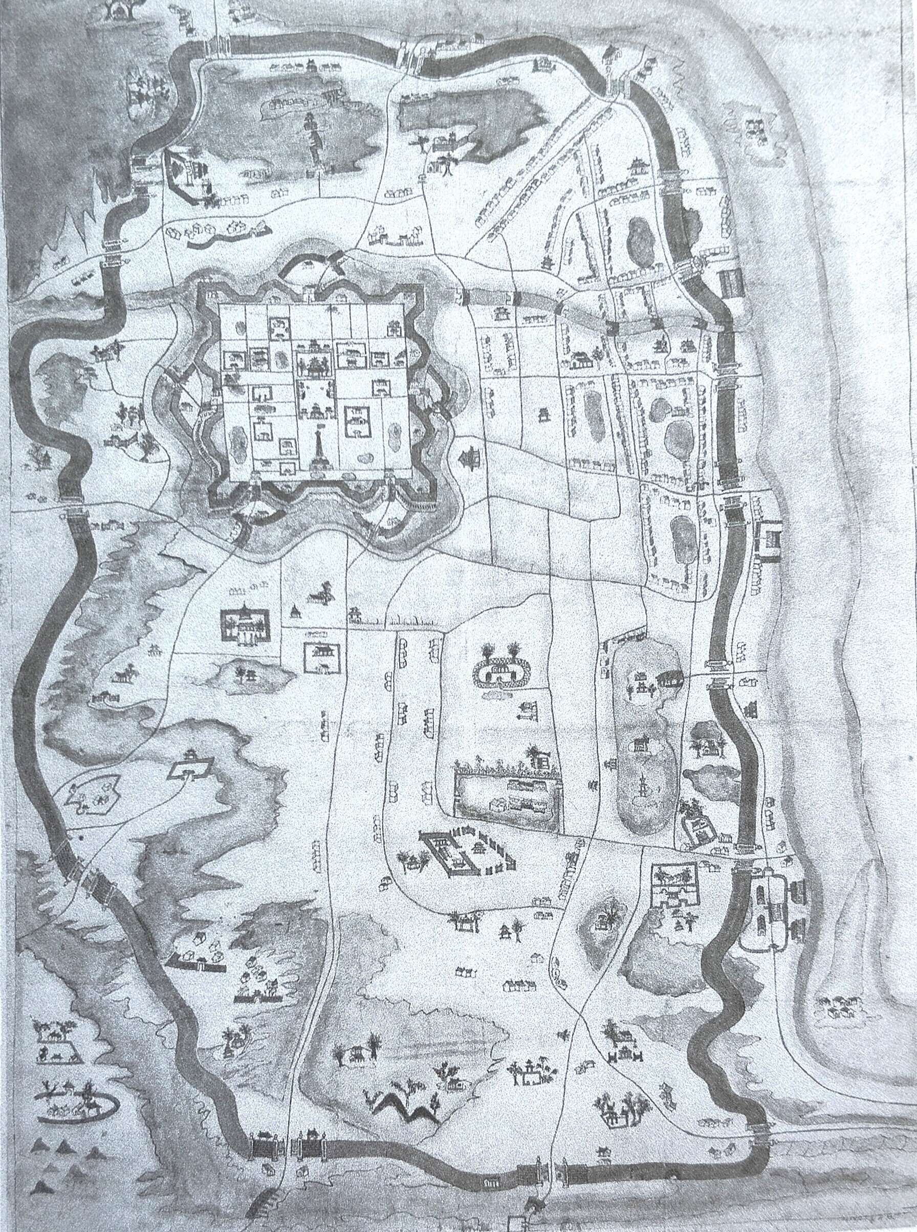
Map of Pursat Province in Khmer, nd
Map of Pursat Province in Khmer, nd [EFEO Collection of Khmer Manuscripts
Map of Pursat Province in Khmer, nd [EFEO Collection of Khmer Manuscripts
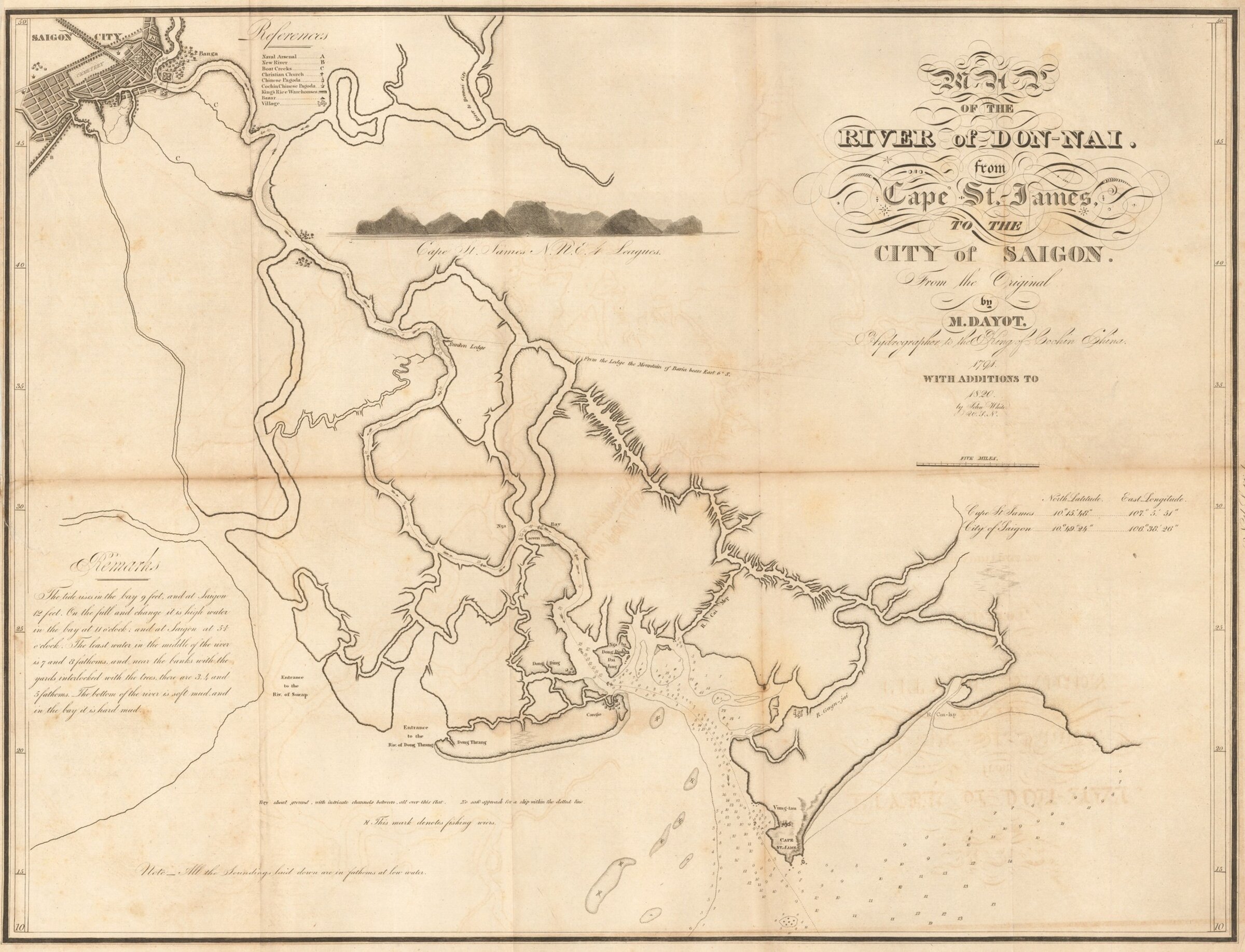
Dong Nai River Map with soundings, 1820
'Map of the River of Don-Nai [Dong Nai] from Cape St. James to the City of Saigon [Ho-Chi-Minh-City], from the Original by M. Dayot, Geographer to the King of Cochin China (1791) with Additions to 1820 by John White, U.S.N.' [folded map in History of A Voyage to the China Sea, Boston, 1823, via Barry Lawrence Ruderman Antique Maps Inc.].
'Map of the River of Don-Nai [Dong Nai] from Cape St. James to the City of Saigon [Ho-Chi-Minh-City], from the Original by M. Dayot, Geographer to the King of Cochin China (1791) with Additions to 1820 by John White, U.S.N.' [folded map in History of A Voyage to the China Sea, Boston, 1823, via Barry Lawrence Ruderman Antique Maps Inc.].
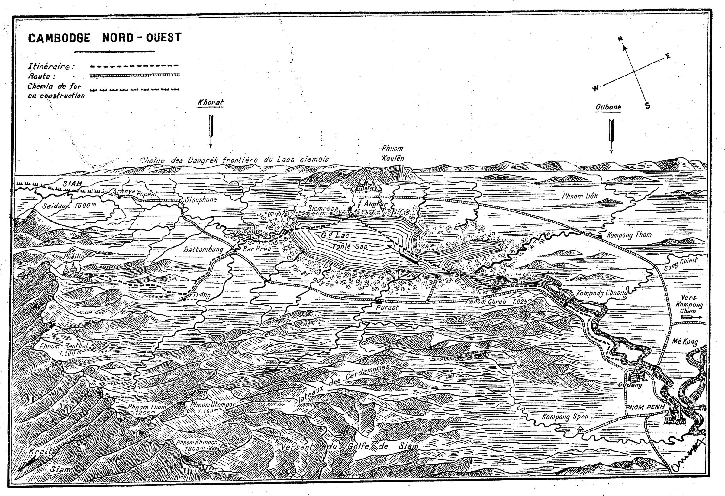
Roland Meyer's itinerary in Northwestern Cambodia, c. 1925
From "Au Royaume des saphirs", L'Eveil économique de l'Indochine, 22 Feb. 1925, p. 10. [via gallica.bnf.fr]
From "Au Royaume des saphirs", L'Eveil économique de l'Indochine, 22 Feb. 1925, p. 10. [via gallica.bnf.fr]