Notices of the Port of Kampot and of the Coast of Cambodia up to Chentabon, 1851, 1852
by George D. Bonnyman

- Author
- George D. Bonnyman
- Publication
- Journal of the Indian Archipelago and Eastern Asia, ed. J.R. Logan, vol 5, Singapore, 1851, pp 430-5 ; vol VI, 1852, pp 117-22, pp 239-41
- Published
- 1852
- Pages
- 16
- Language
- English
pdf 2.0 MB
George D. Bonnyman, captain of the Pantaloon brig, shared his geographical observations from the commercial exploratory trip to Cambodia led by L.V. Helms first in 1851, then in 1852, in the Journal of the Indian Archipelago and Eastern Asia. These notes include the approach to the port of Kampot, and later on the entire coast of Cambodia, as the mission sailed to Bangkok after receiving the news of the death of King Rama III of Siam.
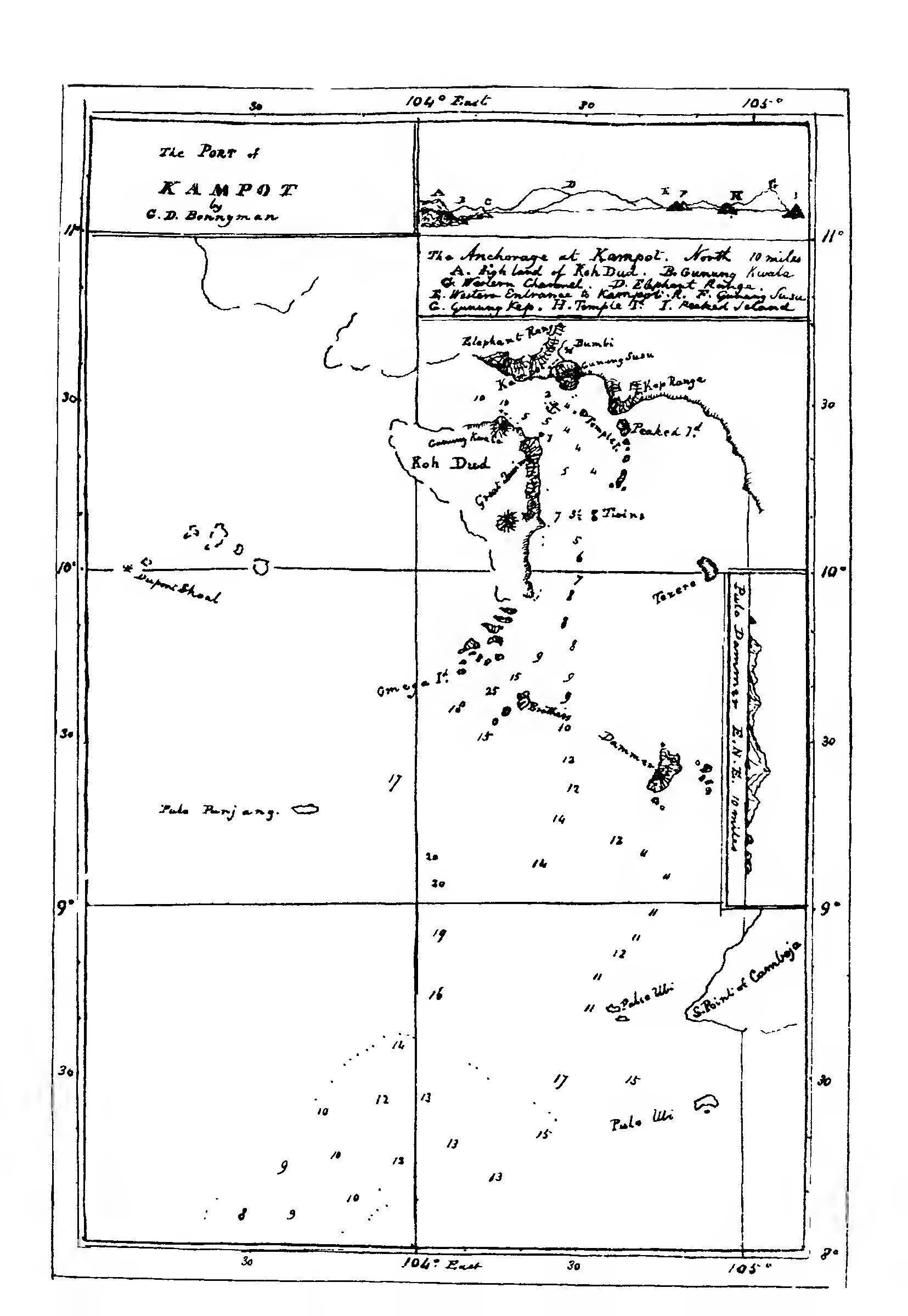
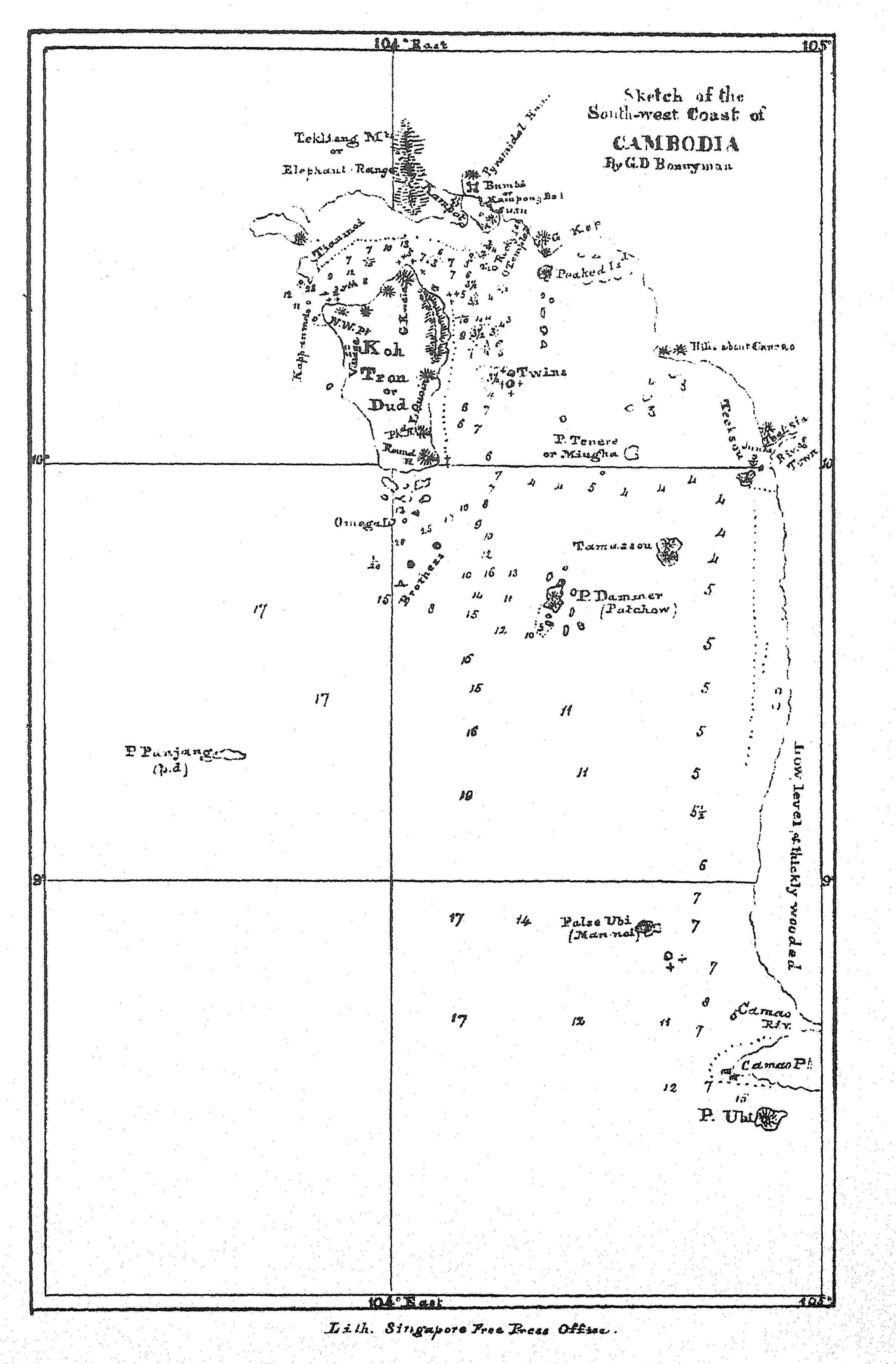
Comparing the two sketches of Kampot area made by Bonnyman, we can see that the navigator improved the geographic and toponymic indications. The author often refers to “Horsburgh’s chart”, and his contribution is certainly an improvement, as Scottish hydrographer James Horsburgh (1762 ‑1836) had marked as “Improperly Known” the coast of Cambodia in his China Sea Sheet 1 (for the East India Company in 1821), improving it in later updates. Horsburgh had been the first mate in the Atlas when it was shipwrecked on the island of Diego Garcia in 1786, hence his committmemt to produce accurate navigation maps. [see Barry Lawrence Ruderman Antique Maps]. In 1811, he finalized Directions for Sailing to and from the East Indies, China, New Holland, Cape of Good Hope, and the interjacent Ports, updated by the Admiralty after his death, a Bible for British seamen such as Bonnyman.
1 — Notices of the Port of Kampot, with directions for the Eastern Channel (JIAEA, 1851)
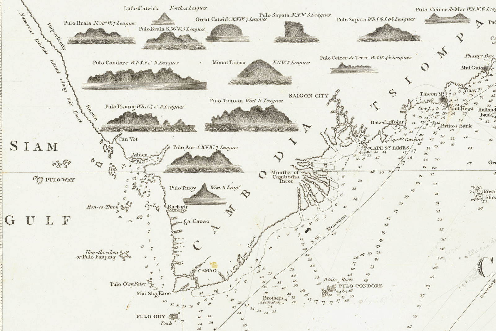
Ships bound to Kampot from Singapore during the north-east monsoon, should endeavour to make Pulo Ubi [1], near the South Point of Cambodia, as it is a useful guide for vessels proceeding along the coast to the north, and enables them to avoid a shoal said to exist some distance to the westward, the position of which is uncertain. After passing False Pulo Ubi, steer to the northward to make Pulo Dammer [3], a high island 12 miles in length north and south, and about 5 miles in breadth, with two small islands near the south extreme, and a single rocky islet off the north end. Dammer Peak, in the southern part of the island, may be seen from a distance of nearly 50 miles in clear weather. It is in Lat. 9“ 25’ N. Long. 104“36’ E. according to a series of measurements carried from the anchorage at Kampot. To the northwest of Pulo Dammer, distant about 35 miles, lies the large island Koh Dud, called also Koh Tron [later Koh Tran, in fact Koh Tral], which is no doubt identical with Hon-co-Thron of Horsburgh’s chart.
This island is of triangular form — with the apex to the southward and extends north and south upwards of 30 miles. The channel between Pulo Dammer and Koh Dud is the one generally used by ships bound to and from Kampot. It is divided into two distinct channels by a group of islands called the Brothers, the northernmost of which, (a peaked island, moderately elevated and about a mile and a half in length) bears from Dammer Peak N. 00“ W. 29 miles. The other island, which is less elevated and more level than the northern Brother, bears from it S. W. by W. J W. 5 miles and has a rocky islet 3 miles off to the S. W. which appeare to be connected with it by a reef.
Omega island, the south-westernmost of a chain of islets which extends from the south point of Koh Dud, bears from the N. Brother N. 69o W. 12 miles. This chain consists of a number of small islets with 5 or 6 of a larger size, each consisting of a Quoin-shaped hill, with the bluff face to the eastward. The channel between this group and the Brothers is safe to work through, with soundings varying from 13 to 30 fathoms.
The east coast of Koh Dud runs nearly north and south for 28 11miles, when it tends N. W. 1/4. W. 7 miles to Rocky Point, the north extreme. The whole of this coast is lined by a reef, said by the natives to extend a considerable distance off the south-east end, but squally weather while passing prevented us from ascertaining its extent. It is avoided by keeping the Great Brother S. 1/2. W. after passing it, and not bringing it to bear more southerly until well past the south point of Koh Dud.
The eastern channel, between Pulo Dammer and the Brothers, is the widest and the least intricate. When abreast of the Brothers a northerly course should be steered to make the Twins, two small islands covered with trees and surrounded by a reef, which appear in one on a N. N. E. bearing. The Twins lie N. 2Uo E. from the Brothers, distant 35 miles. When within 3 miles of the Twins, steer to pass about mid-channel between them and the Koh Dud shore, as the channel to the east-ward of the Twins is not safe. The soundings here will be 3.1÷2 and 3.1÷4 fathoms until the Twins bear about £. S. E. when the water deepens to 5 and 6 fathoms.
If the weather is clear, two mounts or hummocks, having the appearance of islands, will now be seen to the North. These are called Gunung Susu or the Paps [4], and form a good leading mark for the anchorage off Kampot. These should be kept bearing north while steering for the archorage, until Gunung Kwala, the northernmost hill on Koh Dud is brought to bear W. by N. 4 N. when it is necessary to edge off a little to the west-ward until the Pap are brought N. by E. to avoid some patches of 2 fathoms, which lie S. 20 W. from the Paps. […]
From the anchorage as given above, the western mouth of the Kampot river hears N. N.W. h W. 6 miles, the intermediate space being occupied by a shoal flat which must be approached with caution, especially if the Western channel be adopted, as the bank stretches more than midway across from the main-land to the north side of Koh Dud, and is in many places steep-to, with projecting spits of 1 1/2 fathoms. It was on one of these spits that the barque Sea Gull was wrecked during last year, about 4 miles due west from the anchorage.
The town of Kampot lies about 4 miles up the western branch of the river, which has two entrances, one close to the foot of the Paps, which is very shallow, and can only be used by small boats, and the other further to the west-ward, which is deeper, and has the channel marked by bushes, but even this has scarcely water enough for a ship’s long-boat at the end of the dry season. The flat-bottomed boats of the natives, which by the way are exceedingly crank [for curved?], are better adapted for the navigation of the channel, although they are often detained within the river for one or two days for want of sufficient depth of water. At this entrance there is a Custom House protected by a breast-work and wooden palisade and surrounded by a chevaux-de-frise of the same material, the whole being in a very dilapidated condition. The export duties, which vary in amount up to 16 per cent, are here levied in kind.
The town does not contain more than 400 or 600 houses, but as the country is intersected by numerous creeks, each of which has one or two large villages on its banks, the neighbourhood is populous, and the quantity of grain exported considerable. The Governor usually resides at a place called Bumbi [5], a mile and a half above the town, and here also are large store-houses belonging to the King, where grain and other produce is stored, either for his
own vessels, or for sale to traders. Even with this advantage, however, the process of loading a vessel is a very tedious affair, as the natives are exceedingly dilatory. The most enterprising of the inhabitants are the Chinese, who are the principal traders.
Justice is administered by the Governor, each party pleading bis own cause. On one occasion, when a prahu arrived from Siam to demand the delivery of some Chinese who had committed some offence against the laws of Siam and had taken refuge at Kampot, one of the principal merchants acted as pleader for the prisoners, who were brought into Court with their hands tied behind them. His arguments seemed to have considerable weight with the Governor, but judgment was pronouneed against them, and they were delivered over to the Siamese emissary. The offence with which they were charged was selling opium, and I was informed that the punishment that awaited them was death and confiscation of their property and slavery to their wives and children. Accounts of these transactions were taken down by clerks for transmission to the king at Oudong.
Elephants, and wheeled carriages of a light construction, not unlike canoes on wheels, are employed for overland travelling and the transport of merchandise, but the roads appeared to be very indifferent. I saw no manufactures carried on among them except silk-weaving, which is generally performed by the women, who, by the way, are very unfavorable specimens of the gentler sex, and their mode of dressing the hair, which is cut short and brushed up to stand on end, does not improve their appearance. The men seemed to be chiefly employed in husking paddy or
fishing. Fish are to be purchased in the bazar, but during our long stay at the anchorage, not a single boat came alongside the brig with fish for sale, although numbers passed us every day. We were visited, however, by several Siamese prahus, under pretence of selling salt fish, but in reality to trade. Nothing could induce them to proceed up the Kampot river, and on leaving us they generally steered in the direction of Cancao or Ahtien, between which place and Kampot a considerable intercourse is kept up. Most of the junks which took in cargo at Kampot during our stay, about 60 in number, obtained portions of their lading at both places. In addition to the employments mentioned above, the Chinese settled here repair junks very cleverly in small cuttings on the banks of the river, resembling
mud-docks, and several large prahus were in the course of construclion, the material being teak-wood, which I was informed came from Siam.
The coin in common use is similar to the Chinese cash, but of inferior quality, 1,200 of which are the exchange for a dollar. Siamese kops or tikals, and silver ingots of about fifteen dollars value, are also in use as a currency. The system of numerals extends only to 5, higher numbers being compounds, as 5 and 1, 6 and 2 &c. &c. Provisions can be purchased in the bazar, but not without delay, as they have to be collected from the surrounding country.
Fresh water was scarce and of inferior quality during our stay. Our casks were filled at a tank or pond close to the Rajah’s residence at Bumbi, but during the rainy season, some wells within the palisade of the custom-house at the mouth of the river, which were dry at the time of our visit, will probably contain water, in which case the labour of proceeding up the river will be saved.
The winds were mostly from south-east during the months of March and April, with heavy squalls occasionally from N. W. and sometimes from E. N. E. The thermometer generally stood at 87o, but sometimes as high as 90o and 91o. We experienced no ill effects from climate, not having had a single case of sickness among the crew during our stay ; but I was given to understand that on shore the case was otherwise, ague and dysentry being prevalent.
2 — Notice of the Coast of Cambodia from Kampot to Chentabon, JIAEA, Vol. 6, 1852
[Since his first report in 1851, Captain Bonnyman had the opportunity to complete his geographical and nautical observations of the Kampot area and, as the maritime traffic between Singapore, Kampot and Bangkok significantly increased, to expand them to the Cambodian coast and islands from Kampot to Chantaboun (Chanthaburi).
Middle Island or Tian Moi is the leading mark for the mouth of the western channel [to Kampot]. It is a tolerably large island, of moderate elevation, with a few fishermen’s huts on the south side. On the north-west side there is a small sandy bay, in which a vessel can anchor in 4 fathoms about half a mile offshore, and fill up her fresh water very expeditiously. The watering place is indicated by a clearing in the forest, made by the crews of native vessels which resort to the spot to procure fire-wood. A ship’s long boat can lie close alongside the beach, and as the watering
place is only a few paces distant, the casks can be filled with great convenience. There is a small round islet on the west side of Middle Island which must be approached with caution, as a spit projects from it about a mile to the S. W. The space between Middle Island and the extreme of the mainland is chiefly occupied by an island of a larger size, called Ta Chi Chow. The navigable channel lies to the south of Middle Island, between it and a cluster of islets and rocks called Kappan Moi, which lies off the north-west point of Koh Dud. The soundings in mid-channel are 23 fathoms, and the cluster of rocks which bounds it to the south, appears to be steep-to.
There is a group of islands some distance out from the western entrance, the principal of which is a peaked island called Tankwalla, in Lat. 10o 19′ N., Long. 103o 11′ E. [6] Some dangerous reefs exist in their neighbourhood, but the channel between them and Koh Dud is safe, with soundings in from 15 to 20 fathoms.
Rong Sam Lem [Koh Rong Sanloem] is an island about 30 miles in circumference with several sandy bays on its outer side. The south point is in Lat. 10o 34′ N. Long. 103o 18′ E. Koh Rong is about 12 miles long, and like the former is moderately elevated, and covered with trees. There are two bays on the west coast in which we saw some white cliffs. The point
of land which separates them is in Lat. 10° 44′ N. Long. 108° 10′ E. Both islands are uninhabited. These islands front a deep bay called Ka Pong Som, at the head of which is a river of considerable size. As the town of Ka Pong Som, which is under the Cambodian government, was said to be two days journey up the river, we did not visit it. The
trade is represented as inconsiderable. Samit, the western extreme of the bay, is in about Lat. 11o 4′ Long. 103o 07. It was passed during the night. The island Koh Samit [probably Koh Smach] lies close to the westward of the point.
Okisoo or Kusrovie Rock [Koh Ampil?], a round islet about 35 feet high and bare of vegetation, lies to the westward of Koh Samit, distant about 20 miles. It appears to be steep to except on the S. E. side, from which a small reef projects. We made it in Lat. 11o 7′ N. Long. 102° 48′ E. from its bearing and distance from the position of the ship at noon, the distance being estimated from the height at which the surf line was visible, As we were becalmed in this position until night, we had no opportunity of settling the point by cross bearings. This rock is in a transit with Koh Koot, bearing N. 220 W. (true.)
Koh Kong, a large high island covered with trees, hes near the coast to the north-west of Okisoo. It is inhabited by a few gamboge collectors and fishermen. The highest and southernmost of two quoin-shaped hills, which forms a peak, is in Lat. 11° 24′ N. Long. 103o 2′ E. The north extreme of the island must not be approached too closely, as a shoal extends from it parallel with the coast of the mainland, and is continued to the northward beyond the mouths of the Koh Kong river. There are three entrances to this river, but the northem-most is the principal. It may be distinguished by a round hill near the sea which makes like an island when seen from the offing,.and also by the trees on the north bank being much higher than those on other parts of the coast. When standing in for the bar the soundings decrease very regularly. We took up om· anchomge in 3 fathoms about 4 miles off shore, in Lat. 11° 32′ N. Long 10 – 2° 06′ E. from which the following bearings were set : Koh Kong Peak — S. 350 E., Peak of Koh Koot — N. 800 W, Mouth of the River — N. E. by E. 1/2 E.
These bearings put a ship close to the bank which has already been alluded to as extending from Kok Kong along the coast to the north. There is no town here, the inhabitants being scattered in villages erected along the banks of the river. The principal trader, who is also chief of the place (for there is no regular governor) resides at a village about four hours pull up the north branch. There is very little trade, the only article exported in considerable quantity being gamboge, which is sent to Bangkok for sale. lt can only be purchased on the spot with Siamese tikals, the people refusing to take goods in barter. The inhabitants appear to be in a state of great poverty, and to be but little advanced in civilization. The place is under the rule of Siam.
Koh Koot [Ko Koud], a high and level island, well-wooded, and without permanent inhabitants. .A conical hill near the south-west extreme of the island, the height of which by trigonometrical measurement is about 1,014 feet, is in Lat. 11 o 36′ N. Long. 102o 34′ E. The soundings between the island and the main are regular, in from 12 to 14 fathoms, decreasing gradually towards the coast.
Koh Chang [Ko Chang], which terminates this group to the north, (the intermediate islands being small and presenting nothing worthy of notice) consists of a mass of peaked hills separated by precipitous ravines. . A table hill near the middle of the island, upwards of 2,000 feet high, is in Lat. 12o 1 1/2 N. Long. 102o 23′ E. On the north-east part of the island a.re some huts, where a sort of Coast-Guard is stationed.
Tung Yai Point [Laem Sing], the extreme of the land which forms the western boundary of the entrance to the Tung Yai River, has the appearance of a low woody island when first seen from the south ward. It is in Lat. 12° 2′ N. Long. 1020 39′ N. The channel into the river is said to be close round the point, and along the land to the north. We did not visit it, as the trade is inconsiderable, and the rice and pepper which are the chief exports, are carried to Chentabon.
The channel between Koh Chang and the main land is much contracted by an extensive bank which stretches from the main land half way across the strait, with rocks above water on some parts, and a dangerous ledge only visible at low water spring tides on its south-west side. While beating through this channel to the N. W. against a strong head-wind, with a considerable sea running, we saw no apperance of breakers, but a native boatman who was my informant assured me of its existence, although he could not point out its exact position. He described it as being
about the length of a ship. To avoid this ledge, it is prudent to tack when the water shoals to 4 fathoms while standing off from the rocky islets which front the east side of Koh Chang. These islet are safe to approach, as the soundings are 4 to 5 fathoms pretty close to, but the passage between the islets and Koh Chang should not be attempted. […]
Chentabon River, which may be known by a white cliff on the point which forms the western side of the river’s mouth. This cliff is a good land-mark. It is composed of an indurated clay, which has become white, and assumes the appearance of chalk. As the water shoals gradually towards the shore, a ship may anchor to the southward of the cliff in any depth that is deemed necessary. […] The town of Chentabon lies N. E. of the fort by rough bearing, distant 9 or 10 miles, but the windings of the rive nearly double the distance. It consists of a large number of houses, mostly of bambu and attap, erected on the right bank of the river. The Governor, who at the time of our visit was superintending the construction of a fort below the town, received us well, and made no objection to our visiting Chentabon, but at the same time gave us to understand that Bangkok was the only port open to trade. Our stay was therefore short, and our passages up and down the river having both occurred during the night, I can afford little
information concerning the country. The banks of the river are low, and in the neighbourhood of Chentabon the land is well cultivated. Further inland the country is undulating, with some bills of considerable height. The inhabitants seemed active and industrious, and at the time of our visit were busily emploved in getting in the harvest. They shewed us much civility and hospitality, and I regret that we had not occasion to spend more time among them.
The produce of the surrounding country is sent to Bangkok, cash advances being made by merchants there to enable the producers to cultivate the ground. Rice was cheap, but not abundant. The weather was exceedingly cool while the strong north wind prevailed, the thermometer being as low as 65o at sunrise.
On the return voyage to Kampot we passed outside all the islands. The outer line of soundings in the accompanying sketch will point out our track. We met with nothing worthy of attention that had not been observed during the previous passage along the coast.
3 — Remarks on the South-West Coast of Cambodia, JIAEA, Vol. 6, 1852
[In these additional notes, Captain Bonnyman gave more information about the islands surrounding Kampot, and added the following observation:]
A vessel belonging to Singapore arrived at Kampot during our stay, which had called at Cancao for water, but was
peremptorily ordered away without being allowed to land. I could however learn nothing of the route she had taken.
Cancao is a place of considerable traffic, not only owing to its own produce, but from the canal which leads from it across the country, and by which many boats and small Junks proceed to Saigon. A determined opposition however is made to any exports being made by it from the interior of Cambodia, and I believe on one or two occasions boats have been sent back after coming the whole way from Oodong. The consequence is that much valuable produce is lost for want of the means of transport.
[note: after Horsburgh, Bonnyman named two islands close to Koh Tral, Tenere (or Tekere, or Naugha), and Tamassou. Was the first one កោះទន្សាយ Koh Tonsai, 1 mile off Kep, the second Tien Hai, in modern Vietnam? Research has to be continued…]
[1] Pulo Ubi is now Hon Khoai (also called Ile Independence or Pulo Ubi), a small archipelago located about 14 kilometers south from Ca Mau province, Vietnam. About Camao on ancient maps, Crawfurd stated that the name was Khmer, Takmao for “dark water”, the sea water being muddied by local currents.
[2] The name Pulo Dammer is puzzling, as there is one Pulo Dammer in the Sulu Archipelago, far from Cambodia. Hofsburgh had situated it (as Pulo Damar) southeast of Koh Dud (as Hon-co-Tron, and later Patchow) and what he called ‘Can Vot’ (Kampot). It could be Bãi Trướng island, large enough to correspond to Bonnyman’s descriptions, or the largest of the three Hon Dam (or Hon Thom) islands (Dam Duong, Dam Duoc and Dam Gieng, nowadays popular touristic destinations in Vietnam). The island of Hon Son (or Lai Son), much farther east, seems to be what Horsburgh and Bonnyman called False Obi (Ubi) or Nan-nai. The constellation of islands off Kampot, Kep and Hatien were called Pirates Islands by the French at the turn of the century.
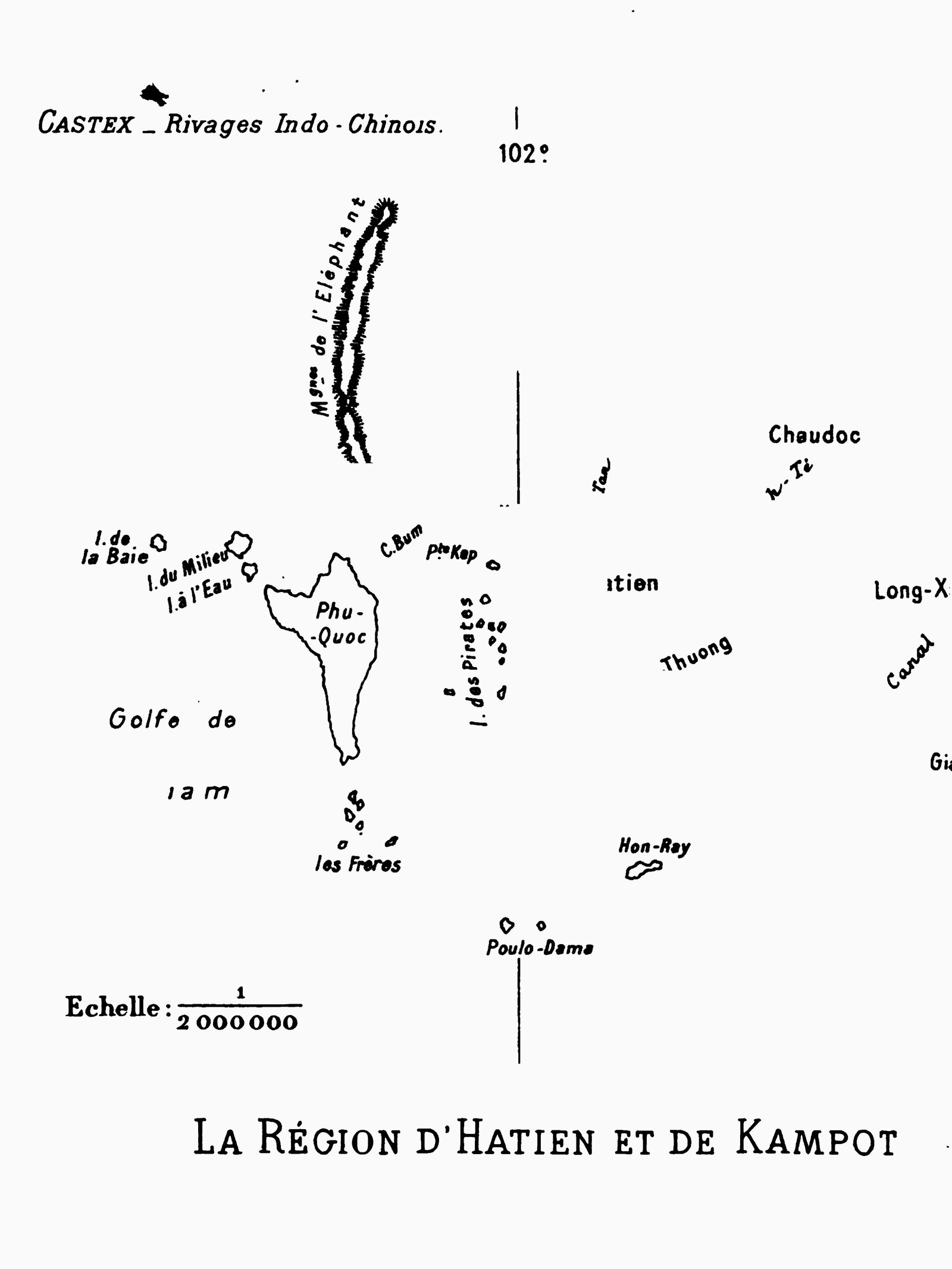
[4] The “Paps” (colloquial for female breasts, nipples) was a common way among Scottish sailors to call breast-shaped hills or seamounts. Similarly, it was common to call “Brothers” or “Twins” two islands of the same archipelago with shared size and configuration. Bonnyman wrote that the eastern channel to Kampot, east of the islands marking the entrance [ភ្នំដូង Phnom Dong and Treuh Koh, which Bonnyman called Ta Chi Chow] ran at the foot of these hills. As for Middle Island or Tian Moi [or Gan Swe], it is probably Koh Krabei, the closest island to the coast before Koh Seh and Phu Quoc. French navigator Castex wrote in 1904 about “l’immense ile de de Phu-Quoc, reliée à la terre par l’île du Milieu et l’île à l’Eau” [“The vast Phu Quoc island, linked to the mainland by Middle Island and Watering Island.”] [see Raoul Castex, Les rivages indo-chinois, Étude economique et maritime, Berger Levrault, Paris-Nancy, 1904, 354 p.] In his map of the coastal area in 1959, Louis Malleret noted “Koh Seh (Ile a l’Eau)”.
[5] ‘Bumbi’ could have been ស្នំប្រាំពីរ Snam Brampi, north of Kampot city.
[6] The coordinates given here don’t help to identify this island (‘Takwalla’ seeming to be a Malay name). It could be កោះសេះ Koh Seh, less likely កោះថ្មី Koh Thmei (Koh Krabei).
Tags: Kampot, Siam, Cochinchina, Cambodian coast, maritime trade, maritime routes, Gulf of Siam, 1850s, British Empire, Dutch trade, British trade, canals
About the Author
George D. Bonnyman
George D. Bonnyman (?-?) was a British Navy officer, Captain of the brig Pantaloon when the ship was commissioned for a commercial exploratory trip to Cambodia and Siam in February-June 1851, and again in September-November of that year.
Little is known of him, except that he left notices on the port of Kampot and the Cambodian coast from Kampot to Chantabon. His surname was probably of Scottish origin, possibly derived from the Laird of Bonnymoon.
Bonnyman was mentioned as the Captain of Pantaloon in the Strait Times on 18 July 1855, as reporting the wreck of American ship Lightfood on its way from Singapore to Calcutta. On 18 November 1854, he was also reported as arriving from Macao to Singapore at the helm of the Pantaloon. The same newspaper reported on 26 July 1848 that the “brig Pantaloon, Captain Lewis” was feared lost on its way to Calcutta.
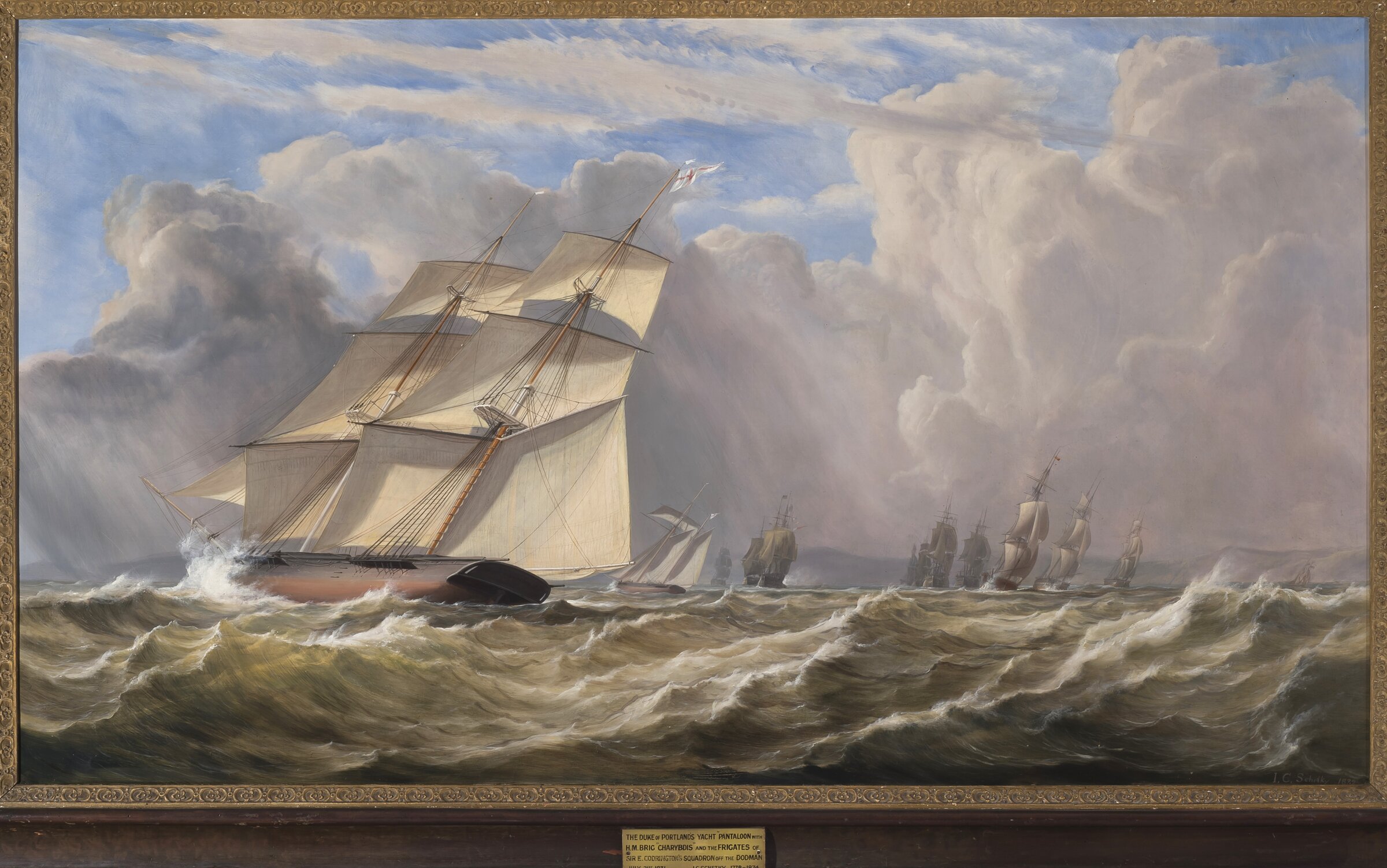
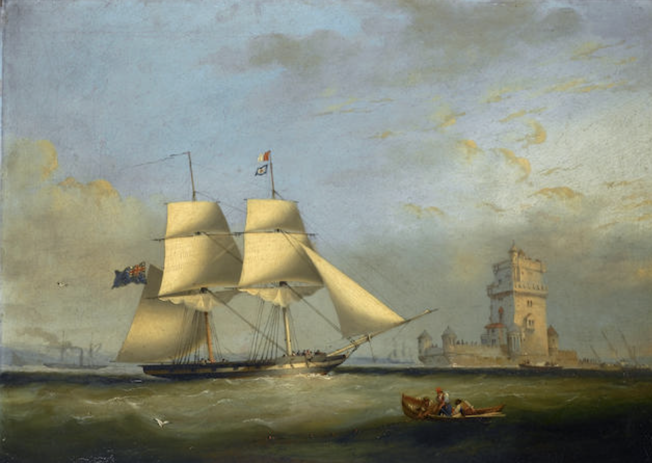
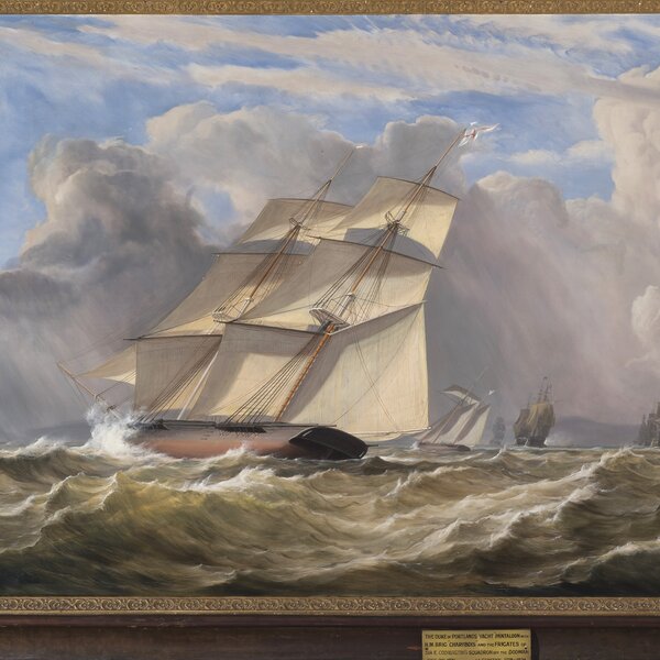
About brig Pantaloon: This unique 323‑t., 10-gun brig built at Troon as the Duke of Portland’s yacht, was immediately 0purchased by the Royal Navy and was active in the dhow chasing campaigns against West African slave trade, and against slaver fast ships bound to Brazil and Cuba (“Preventative Service”).
Designed and adapted by Captain William Symonds RN as a fast armed ocean-going dispatch boat, the brig took part in the “Experimental Squadron” trials in 1844 – 6. Pantaloon is reported broken up (or decommissioned) in 1852 by various sources, however it was still sailing the Indian Ocean and China Sea in 1855, chartered by private traders.