The Hydraulic System of Banteay Chhmar
by Damian Evans & John Sanday

- Authors
- Damian Evans & John Sanday
- Publication
- GHF Technical Report
- Published
- January 2011
- Pages
- 43
- Language
- English

pdf 1.3 MB
How deforestation and kassava extensive culture have destabilized the Banteay Chhmar water system, an intricate network that had worked for more than 800 years.
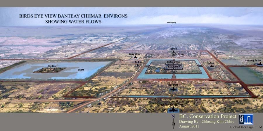
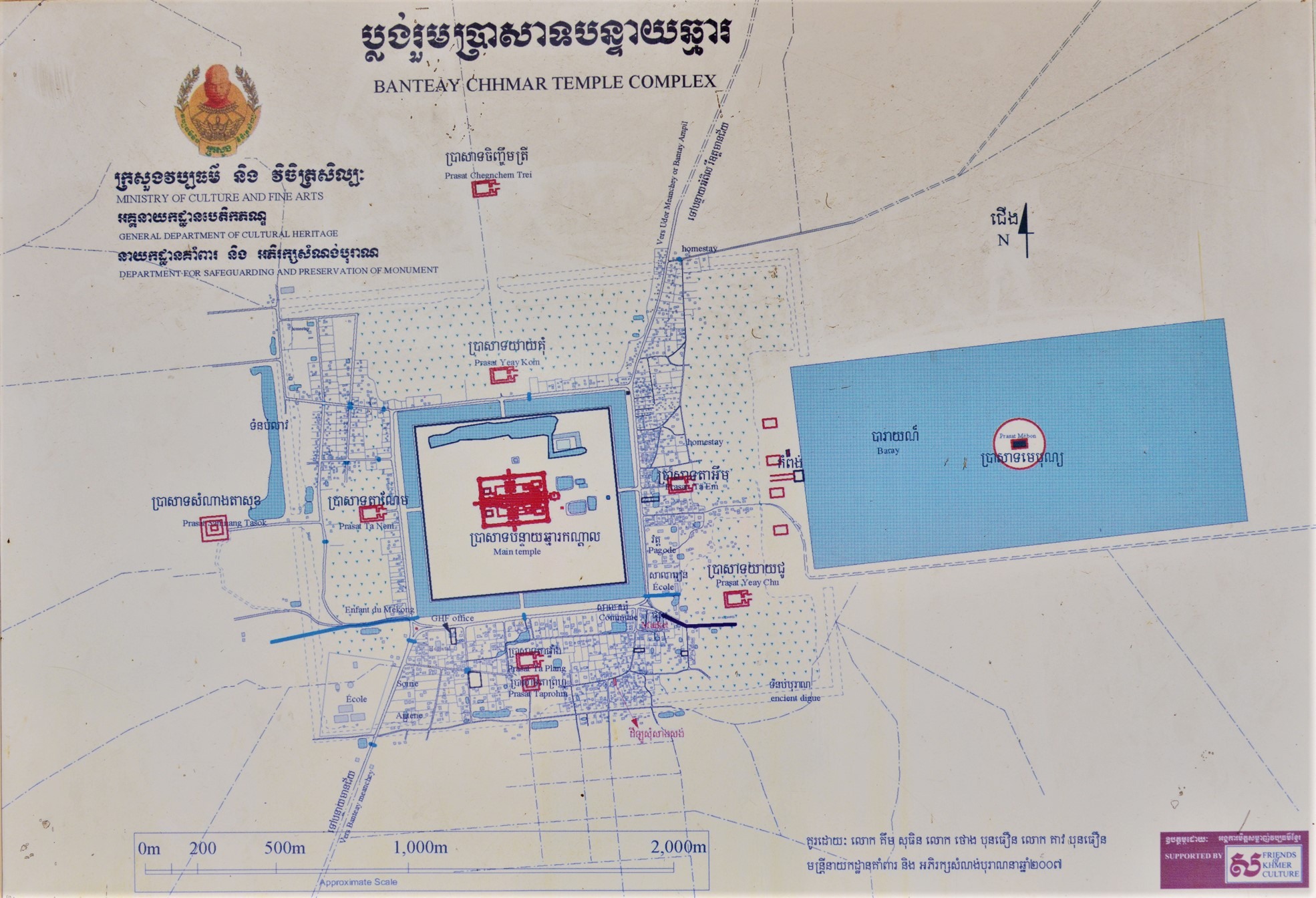
Map established by the Cambodian Ministry of Culture and Fine Arts:
Tags: water, hydraulic systems, baray, Banteay Chhmar
About the Authors

Damian Evans
A Canadian-Australian researcher, Damian Evans (d. 12 Sept 2023, Paris, France) focused on archaeological landscapes in mainland Southeast Asia, in particular those of the Khmer Empire.
He specialized in using advanced remote sensing technologies such as airborne laser scanning (or “LIDAR”) to uncover, map and analyse the urban and agricultural networks that stretched between, and beyond, great temple complexes such as Angkor in Cambodia.
Fellow researcher with the University of Sydney, then the Institut Francais d’Etudes Asiatiques, then EFEO, he has published several essays on Angkorian archaeology and mapping.
“In 2015, his team carried out the most extensive airborne study ever taken by archaeologists – using a laser radar mounted on a helicopter to scan an area of the jungle in Cambodia comparable in size to greater London”, read his obituary in The Guardian.

John Sanday
British architect and conservationist John Sanday has been associated to many Global Heritage Fund projects, especially in Nepal and Cambodia.
He became Asia Field Director for the GHF in 2007.