Maps & Plans
Building an online collection of maps related to Angkor, Khmer and Southeast Asia civilizations.
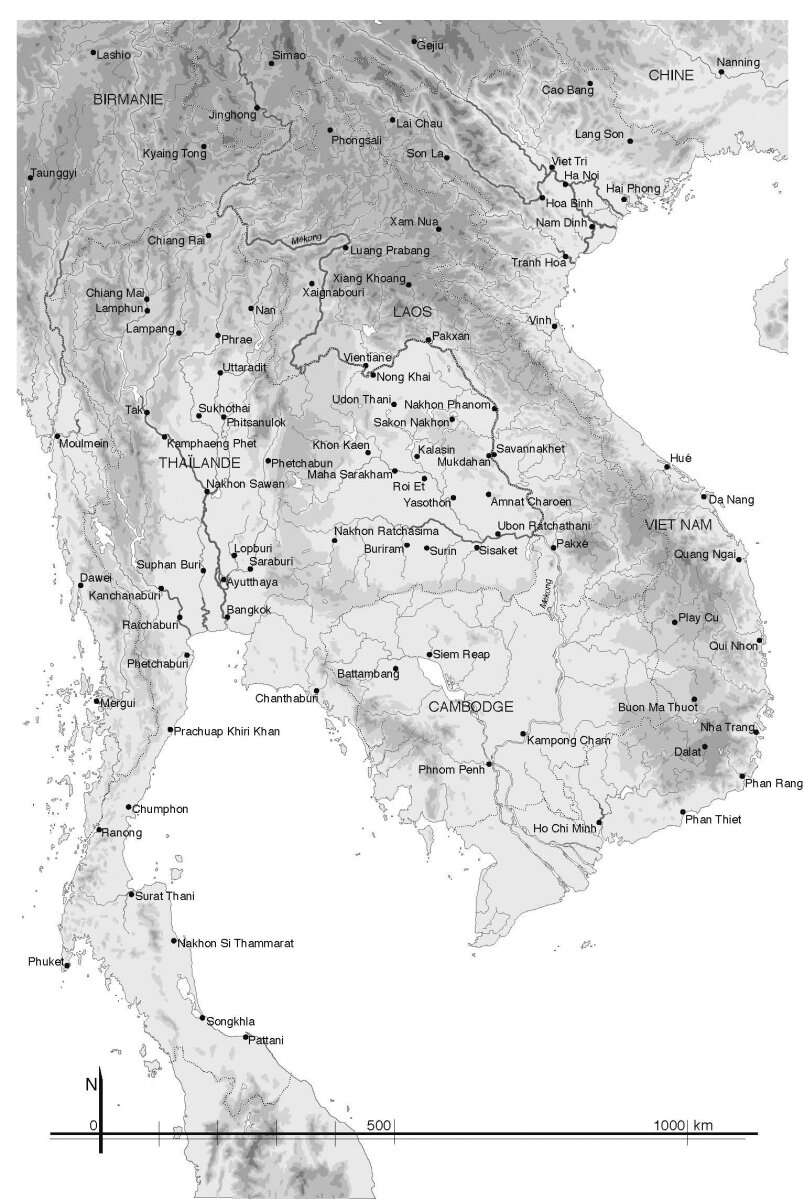
Khmer Inscriptions found in mainland Southeast Asia
Pierre Pichard
Khmer Inscriptions found in mainland Southeast Asia
Pierre Pichard

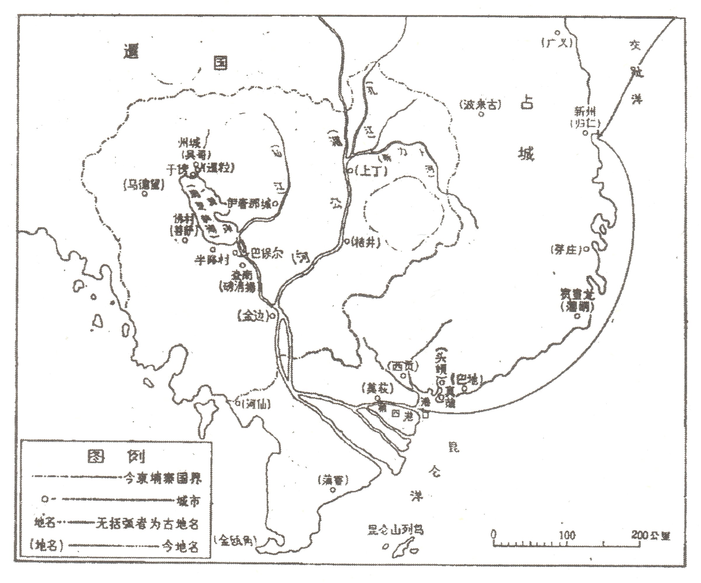
Zhou Daguan Itinerary, Map I
drawn by Xia Nai, 1987
Zhou Daguan Itinerary, Map I
drawn by Xia Nai, 1987
Zhou Daguan Itinerary, Map 2
drawn by Xia Nai, 1987
Zhou Daguan Itinerary, Map 2
drawn by Xia Nai, 1987
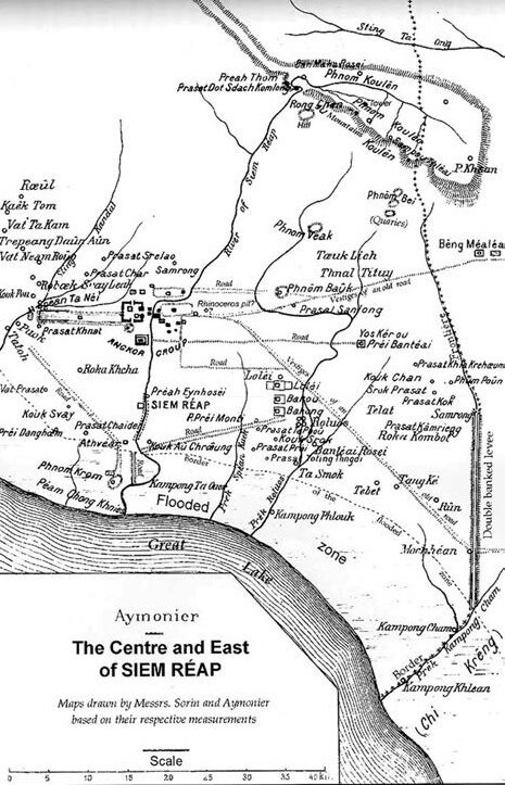
Etienne Aymonier, Center and East of Siem Reap, 1901
coll. Darryl Collins
Etienne Aymonier, Center and East of Siem Reap, 1901
coll. Darryl Collins
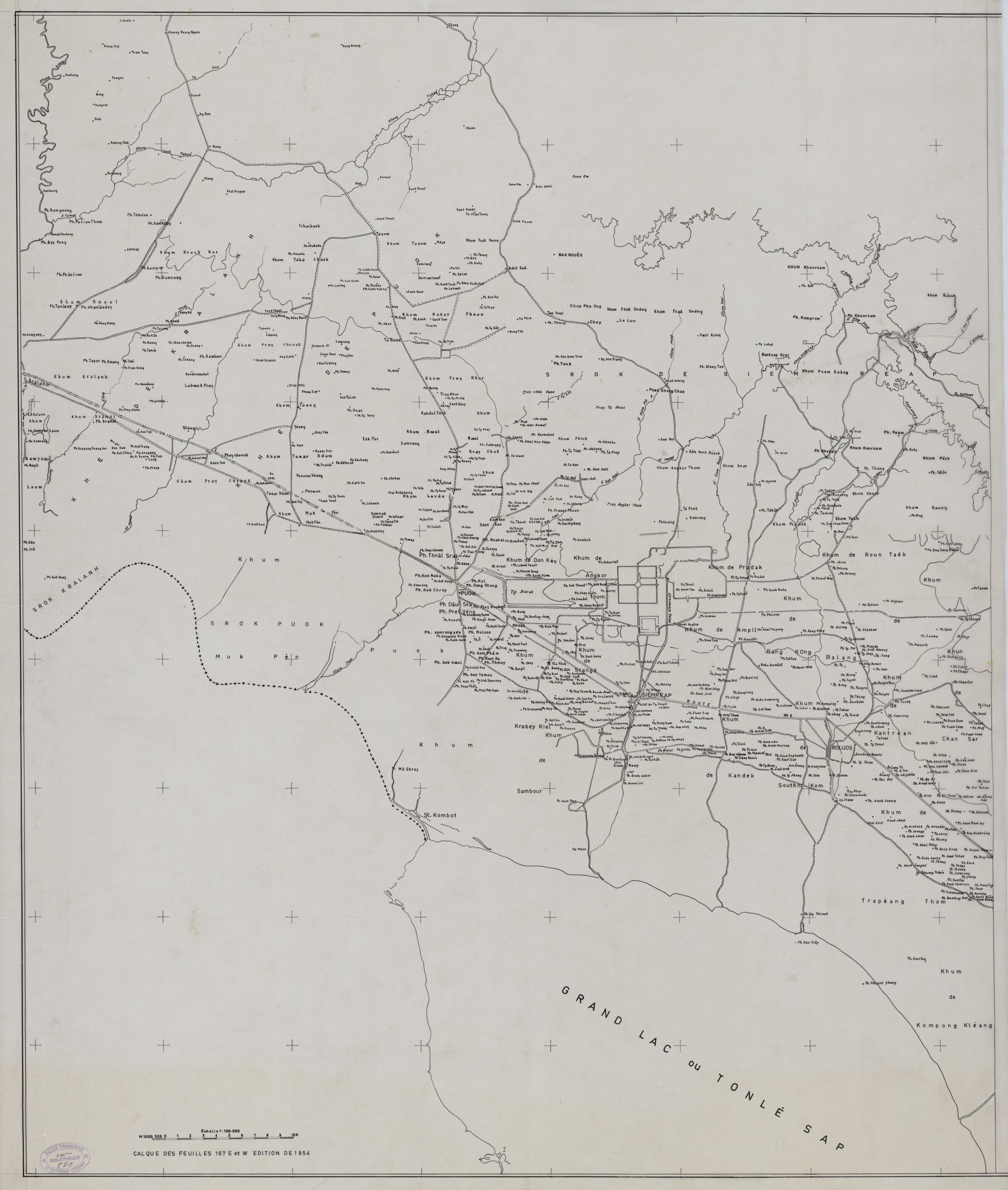
Siem Reap Area, by Angkor Conservation, circa 1954
Showing the complex orography of the area, and the density of "historic villages" around the temples (source: Banyan, EFEO online library, FCA/2/DG/870)
Siem Reap Area, by Angkor Conservation, circa 1954
Showing the complex orography of the area, and the density of "historic villages" around the temples (source: Banyan, EFEO online library, FCA/2/DG/870)
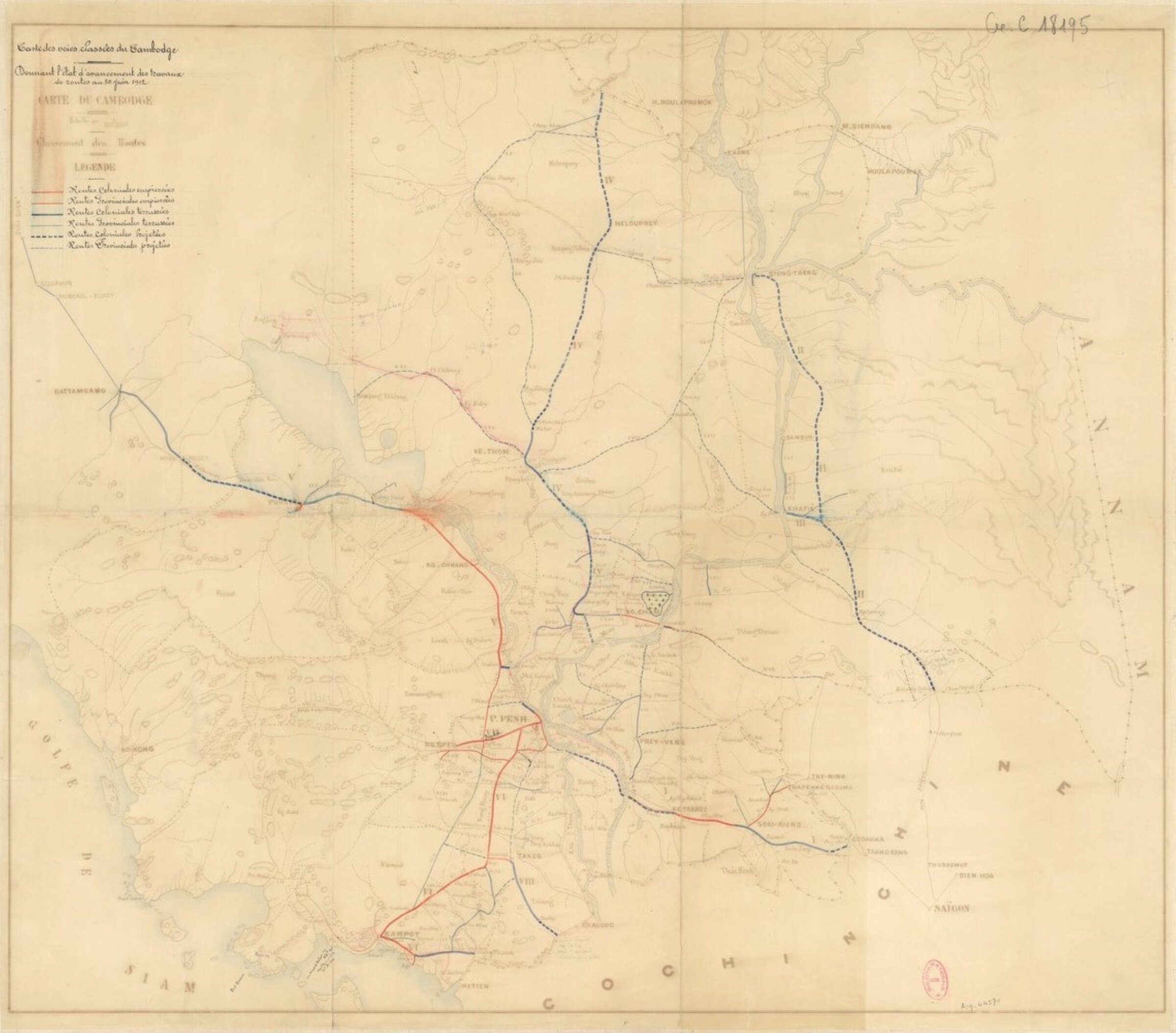
Carte des voies classées du Cambodge [Roads of Cambodia by category] as established on 30 June 1912
gallica.bnf.fr
Carte des voies classées du Cambodge [Roads of Cambodia by category] as established on 30 June 1912
gallica.bnf.fr
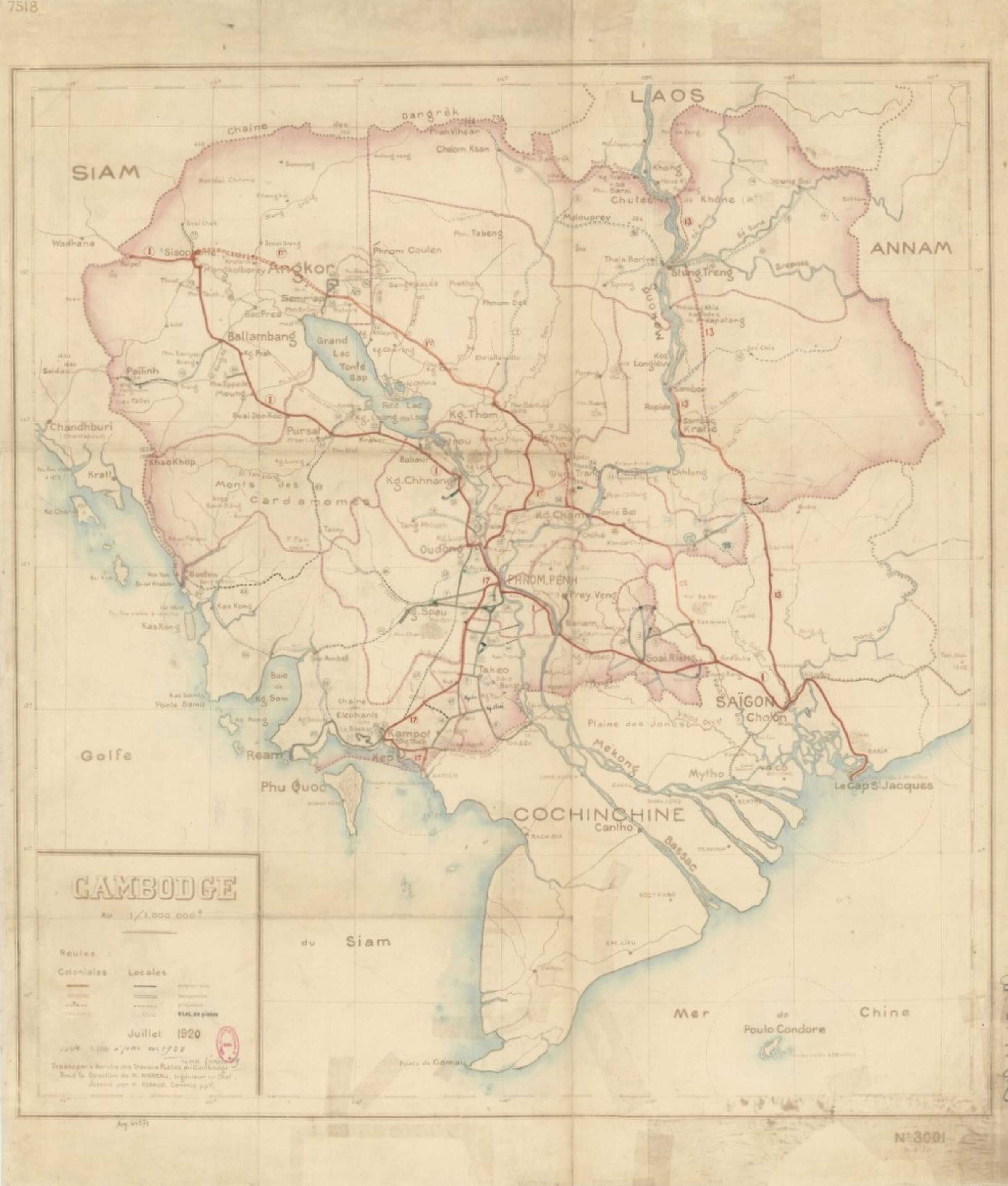
Cambodge: Reseau Routier, 1:1,000,000, 1920 [Cambodia's Road System]
Service des travaux publics, 1920. via gallica.bnf.fr
Cambodge: Reseau Routier, 1:1,000,000, 1920 [Cambodia's Road System]
Service des travaux publics, 1920. via gallica.bnf.fr
Wheatcroft map
Wheatcroft map

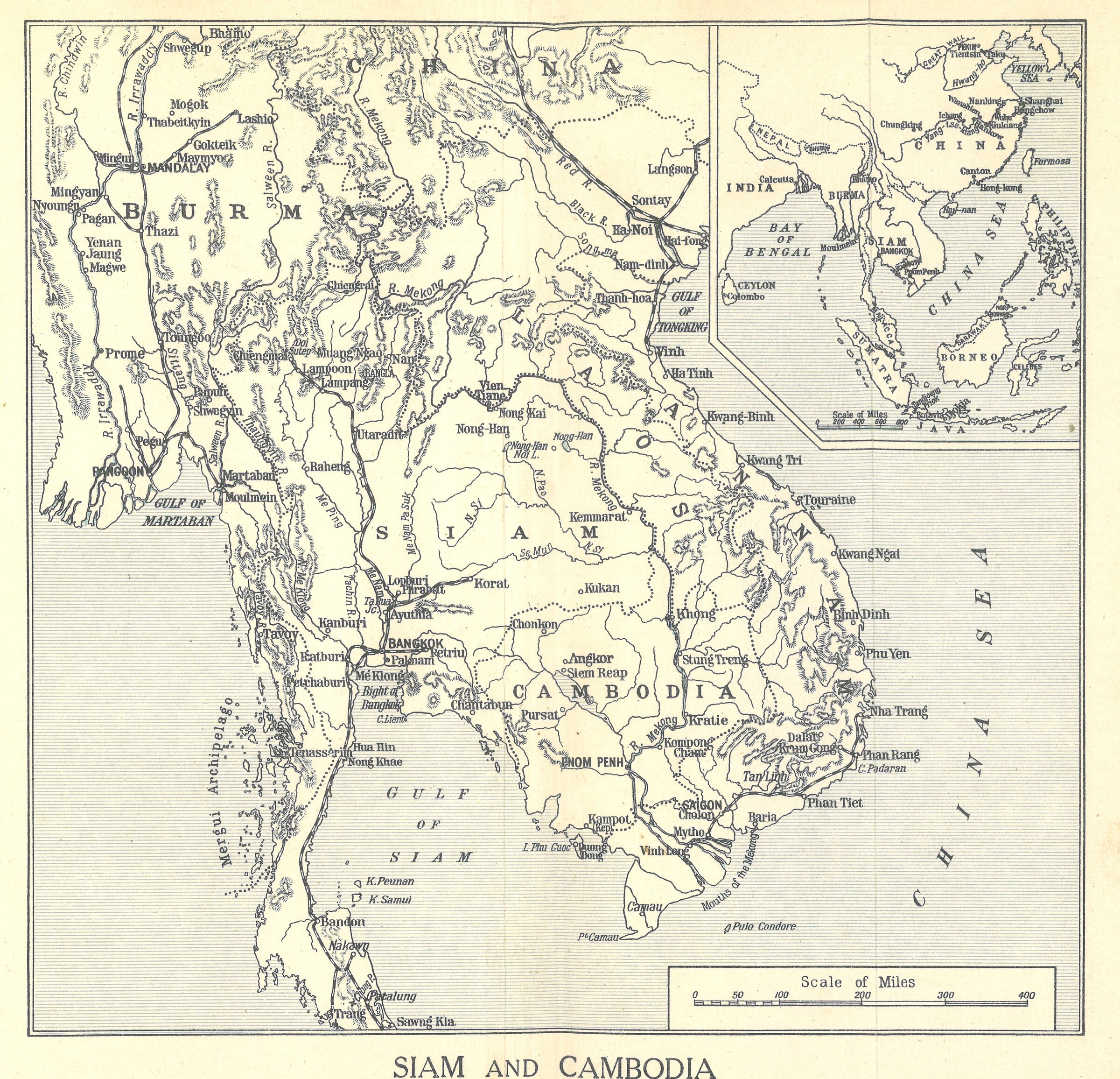
Siam and Cambodia, circa 1928
map from Rachel Wheatcroft, Travels in Siam and Cambodia, 1928.
Siam and Cambodia, circa 1928
map from Rachel Wheatcroft, Travels in Siam and Cambodia, 1928.
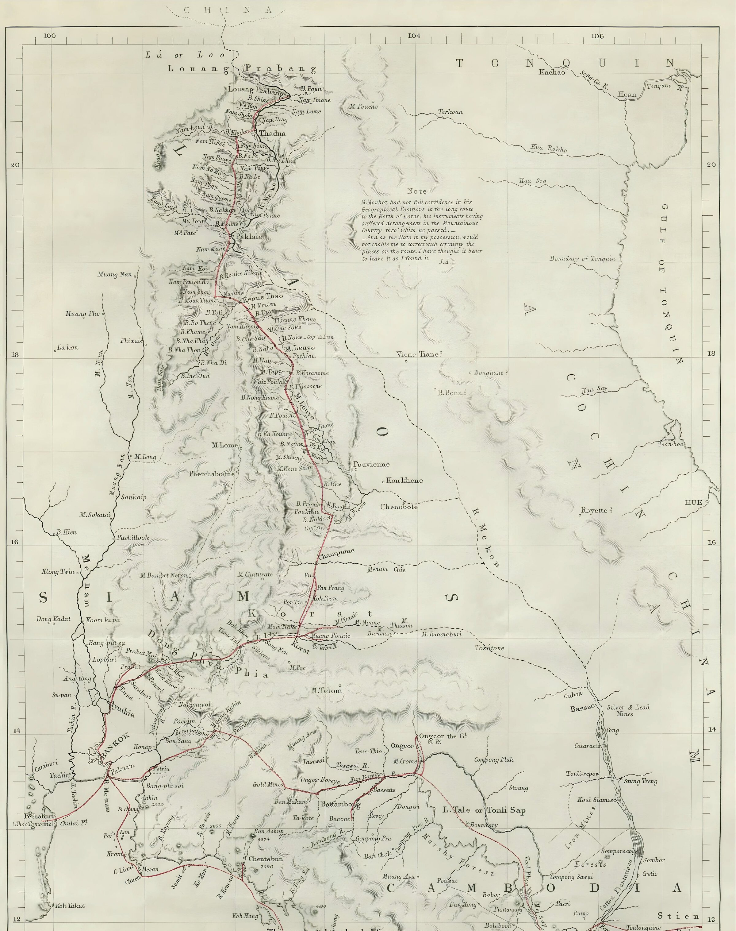
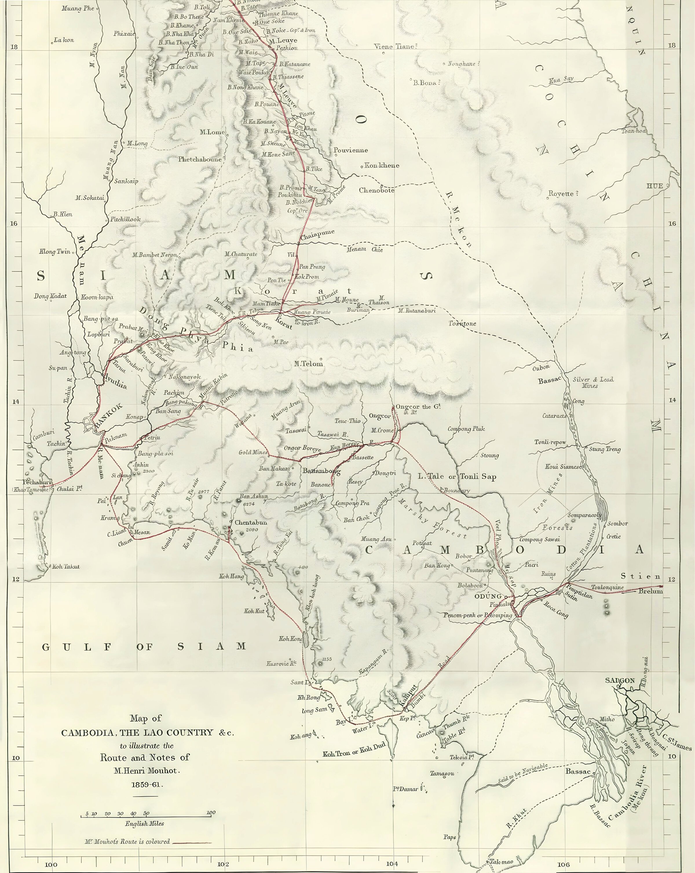
Henri Mouhot's Itinerary in "Central Indochina", 1862, map 1
Initially published in JRGS 1862, reproduced in Travels..., 1864; 2 panels edited by Tieng Satya, 11/2024.
Henri Mouhot's Itinerary in "Central Indochina", 1862, map 1
Initially published in JRGS 1862, reproduced in Travels..., 1864; 2 panels edited by Tieng Satya, 11/2024.
Henri Mouhot's Itinerary in "Central Indochina", 1862, map 2
Initially published in JRGS 1862, reproduced in Travels..., 1864; 2 panels edited by Tieng Satya, 11/2024.
Henri Mouhot's Itinerary in "Central Indochina", 1862, map 2
Initially published in JRGS 1862, reproduced in Travels..., 1864; 2 panels edited by Tieng Satya, 11/2024.

Siem Reap urban center, c. 1944
Conservation d'Angkor | https://banyan.efeo.fr/s/bibnum/collection |EFEO digital library
Siem Reap urban center, c. 1944
Conservation d'Angkor | https://banyan.efeo.fr/s/bibnum/collection |EFEO digital library
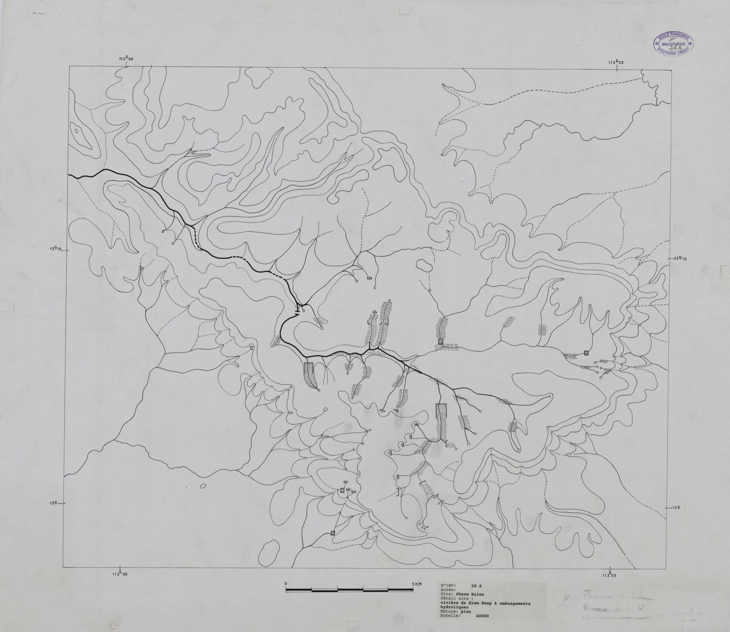
Siem Reap River, Hydraulic System in Phnom Kulen Area
Conservation d'Angkor, nd | Banyan EFEO digital library
Siem Reap River, Hydraulic System in Phnom Kulen Area
Conservation d'Angkor, nd | Banyan EFEO digital library
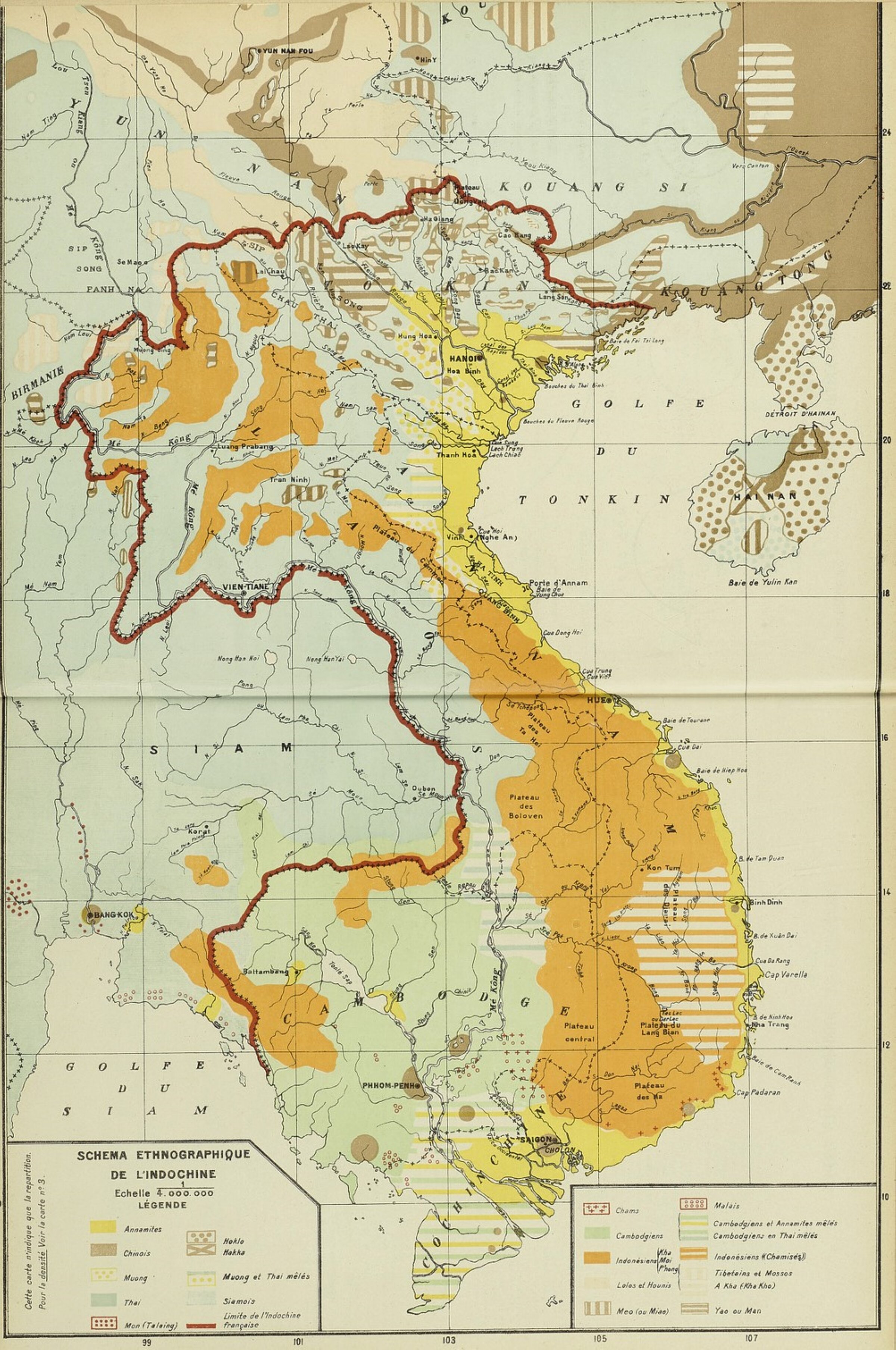
Ethnographic Map of French Indochina, 1913
from H. Bernier, Essai d'atlas statistique de l'Indochine, GGI, Hanoi-Haiphong, 1913
Ethnographic Map of French Indochina, 1913
from H. Bernier, Essai d'atlas statistique de l'Indochine, GGI, Hanoi-Haiphong, 1913
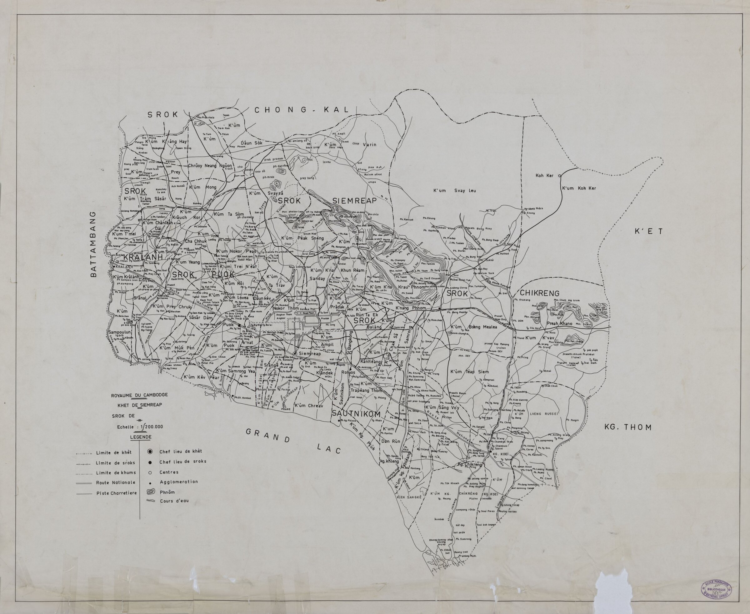
Siem Reap Province (Srok), no date (probably after 1953)
Conservation d'Angkor | https://banyan.efeo.fr/s/bibnum/collection/| code EFEO 2682
Siem Reap Province (Srok), no date (probably after 1953)
Conservation d'Angkor | https://banyan.efeo.fr/s/bibnum/collection/| code EFEO 2682
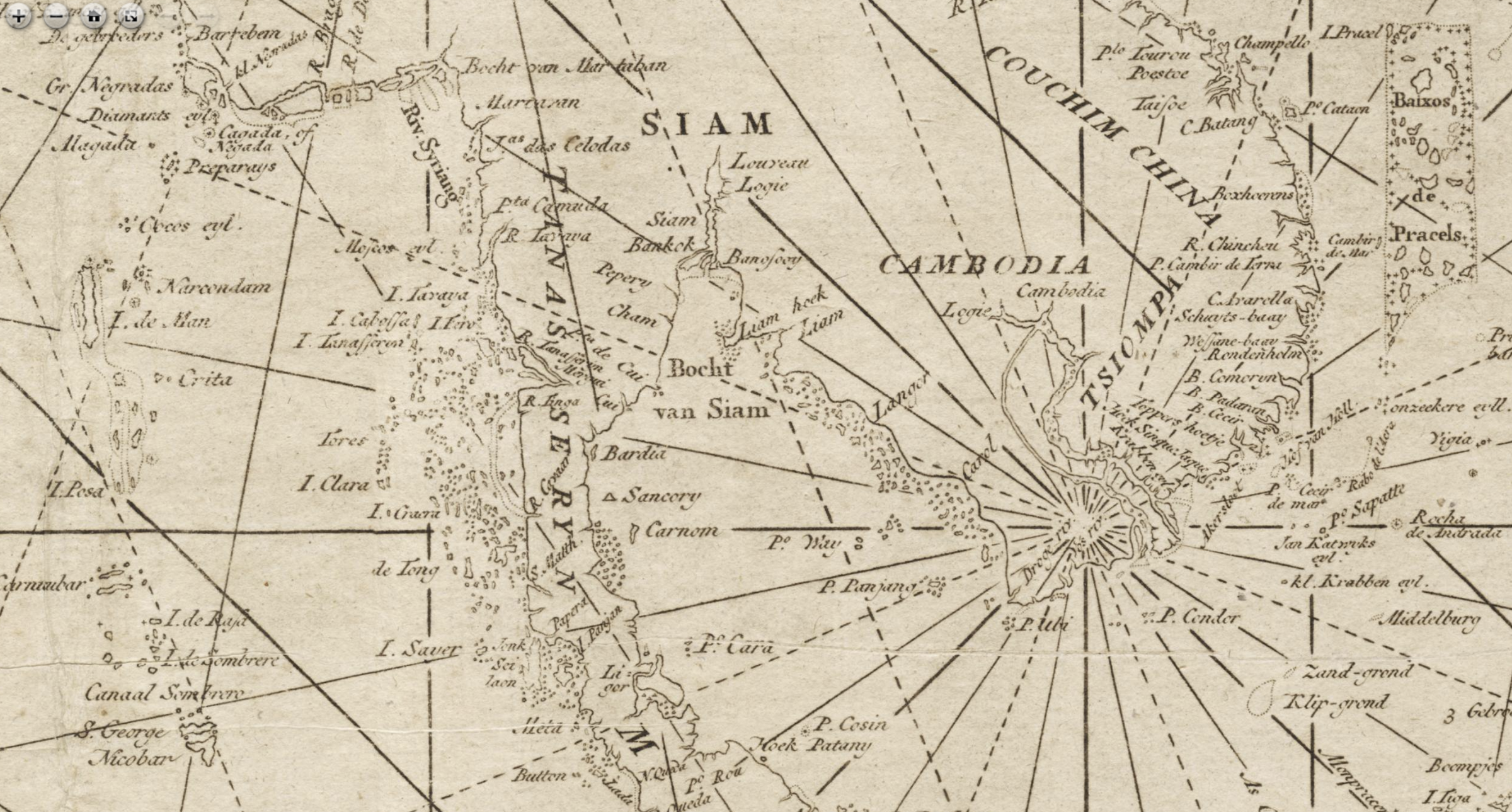
Ancient Portuguese, Dutch and Italian Maps, 16th-18th centuries, focused on Cambodia
Leen Helmink Antique Maps Collection
Ancient Portuguese, Dutch and Italian Maps, 16th-18th centuries, focused on Cambodia
Leen Helmink Antique Maps Collection
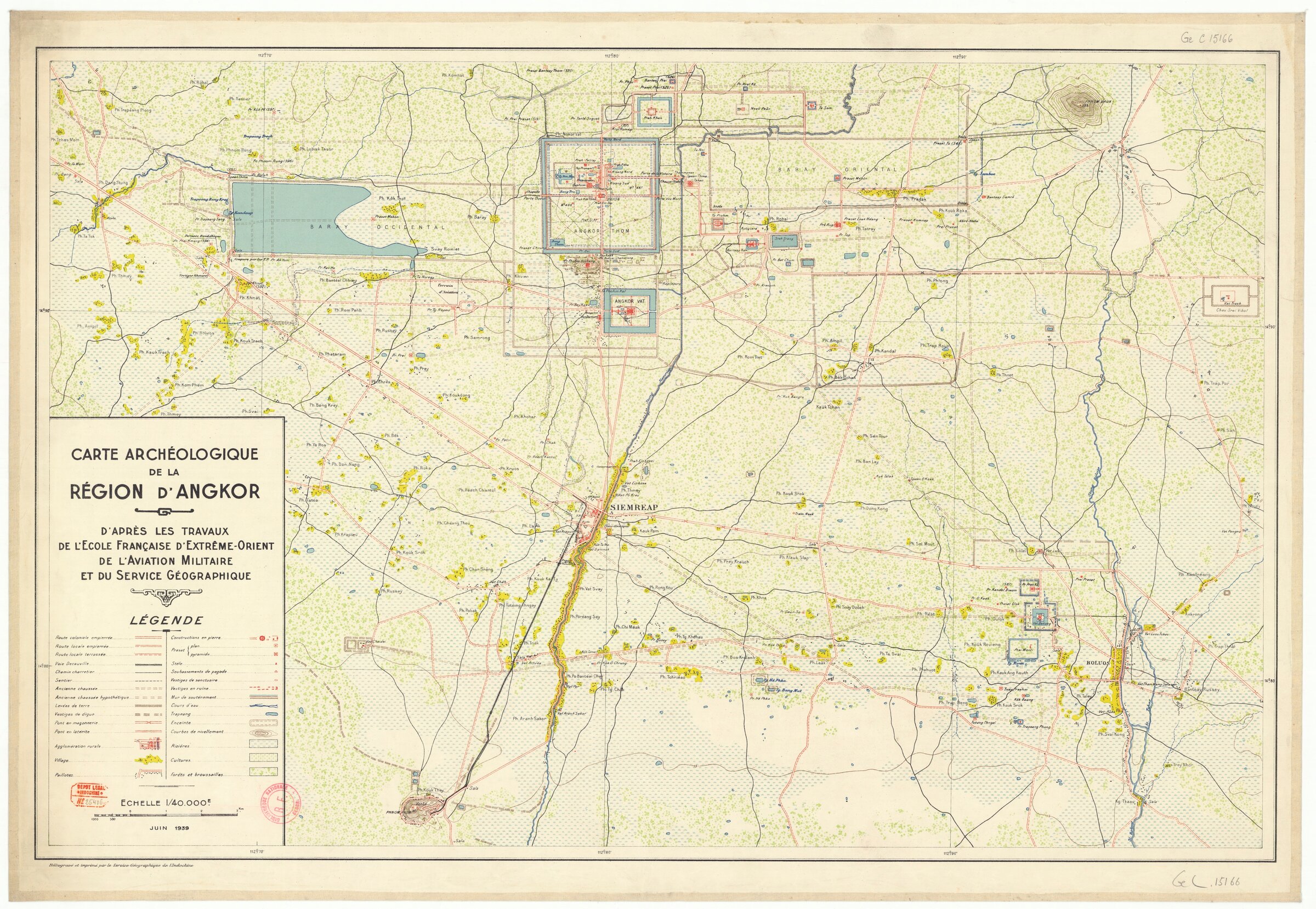
Carte archeologique de la Region d'Angkor [Map of Angkor Region], 1939
"d'apres les travaux de l'Ecole Francaise d'Extreme Orient, de l'Aviation Militaire et du Service Geographique" | 1/40,000 scale | source:gallica.bnf.fr
Carte archeologique de la Region d'Angkor [Map of Angkor Region], 1939
"d'apres les travaux de l'Ecole Francaise d'Extreme Orient, de l'Aviation Militaire et du Service Geographique" | 1/40,000 scale | source:gallica.bnf.fr

Banteay Srei: Reconstruction by Olivier Cunin
in Swati Chemburkar, "Khmer Empire and Southeast Asia, 800-1450" [2020]
Banteay Srei: Reconstruction by Olivier Cunin
in Swati Chemburkar, "Khmer Empire and Southeast Asia, 800-1450" [2020]

Lunet de Lajonquiere Lajonquiere, 1900
Lunet de Lajonquiere Lajonquiere, 1900

1718 London New Map Of The West Indies
1718 London New Map Of The West Indies