

Publications
Exploration du grand fleuve du Cambodge (Septembre 1862) [Exploration of the Great River of Cambodia, Sept. 1862]
by Louis Bonard
by Andrew Spooner
An early description of Angkor Wat by a young and curious-minded traveler dating back from 1862. And more about Banteay Srei?

While engaged in trading activities in Saigon, merchant and amateur explorer Andrew Spooner managed to join Admiral Bonard’s boat expedition to Angkor in September 1862. His description, published some four years later, remains valuable firstly for its description — and depiction in a drawing in which Angkor Wat seemed to emerge from a lake, almost like Udaipur in Rajasthan, India — of a place of water and land.
The author mentioned Henri Mouhot’s rediscovery of the Angkorian site six years before him — no mention of Scotsman photographer John Thomson, however -, yet he apparently went further than both in exploring the temple of Angkor Wat proper, as he describes quite precisely the upper elements of the Bakan, the central tower. He gave us also the first detailed description of the Western causeway (comparing its stone stations to the Pont-Neuf pillars in Paris).
It has been generally assumed that Western explorers and archaeologists ignored the existence of Banteay Srei បន្ទាយស្រី (cons. 967 CE) until its “discovery” by French cartographer George Demasur in 1913, and later on plundered by André Malraux’s during his infamous expedition in December 1923, when he attempted the first instance of in situ looting of a Khmer temple in modern history.
While neither Francis Garnier, Lunet de Lajonquière [1], Jean Moura nor Etienne Aymonier mentioned the gorgeous structure built in pink sandstone some 23 kms northwest of Angkor Wat — even in their collections of oral traditions -, young Andrew Spooner did exactly that in the present publication, and even showed it on a map:
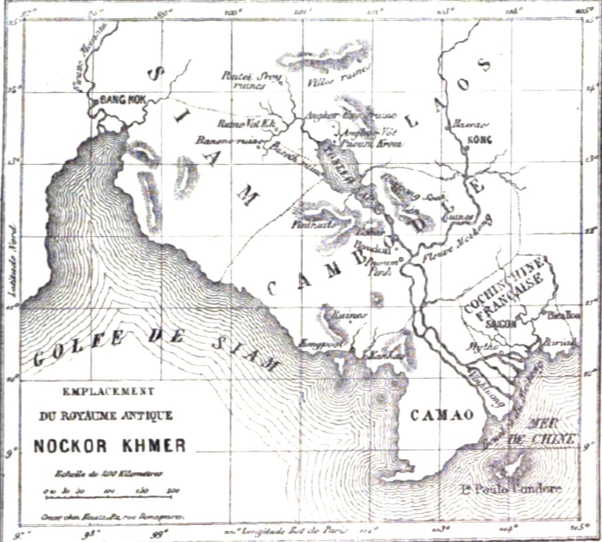
‘Ponthei Srey’ [Banteay Srei] and ‘Villes and Ruins’ [Cities and Ruins] located on Phnom Kulen shown on this A. Spooner’s map [L’Illustration, 1866].
‘Ponthei Srey’ [Banteay Srei] and ‘Villes and Ruins’ [Cities and Ruins] located on Phnom Kulen shown on this A. Spooner’s 1866 map.
As we were able to improve the quality of available digital scans by comparing the [botched] University of Michigan-Google scan with the original document acquired at L’Illustration website [2], we could read better the original map of “Nocor Khmer”, and thus found out that
If, at this stage, we can’t confirm the author actually went and saw these sites, we can safely presume that in Angkor — the ruins, and the ‘modern town’ which didn’t yet hold the name ‘Siem Reap’ — he had already heard about both Banteay Srei and Jayavarman II’s royal city on Phnom Kulen.
[1] In his Inventaire descriptif des monuments du Cambodge [vol. III, p 260], Lunet mentioned [Item 575] a Banteai Srei temple, “à environ 5 kilometres au N. 0. du village de Run,” not far from the ancient road Angkor — Kompong Thom, not at all where this map pointed to a Pontheu Srey, as “an isolated monument made of sandstone […], no more than a pile of ruins nowadays.”
[2] Remark: to get a better view of the original publication, we suscribed to the paid website. It is quite disheartening to find that, for some merchandising reason, documents 150-year old are still not available as high-quality scans. Big Corp is currently sending its robots on, and will extract all relevant information while academics and independent researchers are still struggling in order to read, process and comment.
Deux grands fleuves, dont les sources nous sont plus inconnues que celles du Nil, forment un vaste delta, sorte de paradis terrestre, vers l’extrémité méridionale de l’Asie. Ce que nous connaissons de leur cours capricieux est presque fantastique, et la variation entre les niveaux extrêmes de leurs eaux en change, d’une saison à l’autre, complétement l’aspect. Il semblerait, en certains endroits, que le chemin de la mer leur était fermé, et qu’au travers des gorges de montagnes ils ont dû se frayer une voie: tantòt on les trouve glissant rapidement entre deux chaînes élevées; tantôt, divisés en mille bras divers, ils créent des îlots sans nombre; tantôt, vastes et calmes, ils ont la majesté d’un lac; tantôt ils inondent à perte de vue les plaines des bassins inférieurs.
Ce sont le Meinam et le Meikong. Le premier a son embouchure au fond du golfe de Siam; sur ses rives s’étend, à trente milles de la mer, la longue cité de Bankok. Le second sillonne de six bras immenses la presqu’île sablonneuse de Camao, et semble comme se répandre dans la mer de Chine. Entre ces deux fleuves était le royaume de Khmer.
Khmer avait des villes et des palais, des flottes et des armées; sa puissance faisait trembler l’Asie; sa richesse et sa civilisation n’avaient sans doute rien à envier aux Grecs et aux Romains. Les ruines éparses au milieu des forêts siamo-cambodgiennes attestent d’une grandeur immense; elles sont le cimetière mystérieux de toute une époque, peut-être la plus remarquable de l’antiquité en Orient, et de laquelle nous né connaissons rien.
Demandez aux princes qui ont créé les merveilles de ce royaume, demandez aux bonzes; les uns diront: c’est le roi lépreux, les autres, c’est Boudha. Quant aux peuples et aux sauvages qui sont répandus dans les forêts, ils n’en savent rien, ils n’y ont même jamais songé. Quelles races ont formé Khmer; quand a‑t-il commencé; quelle catastrophe l’a anéanti? Étudiez sur les bas-reliefs sans nombre qui couvrent les murailles encore debout, vous y trouverez des hommes de toutes les races asiatiques, tous les poissons et les coquillages de la mer, tous les animaux des forêts, tous les oiseaux, depuis le corbeau jusqu’au paon; il y a des armes, des chars, des dieux, des êtres fantastiques, des fêtes et des combats, le ciel et l’enfer; il y a des entablements, des encadrements de portes dont les arabesques maures né dépassent pas la légèreté et n’atteignent pas la richesse.
Du nord au sud, de Stung-Treng à Kongpoot, tout a le cachet d’une même nationalité; c’est le même style, ce sont des plans analogues. Dans l’intérieur de ces forêts est une sorte de bassin inférieur environné de montagnes; aujourd’hui on les nomme Bobor, Poursate, Pnoum Krom, Compong-Soaï, Compong-Lèn; au milieu est un lac d’eau douce, le Touleh-Sap. C’est au nord de ce lac, par 101° 35′ longitude E., latitude N., derrière le mont Pnoum-Kròm, que se trouve la capitale du royaume de Khmer, Angkor-Thom, plus une vraie capitale qu’Angkor la Grande. Dans son enceinte rectangulaire, on né trouve enfouis sous la végétation que des palais ruinés dans lesquels croissent des arbres [énormes]; on né voit que des portes grandioses, des colonnades écroulées, des bains, des statues, des voies dallées.
“C’est plus beau que le Parthénon,” me disait un compagnon de voyage qui a parcouru la Grèce. Ces merveilles exerce sur chacun une impression profonde : l’intrépide Mouhat [sic, for Mouhot], qui pendant trois ans a parcouru ces contrées, où il est mort des fièvres en 1861, fait d’Angkor une description enthousiaste, qui donne une juste idée de l’émotion extraordinaire qu’on éprouve devant cette cité morte.
[“Two great rivers, whose sources are less known to us than those of the Nile, form a vast delta, a kind of earthly paradise, towards the southern tip of Asia. What we know of their capricious course is almost fantastical, and the variation between the extreme levels of their waters completely changes their appearance from one season to the next. It would seem, in certain places, that the path to the sea was closed to them, and that they had to carve their way through mountain gorges: sometimes they are found gliding swiftly between two high ranges; sometimes, divided into a thousand different branches, they create countless islets; sometimes, vast and calm, they have the majesty of a lake; sometimes they flood the plains of the lower basins as far as the eye can see.
These are the Meinam and the Meikong. The former has its mouth at the bottom of the Gulf of Siam; On its banks, thirty miles from the sea, stretches the long city of Bangkok. The second river winds its way through the sandy peninsula of Camao with six immense branches, and seems to flow into the South China Sea. Between these two rivers lay the kingdom of Khmer.
Khmer had cities and palaces, fleets and armies; its power made Asia tremble; its wealth and civilization were undoubtedly the equal of the Greeks and Romans. The ruins scattered amidst the Siamese-Cambodian forests attest to immense grandeur; they are the mysterious graveyard of an entire era, perhaps the most remarkable of antiquity in the East, and of which we know nothing.
Ask the princes who created the marvels of this kingdom, ask the monks; some will say: it was the Leper King, others, it was Buddha. As for the peoples and savages scattered throughout the forests, they know nothing of it, they have never even considered it. What races formed the Khmer? When did it begin? What catastrophe destroyed it? Study the countless bas-reliefs that cover the still-standing walls, and you will find men of every Asian race, all the fish and shells of the sea, all the animals of the forests, all the birds, from the raven to the peacock; there are weapons, chariots, gods, fantastic beings, festivals and battles, heaven and hell; there are entablatures, door frames whose Moorish arabesques are neither light nor rich.
From north to south, from Stung Treng to Kongpoot, everything bears the hallmark of a single nation; it is the same style, the plans are similar. Within these forests lies a kind of lower basin surrounded by mountains; today they are called Bobor, Poursate, Pnoum Krom, Compong-Soai, and Compong-Len. In the middle is a freshwater lake, Tuleh-Sap. It is north of this lake, at 101° 35′ E longitude, N latitude, behind Mount Pnoum-Krom, that the capital of the Khmer kingdom, Angkor Thom, is located — more of a true capital than Angkor the Great. Within its rectangular enclosure, buried beneath the vegetation, one finds only ruined palaces in which enormous trees grow; one sees only magnificent gates, crumbling colonnades, baths, statues, and paved walkways.
“It’s more beautiful than the Parthenon,” a traveling companion who had journeyed through Greece told me. These wonders exert a profound impression on everyone: the intrepid Mouhat [sic, for Mouhot], who for three years travelled through these lands, where he died of fevers in 1861, gives an enthusiastic description of Angkor, which gives a true idea of the extraordinary emotion one feels before this dead city.
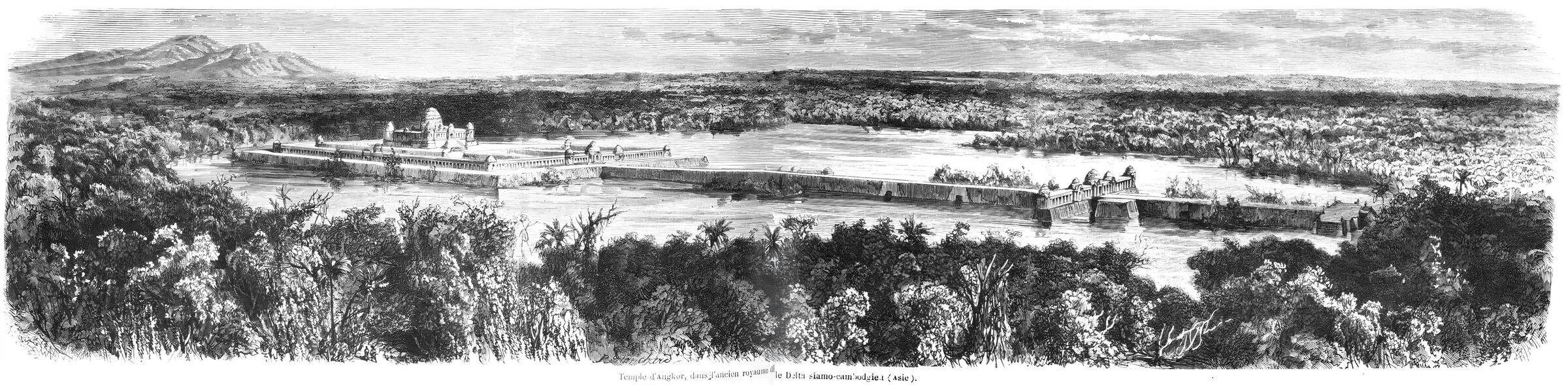
“Angkor, Khmer Kingdom in the Siamese-Cambodian Delta, Asia” [illustration from a drawing by A. Spooner restored by ADB, L’illustration vol 46, 1866.]
“Angkor, Khmer Kingdom in the Siamese-Cambodian Delta, Asia”. The author apparently went up Phnom Bakheng to render this overview of the temple and its access, seemingly emerging from a lake [illustration from a drawing by A. Spooner restored by ADB, L’illustration vol 46, 1866.]
Les Cambodgiens nomment Touleh-Sap le Grand-Lac. Il s’étend en longueur, du S.-E. au N.-O., sur 26 lieues, et en largeur sur 5 environ. Sa forme est celle d’une double gourde, dont la plus petite partie est au S.-E.; elle est précédée d’un delta, le Veal-Pock (vallée de boue), lequel, par un canal naturel à courants variables, communiqué avec le Meikong, que les indigènes appellent, au Cambodge, le Touleh Tom, ou le “fleuve grand.”
Au nord du lac, par-dessus les marais et les forêts inondées, on aperçoit une montagne dénudée, de forme aplatie; c’est le Pnoum-Krom. Un point blanchâtre couronne son sommet; c’est un temple moderne. Une petite rivière, qui se perd dans les marais du lac, contourne sa base à l’E. et au N.-E., c’est la route d’Angkor.
Qu’on se figure une nuit passée en barque, cherchant un rivelet qui se perd dans les mares couvertes de hautes herbes peuplées de moustiques implacables, d’oiseaux de toutes sortes. A chaque éclaircie de palétuviers ou indice d’un courant […garbled text…], on croit discerner la route. Helas! les heures passent, les grenouilles né coassent plus, et bientot on aperçoit de grandes ombres qui rentrent dans la forêt, ce sont les gracieuses aigrettes partant en troupe à la chasse du matin…
Au point du jour, nous étions à la ville moderne, et quelques heures après, installés sur les éléphants, nous partions pour les ruines. A une heure de la rive, par un sentier etroit dans la forêt, on arrive a un espace en partie fermé par une nappe d’eau, ou les rois ont jete les fondations d’un temple immense, Angkor-Vot.
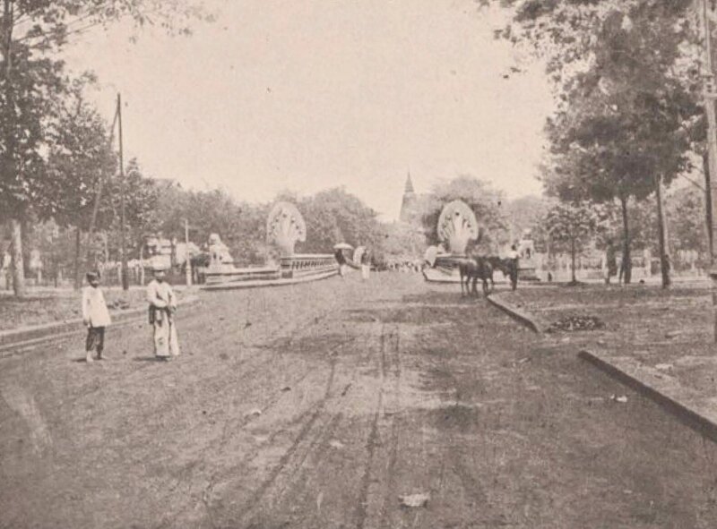
L’entrée est une terrasse en croix; trois des côtés sont terminés par des escaliers gigantesques de plus de 3 mètres de hauteur. Le quatrieme côté, celui exactement tourné vers l’Est, est le commencement d’une chaussée en pierres. Cette voie est percée çà et là, de voûtes sans doute pour faciliter l’équilibre des eaux; elle est entrecoupée de petites places rectangulaires, dont la saillie est supportée par des colonnes cylindriques; les demi-lunes du pont Neuf peuvent en donner une idée. Une rampe formée de chapiteaux sculptés supportant une main courante large d’un pied et demi, garnit les côtés. La chaussée est coupée au tiers de sa longueur par un premier temple précédé d’un square élevé de trois marches, et sur lequel s’avance le péristyle de l’entrée principale; les rampes de cette terrasse sont des serpents à sept têtes, les plus grands monolithes que j’aie vus dans ces ruines; ils ont 6 mètres de longueur et près de 2 mètres de hauteur.
Ce premier temple est formé de cinq tours jointes par une galerie que supporte, d’un côté, une double colonnade, de l’autre, un mur couvert de bas-reliefs à l’intérieur, et orné à l’extérieur de fausses fenêtres sculptées.
[The Cambodians call the Great Lake Tuleh-Sap. It stretches 26 leagues long from southeast to northwest and about 5 leagues wide. Its shape is that of a double gourd, the smaller part being in the southeast. It is preceded by a delta, the Veal-Pock (mud valley), which, through a natural channel with fluctuating currents, connects with the Meikong, which the natives of Cambodia call the Tuleh Tom, or the “great river.”
To the north of the lake, above the marshes and flooded forests, one can see a bare, flattened mountain; this is Pnoum-Krom. A whitish dot crowns its summit; it is a modern temple. A small river, which disappears into the lake’s marshes, flows around its base to the east and northeast; this is the road to Angkor.
Imagine a night spent in a boat, searching for a stream that disappears into pools covered with tall grass teeming with relentless mosquitoes and birds of every kind. At each break in the mangrove or sign of a current, you think you’ve found your way. Alas! The hours pass, the frogs fall silent, and soon you see large shadows disappearing into the forest — the graceful egrets setting off in flocks for their morning hunt.
At daybreak, we were in the modern city, and a few hours later, settled on the elephants, we set off for the ruins. An hour from the shore, along a narrow path through the forest, you arrive at a space partially enclosed by a sheet of water, where the kings laid the foundations of an immense temple, Angkor Wat.
The entrance is a cruciform terrace; Three sides end in gigantic staircases over 3 meters high. The fourth side, facing directly east, is the beginning of a stone causeway. This causeway is pierced here and there with vaults, no doubt to facilitate the flow of water; it is interspersed with small rectangular squares, the projection of which is supported by cylindrical columns; the semicircular arches of the Pont Neuf can give an idea of this. A railing formed of sculpted capitals supporting a handrail a foot and a half wide lines the sides. The causeway is interrupted at one-third of its length by a first temple preceded by a raised square of three steps, onto which the peristyle of the main entrance projects; the railings of this terrace are seven-headed serpents, the largest monoliths I have seen in these ruins; they are 6 meters long and nearly 2 meters high.
This first temple consists of five towers joined by a gallery supported on one side by a double colonnade, on the other by a wall covered with bas-reliefs on the inside, and adorned on the outside with sculpted false windows.]
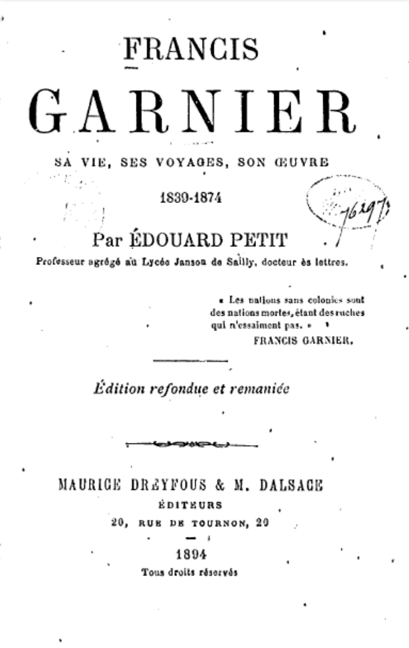
1) Publication Cover Page. 2) Pilaster, Angkor Wat. 3)“Serpent monolithe à sept têtes des rampes de la terrasse du temple d’Angkor” [Seven-headed snake monolith, one of the balusters on Angkor Temple terrace][illustrations from Andrew Spooner’s drawings, L’Illustration, 1866].
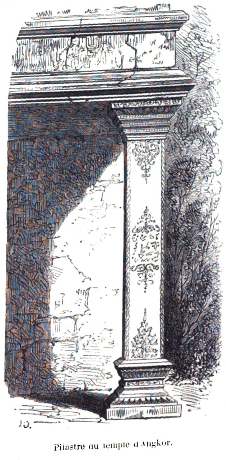
Pilaster, Angkor Wat. [illustration from Andrew Spooner’s drawings, L’Illustration, 1866].
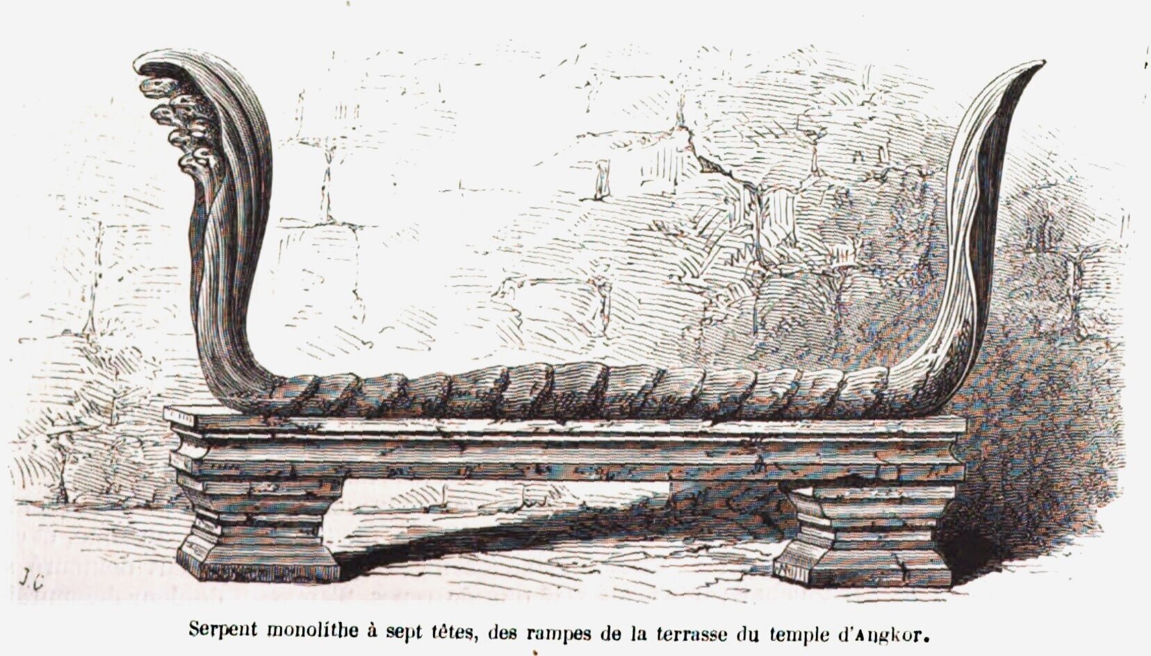
“Serpent monolithe à sept têtes des rampes de la terrasse du temple d’Angkor” [Seven-headed snake monolith, one of the balusters on Angkor Temple terrace].[illustrations from Andrew Spooner’s drawings, L’Illustration, 1866].
1) Publication Cover Page. 2) Pilaster, Angkor Wat. 3)“Serpent monolithe à sept têtes des rampes de la terrasse du temple d’Angkor” [Seven-headed snake monolith, one of the balusters on Angkor Temple terrace][illustrations from Andrew Spooner’s drawings, L’Illustration, 1866].
Mais il y a dans l’agencement, dans les détails, un enchevêtrement de lignes indescriptibles : des doubles toits à côtes horizontaux et verticaux , formant cintre à l’intérieur ; des tours octogonales à étage, en forme de dome allongé, des soubassements arqués à moulures , des escaliers en pyramides, des murs à corniche , des frontons approchant de triangles sphériques, des péristyles , des vestibules, des cycles sculptés, des galeries, des colonnades . Il faudrait presque des mots nouveaux pour décrire ces types inconnus ; la photographie seule pourrait en donner les détails.
Traversant ce premier temple sous la tour du milieu, qui est la plus élevée, on trouve la continuation de la chaussée aboutissant au grand rectangle sur lequel s’élève le temple principal ; avant d’y arriver , et de chaque côté de la troisième place ou reposoir , deux petits monuments sont construits sur le marais . Ils sont beaucoup plus simples que le reste , mais c’est un ravissant morceau d’architecture ; le croquis que j’en ai fait n’est qu’un souvenir , et je n’en puis garantir l’exactitude.
Le plan ébauché du temple et la vue générale donnent de ce chef-d’oeuvre une idée bien incomplète, mais plus juste que né peut le faire une plume inhabile ; aussi je n’en dirai que quelques mots.
Comme dans le premier temple, une double colonnade extérieure, reposant sur un soubassement haut de 3 mètres, soutient le toit en double voûte, qui, de l’autre côté, s’appuie sur un mur épais et plein . La partie de ce mur abritée par la galerie est un vaste bas-relief qui fait le tour de l’édifice, et n’est interrompu que par les portes de sortie et des galeries intérieures. Sur la façade occidentale, où est l’entrée, on voit des combats; le côté méridional est couvert de scènes mythologiques, dont la plus curieuse représente tous les supplices de l’enfer. Le fond, ou façade orientale, reproduit tous les annimaux [sic] de la création et deux scènes boudhiques, la divinité faisant tuer le serpent à sept têtes, et Boudha naissant dans l’arbre sacré. Les bas-reliefs du côté boréal représentent des processions, des fêtes; les sculptures n’en sont pas finies; il semble que la mort de tout un peuple ait laissé la grande œuvre inachevée. Extérieurement, les murs sont décorés de fausses fenêtres ornées de balustres en pierres sculptées.
Dans tout le monument, il y a ni fer ni ciment, ni bois; ce sont des blocs juxtaposés avec un fini tellement fabuleux, que les plus longs bas-reliefs semblent d’une seule pièce. La pierre dont est construit ce monument (et la plupart des autres grands édifices), est une roche aqueuse micacée, couleur de granit gris; elle durcit à l’air et semble parfaitement résister aux intempéries de l’atmosphère.
De courtes galeries joignent la première enceinte à la seconde et relient cinq tourelles, derrière l’en-trée occidentale. Elles forment quatre cours car-rées découvertes. Aux points d’intersection, se trouvent des panneaux représentant des groupes de trois femmes dansant; de la ceinture aux ge-noux, elles sont vêtues d’une jupe courte; elles portent aux bras et aux jambes des bracelets, leur cou est orné d’un collier; sur la tête, elles ont pour coiffure une sorte de tiare qui rappelle les tours de l’édifice. Ces galeries courtes ont plus de hau-teur que celles des enceintes, et peuvent mesurer 5 mètres.
Toutes les colonnes (ou pour mieux dire tous ces pilastres) du temple sont carrés et couverts de sculptures très-légères feuillages de fantaisie. dont beaucoup encadrent des inscriptions en caractères qui doivent être du bali [pali]. Le chapiteau est très compliqué, le socle en est a peu près le renversement. Il y a en tout plus de mille sept cents colonnes. Après avoir franchi la seconde enceinte, on se trouve en présence du sanctuaire, au pied duquel s’élèvent deux petits monuments, sorte de sentinelles.
On peut appeler le support de ce temple in-térieur nne montagne sculptée. C’est un massif qui a 12 mètres de hauteur environ, dont le sommet est presque aussi large que la base; il est formé d’une innombrable quantité de moulures: talons, quarts de ronds, entablements, filets, etc. Sur cet ensemble courent des escaliers raides à trois pans; chaque saillie, chaque arète de la terrasse supé-rieure en forme un qui descend à la base en s’élar-gissant; il y en a dix-huit principaux. Le plus grand est à l’occident; ceux des angles sont telle-ment rapides qu’ils né peuvent être gravis qu’avec les pieds et les mains.
En haut, les quatre coins de la plate-forme et le centre sont occupés par les plus hautes tours du monument. Entre chacune des tours latérales, est une porte à péristyle et fronton majestueux; le tout est relié par des galeries; il y a donc aussi quatre cours découvertes, semblables à celles de L’entrée. Sous ce grand dome octogonal du centre quatre niches tournées vers les quatre points cardinaux ont du renfermer l’éternelle divinité, la béatitude dans l’anéantissement.
Dans une des tours latérales, quelques blocs écroulés laissent apercevoir une cavité ténébreuse qui peut faire supposer un temple souterrain ou un caveau funéraire, bien qu’aucune issue apра-rente n’y puisse transmettre l’air et la lumière. La tour principale est entourée d’une galerie à co-lonnes; contrairement aux autres, il n’y a pas de passage au travers.
Quelques arbustes croissent çà et là sur les toits; l’herbe et la mousse ont envahi les cours découvertes; les crevasses commencent à lézarder les murs, quelques colonnes penchent et se dis-joignent de l’entablement. Mais tout est encore de-bout.
Accourez vite, savants archéologues, pour voir le dernier des monuments encore complets du royau-me du Khmer. Accourez avant que ce tout magnifique né devienne un amas informe couvert par les eaux du lac et les arbres de la forêt.
[But in the layout, in the details, there is an indescribable tangle of lines — double roofs with horizontal and vertical ribs, forming an arch inside; octagonal towers with multiple stories, shaped like elongated domes, arched bases with moldings, pyramidal staircases, cornicated walls, pediments approaching spherical triangles, peristyles, vestibules, sculpted cycles, galleries, colonnades. One would almost need new words to describe these unfamiliar types; only photography could render all the details.
Crossing this first temple under the central tower, which is the tallest, one finds the continuation
of the causeway leading to the large rectangle on which the main temple stands; before
reaching it, and on either side of the third plaza or resting place, two small monuments are built on the marsh. They are much simpler than the rest, but it is a delightful piece of architecture; the sketch I made of it is merely a memory, and I cannot guarantee its accuracy.
The rough plan of the temple and the general view give a very incomplete idea of this masterpiece, but a more accurate one than an unskillful pen could; therefore, I will say only a few words about it.
As in the first temple, a double exterior colonnade, resting on a base 3 meters high, supports the double-vaulted roof, which, on the other side, rests on a thick, solid wall. The section of this wall sheltered by the gallery is a vast bas-relief that runs around the entire building and is interrupted only by the exit gates and the interior galleries. On the western façade, where the entrance is located, one sees battles; The southern side is covered with mythological scenes, the most curious of which depicts all the torments of hell. The background, or eastern façade, reproduces all the animals of creation and two Buddhist scenes: the deity slaying the seven-headed serpent, and Buddha being born in the sacred tree. The bas-reliefs on the northern side represent processions and festivals; the sculptures are unfinished; it seems that the death of an entire people left the great work incomplete. Externally, the walls are decorated with false windows adorned with carved stone balusters.
Throughout the entire monument, there is no iron, cement, or wood; the blocks are juxtaposed with such a fabulous finish that the longest bas-reliefs appear to be carved from a single piece. The stone from which this monument (and most of the other great buildings) is constructed is a micaceous, watery rock, the color of gray granite. It hardens in the air and seems perfectly resistant to atmospheric conditions.
Short galleries connect the first enclosure to the second and link five turrets behind the western entrance. They form four open, square courtyards. At the points of intersection are panels depicting groups of three women dancing; from waist to knee, they are dressed in short skirts; they wear bracelets on their arms and legs, their necks are adorned with necklaces; on their heads, they wear a kind of tiara reminiscent of the towers of the structure. These short galleries are higher than those of the enclosures and can measure 5 meters.
All the columns (or rather, all the pilasters) of the temple are square and covered with very delicate, fanciful foliage carvings, many of which frame inscriptions in characters that must be Balinese [Pali]. The capital is very intricate, and the base is almost its inverted counterpart. There are more than 1,700 columns in total. After passing through the second enclosure, one finds oneself in front of the sanctuary, at the foot of which stand two small monuments, like sentinels.
The support of this inner temple can be called a sculpted mountain. It is a massive structure about 12 meters high, whose summit is almost as wide as its base; it is formed of countless moldings: finials, quarter-rounds, entablatures, fillets, etc. Steep, three-sided staircases run along this structure; Each projection, each edge of the upper terrace forms a curve that descends to the base, widening as it rises; there are eighteen main ones. The largest is to the west; those at the corners are so steep that they can only be climbed with hands and feet.
At the top, the four corners of the platform and the center are occupied by the tallest towers of the monument. Between each of the lateral towers is a peristyle gateway with a majestic pediment; the whole is connected by galleries; thus, there are four open courtyards, similar to those of the entrance. Beneath this large octagonal dome in the center, four niches facing the four cardinal points must have contained the eternal divinity, bliss in annihilation.
In one of the side towers, a few fallen blocks reveal a dark cavity that might suggest an underground temple or a burial chamber, although no apparent opening allows air and light to enter. The main tower is surrounded by a colonnaded gallery; unlike the others, there is no passage through it.
A few shrubs grow here and there on the roofs; grass and moss have invaded the open courtyards; cracks are beginning to appear in the walls, and some columns are leaning and separating from the entablature. But everything is still standing.
Come quickly, learned archaeologists, to see the last of the still-complete monuments of the Khmer kingdom. Come before this magnificent whole becomes a shapeless heap covered by the waters of the lake and the trees of the forest.
Tags: French explorers, colonization, French Navy, architecture, rivers, water system, water management, Tonle Sap Lake, tonle sap basin, Phnom Kulen, Bakheng, Banteay Srei
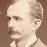
Andrew Spooner (1840, Paris — 29 July 1884, Cascade du Bois de Boulogne, Paris) was a French-American merchant established in Saigon [Ho Chi Minh Ville] in 1861, a reporter with French magazine L’Illustration who covered the French army’s assault on Bien-Hoa on 9 Dec. 1861, and an early Western explorer of Cambodia in November-December 1862.
With an American father (Andre-Andrew Spooner(1789-?), a chemical industrialist born in Boston (USA) on 30 Sept 1789, previously married to Charlotte Louis in 1823, Paris) and a French mother (Henriette Victorine Octavie Sebille-Descayes) he both hardly knew, as hew was raised by his eldest half-sister, Spooner apparently never visited the USA but held American citenzship all his life, and his guardian, a M. Courtin, encouraged him to leave for Singapore in 1859 in order to commercialize “Parisian items” such as lace on behalf of Maison Edouard Renard et Cie.
At 21, he had already spent two years in Singapore when he started his activities in French Indochina. He tried his hand in “several commercial ventures, from agriculture (an unsuccessful indigo plantation in 1869) to transport (a bimonthly steamboat service between Saigon and Phnom Penh in 1870) to the provision of urban amenities (gas lighting for Saigon). In the 1870s and early 1880s, he was a partner in a French-operated steam-driven rice mill, one of the few non-Chinese rice mills in Saigon [Rizeries de Cholon, launched with Renard & Cie in 1869].” [see “Rapport sur le Cambodge. Voyage de Sai-Gon à Bat-tam-bang/“Report on Cambodia. A Trip from Saigon to Battambang”, transl. by Nola Cooke, Chinese Southern Diaspora Studies 南方華裔研究雜誌 , Vol. 1, 2007, p 154 – 169].
Mandated to manage the “ferme de l’opium” (opium tax management, which at some point made 25% of the French administration income) from 1867 to 1882, when the institution of the “Douanes et Régies” by Governor Le Myre de Villiers in 1881, brought to an end the occult monopoly of Chinese congregations on opium and alcohol imports — in particular Chinese businessmen Wang Tai, Banhap and Lu Chan, also influential in Phnom Penh and who were his business partners, along with Edouard Cornu, an affairist from Bordeaux -, Spooner was a member of the ‘Conseil privé de la colonie’, a powerful colonial governing body in Cochinchina, and had the upper hand on raw opium distribution in Cambodia. In 1860, he had coined the phrase: “The Chinese are Europeans’ indispensable ennemies.”
In 1862, Spooner explored Cambodia in order to assess the topography and potential resources for the French Navy. His findings were published three years later in a study, “Renseignements topographiques, statistiques et commerciaux sur le Cambodge” [“Topographical, statistical and commercial information on Cambodia”], where he lauded the natural resources and the silk from the country, advocating for the establishment of European trading posts in Phnom Penh. He was working closely with Admiral Louis Bonard.
Back to France in 1882, he married Valentine Charlotte Camille Angamarre (1859−1946) in Paris on 27 November that year, and they had one daughter, Marguerite Adélaïde Spooner, born on 8 June 1884, six weeks before Spooner’s premature death.
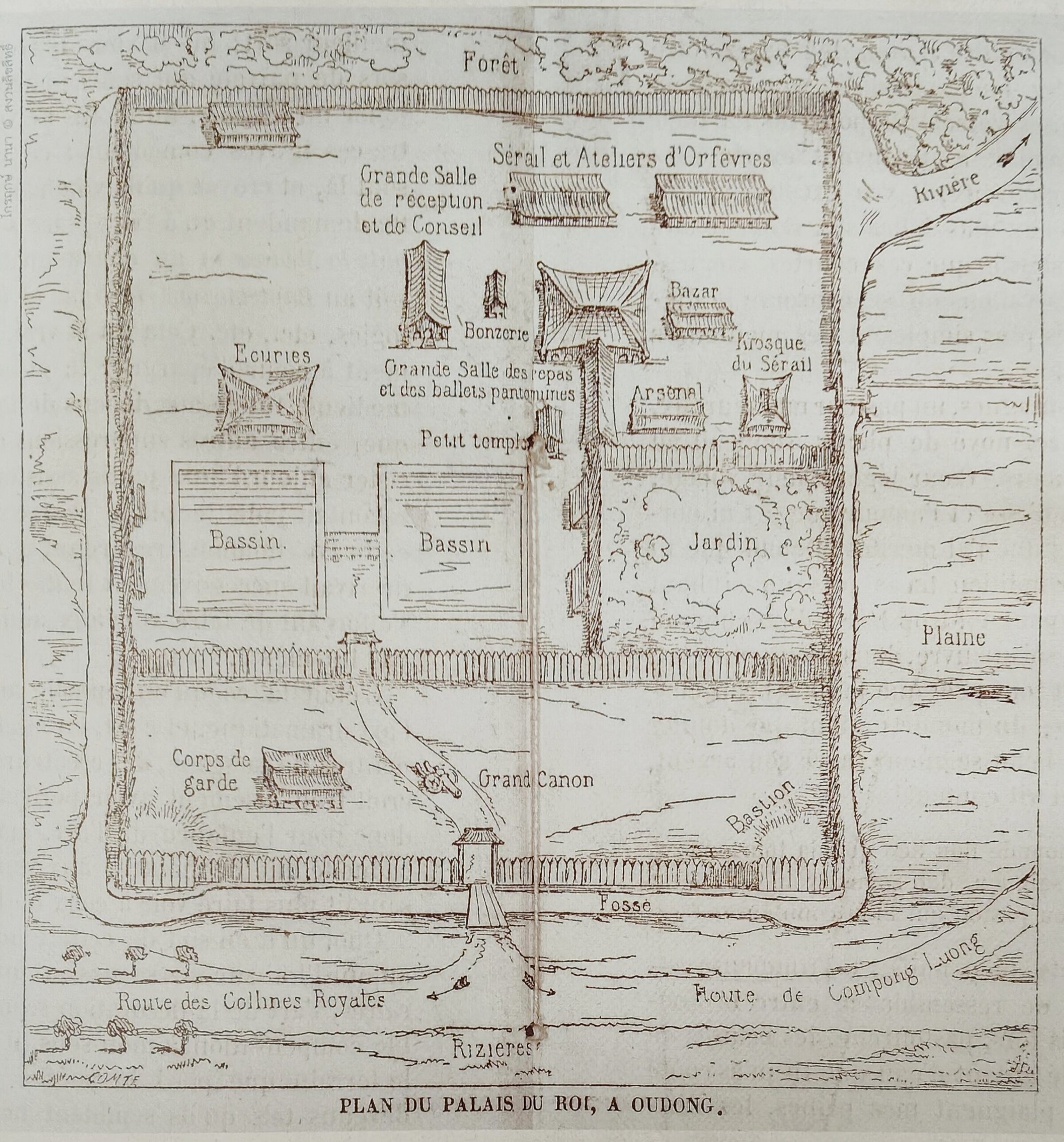
The only known plan of Oudong Royal Palace, site of Cambodian royal power until King Norodom undertook the erection of the new Palace in Phnom Penh starting from 1865 [source: L’Illustration, 30 Jan. 1864 [n 1092]: 72.]
Andrew Spooner authored the only known plan of Udong Royal Palace, site of Cambodian royal power until King Norodom undertook the erection of the new Palace in Phnom Penh starting from 1866 [source: L’Illustration, 30 Jan. 1864 [n 1092]: 72.]
Photo: from family tree Marie Odile Martin Descrienne, Geneanet.